James Spann: Occasional showers, storms for Alabama through midweek
James Spann forecasts more wet weather for Alabama from Alabama NewsCenter on Vimeo.
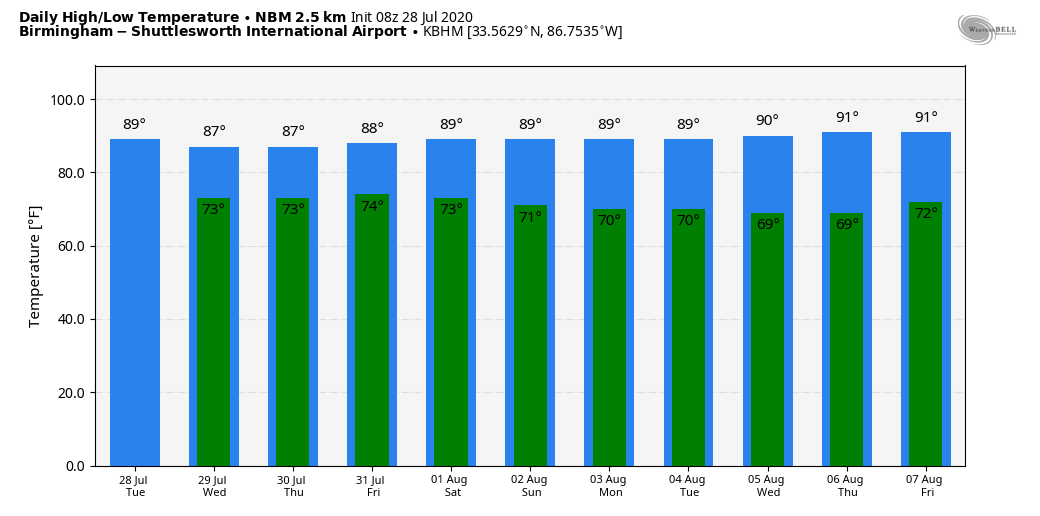
UNSETTLED SUMMER WEATHER: A broad upper trough will cover the Deep South in coming days, and that, in combination with high precipitable water values, will set the stage for scattered to numerous showers and thunderstorms daily through midweek. While the radar is quiet this morning, look for lots of activity this afternoon, and the showers and storms that form should be very efficient rain producers. The high today should be in the mid 80s for most communities; the average high for Birmingham on July 28 is 91.
Highs will remain in the mid to upper 80s Wednesday through Friday because of clouds and occasional showers. While most of the showers and thunderstorms will come from noon to midnight, we can’t rule out some rain during the late night or morning in this environment.
THE ALABAMA WEEKEND: Look for very humid conditions to continue over the weekend with a mix of sun and clouds both days. Scattered to numerous showers and thunderstorms are a good possibility, mostly during the afternoon and evening hours. Temperatures will remain a little below average for the first of August, with highs between 87 and 90 degrees.
NEXT WEEK: For now we are forecasting pretty classic summer weather during the week; partly sunny days with random, scattered, mostly afternoon and evening showers and thunderstorms. Highs will be close to 90 degrees.
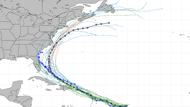
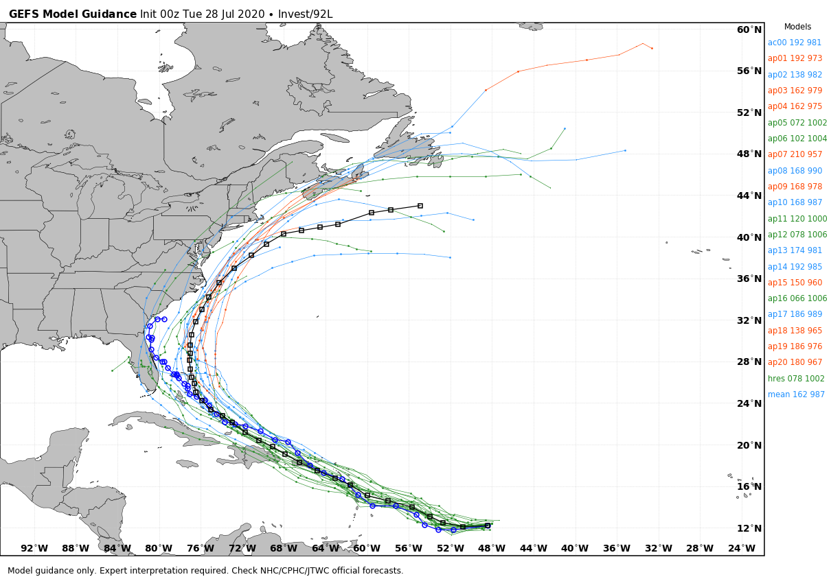
TROPICS: Invest 92L is still expected to become a tropical depression or storm within 48 hours. The system is about 750 miles east of the Windward Islands and is gradually increasing in organization. When it reaches tropical storm strength, the name will be Isaias (ees-ah-EE-ahs). Models show the system moving over the Leeward Islands Thursday and Puerto Rico Friday as a tropical storm with potential for strong winds and heavy rain. From there, it moves toward the Bahamas, where it begins to turn north. It remains to be seen whether it will directly impact the U.S. East Coast or stay offshore. One way or another, it does not look like a Gulf of Mexico storm. We will keep a close eye on it.
The rest of the Atlantic basin is quiet.
ON THIS DATE IN 1960: Tropical Storm Brenda developed in the northeastern Gulf of Mexico; it was the second named storm of the 1960 Atlantic hurricane season. After moving ashore over the Florida Peninsula, it accelerated northeast along the U.S. East Coast, ultimately peaking as a moderate storm with winds of 60 mph before crossing the Mid-Atlantic states and New England. It dissipated July 31 over southern Canada. The storm inflicted moderate damage in Florida, the worst since Hurricane Easy of 1950, and dropped heavy rainfall as far north as New York City.
BEACH FORECAST: Click here to see the AlabamaWx Beach Forecast Center page.
WEATHER BRAINS: You can listen to our weekly 90-minute show anytime on your favorite podcast app. This is the show all about weather featuring many familiar voices, including the meteorologists at ABC 33/40.
CONNECT: You can find me on the major social networks:
Facebook
Twitter
Instagram
Pinterest
Snapchat: spannwx
For more weather news and information from James Spann and his team, visit AlabamaWx.


