James Spann: Alabama gets more showers, storms today, trends drier over the weekend
James Spann forecasts another rainy afternoon for much of Alabama from Alabama NewsCenter on Vimeo.
RADAR CHECK: A few scattered showers are across central Alabama early this morning; rain and storms are more widespread to the west over north Mississippi, moving southeast. We expect scattered to numerous showers and thunderstorms across Alabama today with a mix of sun and clouds; the high will be between 81 and 85 degrees. Like recent days, the stronger thunderstorms will be very efficient rain producers, and some spots will see heavy amounts of rain. The chance of any one spot getting wet today is 60-70%.
THE ALABAMA WEEKEND: The weather trends drier as the upper trough lifts out and precipitable water values slowly fall. Showers and storms Saturday will be widely scattered and mostly during the afternoon and evening. On Sunday, any afternoon showers should be very isolated with a good supply of sunshine during the day. The chance of any one community seeing rain is 30% Saturday and 10-20% Sunday. With increasing amounts of sun heat levels will rise; expect a high in the upper 80s Saturday, and we will be close to 90 degrees Sunday afternoon.
NEXT WEEK: The first half of the week looks relatively dry with only a small risk of a shower; moisture will increase Wednesday through Friday over south Alabama, where showers and storms will be possible, but the northern counties will stay relatively dry. Highs through the week will be between 88 and 92 degrees most days.
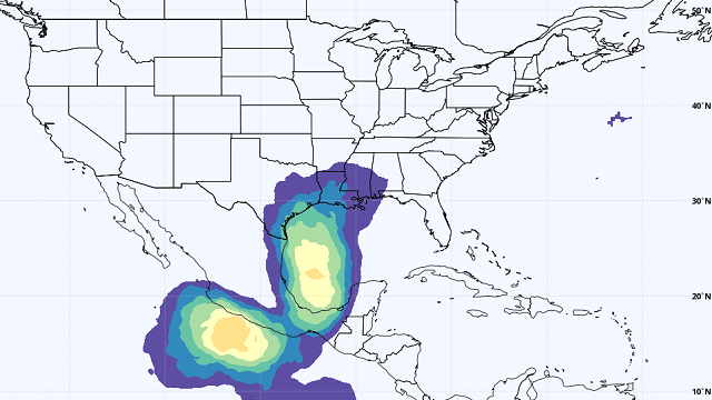
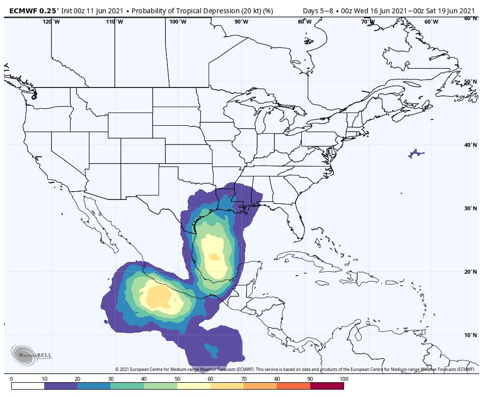
TROPICS: The Atlantic basin is expected to remain quiet through the weekend, but global models are showing a good chance of tropical depression or storm development in the western Gulf of Mexico by the middle of next week. The general idea is for the system to bring potential for heavy rain to parts of the Texas and Louisiana coast by the end of next week, but it is too early to be specific. One way or another this will likely increase the rip-current danger along the entire Gulf Coast in a week or so.
ON THIS DATE IN 1990: One of the most expensive hailstorms in U.S. history occurred, causing $625 million of damage along the Colorado Front Range from Colorado Springs to Estes Park. Golf- to baseball-sized hail fell along with heavy rain. Sixty people were injured in the storm.
BEACH FORECAST: Click here to see the AlabamaWx Beach Forecast Center page.
WEATHER BRAINS: You can listen to our weekly 90-minute show any time on your favorite podcast app. This is the show all about weather featuring many familiar voices, including the meteorologists at ABC 33/40.
CONNECT: You can find me on the major social networks:
For more weather news and information from James Spann and his team, visit AlabamaWx.


