Scott Martin: A few isolated showers for Alabama Saturday, scattered activity Sunday
THE ALABAMA WEEKEND: Moisture levels will begin to slowly increase throughout the weekend, which will lead to slightly higher rain chances. A few isolated to scattered afternoon showers and storms will be possible Saturday, but those chances increase to around a 50/50 shot of scattered storms on Sunday. Highs will be in the mid-80s to the lower 90s Saturday and slightly warmer Sunday, in the upper 80s to the lower 90s.
NEXT WEEK: Monday and Tuesday will be typical summer days with partly sunny skies and a small chance of scattered afternoon showers and storms. Tuesday’s rain chances will be slightly higher, but many locations should remain dry. Highs will be in the upper 80s to the lower 90s.
Moisture levels increase Wednesday and Thursday, and so do the chances for showers and thunderstorms. Both days will feature around a 50/50 shot, mainly during the late morning through the early evening hours. Highs will be in the mid-80s to the lower 90s Wednesday, dropping back into the 80s Thursday.
A surface front will push into the area Friday that will bring enough lift to allow showers and thunderstorms to be likely throughout the day, but most of the action should occur during the late morning through the early evening. Highs will be in the 80s.
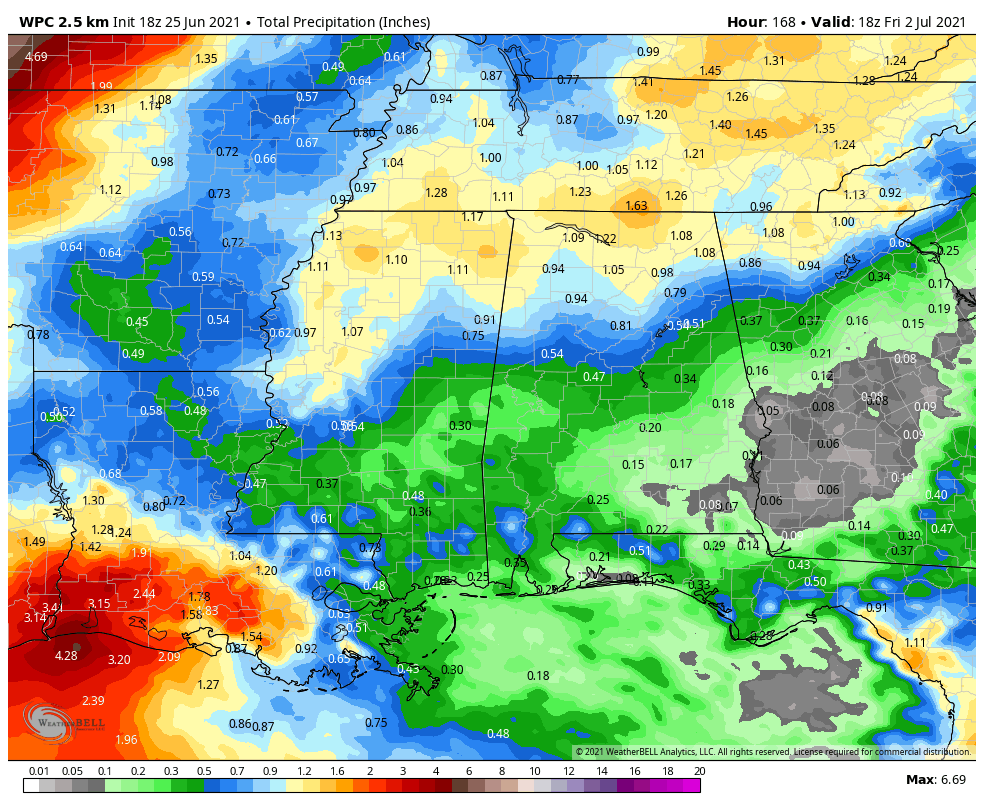
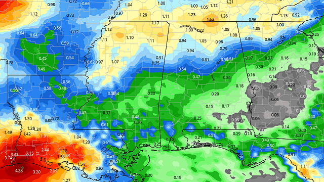
FORECAST RAINFALL TOTALS: As with summer thunderstorms in Alabama, rainfall expectations will be hit-and-miss due to the scattered nature for the forecast period. With the increased moisture to end the week and the surface front moving into the area, we may see totals ranging from less than one-quarter inch in the southeast to as high as 1 inch over the extreme northern and northwestern parts of the state by midday Friday.
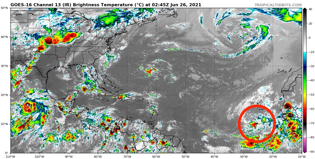
TROPICS: Invest 95L is a tropical wave over the eastern tropical Atlantic Ocean that is producing a large area of disorganized showers and thunderstorms well south of the Cabo Verde Islands. It is expected to move westward at 15 to 20 mph through the weekend over cooler waters in the central tropical Atlantic, and therefore any development of this system should be slow to occur. The National Hurricane Center is giving 95L only a 10% chance of developing into a depression or tropical storm within the next five days.
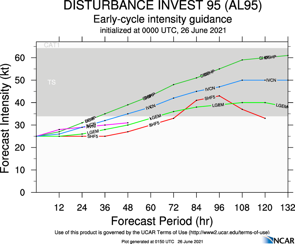
However, the latest forecast intensity guidance shows that every member believes Invest 95L will get its act together and eventually make it to tropical storm strength within the next 36-72 hours, but then roughly leveling off until the model run ends at 132 hours.
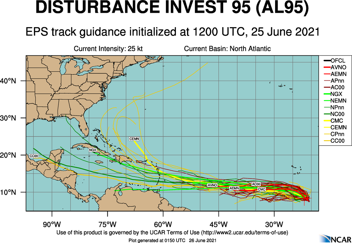
The forecast track guidance continues to show the potential of 95L making it into the Caribbean Sea, with a couple of the long-range members showing it potentially moving into the Gulf of Mexico.
This is not a forecast. We are just giving the information that is being displayed to us to help us get a feeling on what 95L could do. It is just way too early to know any details at this point. We can get a much clearer picture once (and if) 95L becomes better organized and at least becomes a depression. We’ll be watching for sure.
ON THIS DATE IN 1977: “The Human Lightning Conductor,” park ranger Roy C. Sullivan, was struck by lightning for the seventh time. He was first hit in 1942, then again in 1969, 1970, 1972, 1973 and 1976.
ON THIS DATE IN 1986: Hurricane Bonnie made landfall on the upper Texas coast. A wind gust to 98 mph occurred at Sea Rim State Park. Ace, Texas, recorded 13 inches of rain from the hurricane.
For more weather news and information from James Spann, Scott Martin and other members of the James Spann team, visit AlabamaWx.


