James Spann: Higher rain chances remain over south Alabama today
James Spann forecasts some rain for south Alabama today from Alabama NewsCenter on Vimeo.
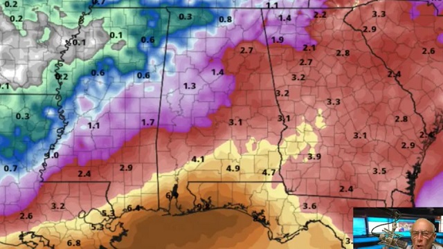
DEEPER MOISTURE OVER SOUTH ALABAMA: Our weather won’t change much today; the air over the northern half of the state is relatively dry, meaning the best chance of scattered showers and thunderstorms this afternoon will be over central and south Alabama, much like Monday. Odds of any one spot getting wet range from 10% across the Tennessee Valley to 60-70% near the Gulf Coast. The high will be in the low 90s in most spots; the average high for Birmingham on July 12 is 91.
REST OF THE WEEK AND THE WEEKEND: Moisture will surge northward Wednesday, and scattered to numerous showers and storms are likely statewide, mostly during the afternoon and evening. The sky will be occasionally cloudy with a high between 87 and 91 degrees. Beyond that, there is considerable model inconsistency in moisture levels Thursday through the weekend. We are seeing evidence another push of drier air could work into north Alabama Friday and Saturday, but that is not a certainty. For now we will broad brush the forecast with the typical summer mix of sun and scattered afternoon storms each day and fine tune the forecast as we get better clarity. The highest coverage of showers and storms will be over the southern quarter of the state; afternoon highs will remain in the upper 80s and low 90s.
NEXT WEEK: We will maintain the persistence forecast through the week with partly sunny days and random, scattered showers and storms, mostly from about 2 until 10 p.m. Highs will be in the low 90s most days, right at seasonal values for mid-July.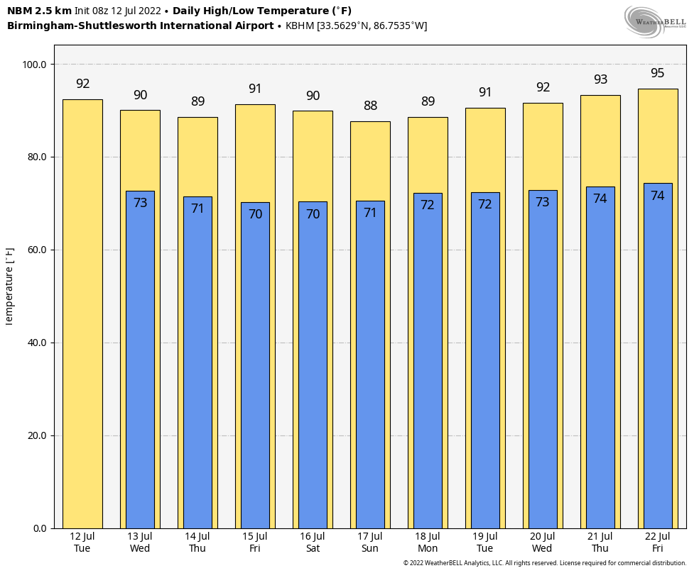 TROPICS: Disorganized showers and thunderstorms over the northern Gulf of Mexico are associated with a trough of low pressure. Gradual development of this system is possible if it can remain offshore while it meanders near the northern Gulf Coast through the end of the week. Regardless of development, heavy rains will be possible from Louisiana to the Florida Panhandle over the next several days.
If you have a trip planned to the central Gulf Coast (Gulf Shores to Panama City Beach), it won’t rain all day every day (no total washout days) and you will see some sun. But the coverage of showers and storms will be higher than usual through the weekend, and some spots could see heavy rain at times.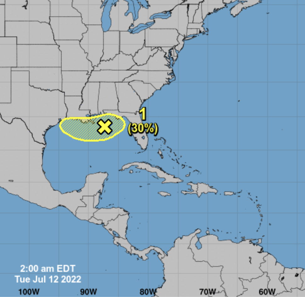 The rest of the Atlantic basin remains very quiet.
ON THIS DATE IN 1995: An intense heat wave affected much of the Midwest for a four-day period beginning on this day. The worst effects of the heat were in the Chicago metropolitan area, where 583 people died from the heat. Temperatures across the region reached as high as 104 degrees.
BEACH FORECAST: Click here to see the AlabamaWx Beach Forecast Center page.
For more weather news and information from James Spann and his team, visit AlabamaWx.


