James Spann: Alabama’s long dry spell continues this week
James Spann forecasts more dry days for Alabama this week from Alabama NewsCenter on Vimeo.
DRY IS THE WORD: Here are some notes on the dry spell we are experiencing, based on data at Birmingham:
- Today will be the eighth consecutive day with no measurable rain.
- Our last measurable rain was on Sept. 25, but the amount was only 0.03 inch.
- We have gone without measurable rain on 22 of the last 23 days.
- The last day with more than one-tenth of an inch of rain was Sept. 4, when the total was 1.55 inches.
We see no chance of rain for at least the next 10 days across Alabama. This isn’t too unusual; October is our driest month of the year, with an average of 3 inches (based on records back to 1900). The weather gets much more active in November, when our tornado season begins (November through May).
Look for sunny days and clear nights through the weekend. Highs will be between 78 and 82 degrees through Friday, but cooler air arrives Saturday as the high drops into the low 70s. Sunday morning will be our coolest morning so far this young season, with lows well down in the 40s — and cooler spots could visit the 30s. We can’t totally rule out a bit of patchy, light frost across the coldest areas.
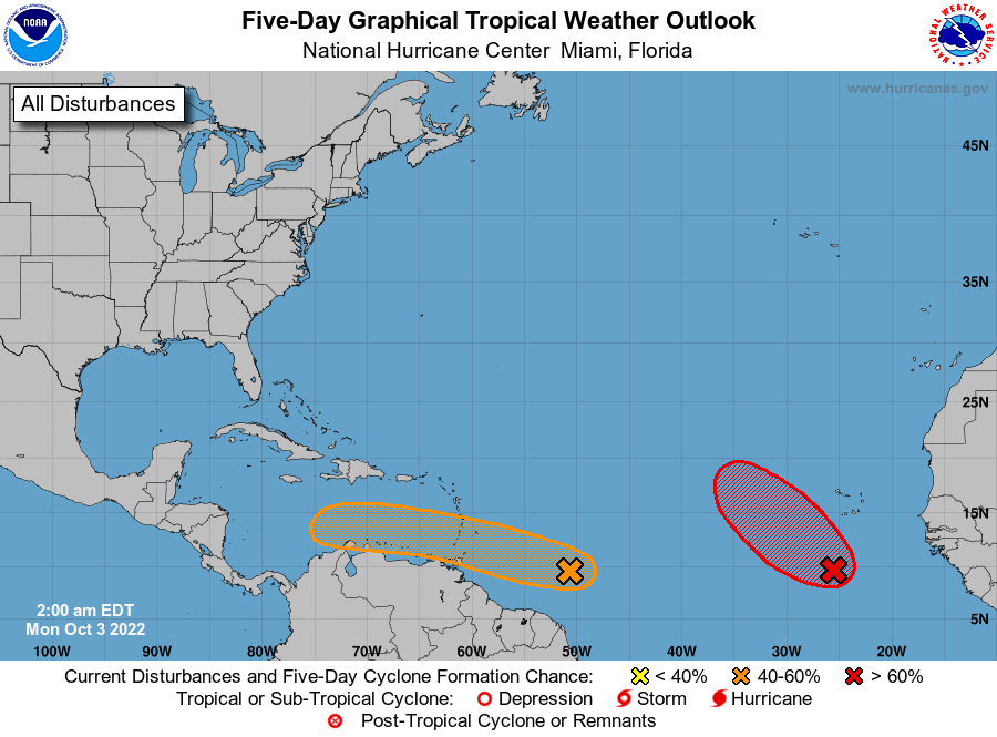
NEXT WEEK: We see no real change in the pattern, with sunny, pleasant days and clear, cool nights. The next hope for rain comes around mid-month.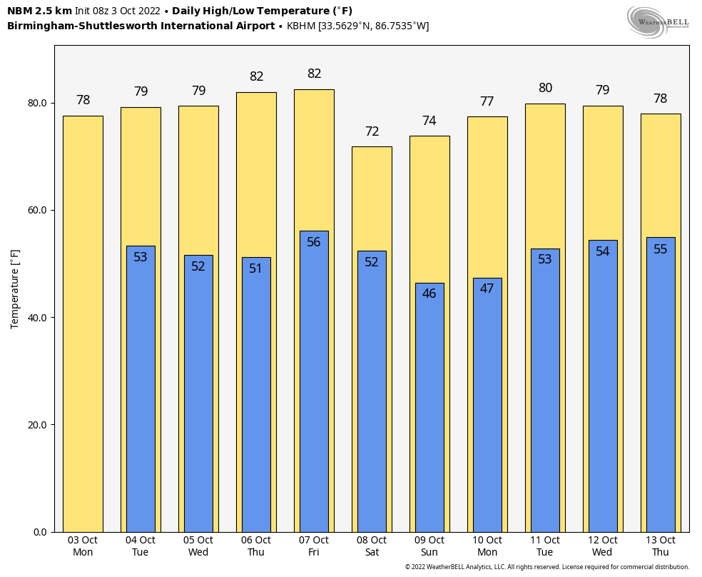 TROPICS: A tropical wave in the eastern Atlantic has a high chance of becoming a depression or storm this week, but it will turn north and weaken in five to seven days due to strong upper winds; most likely this remains far from land.
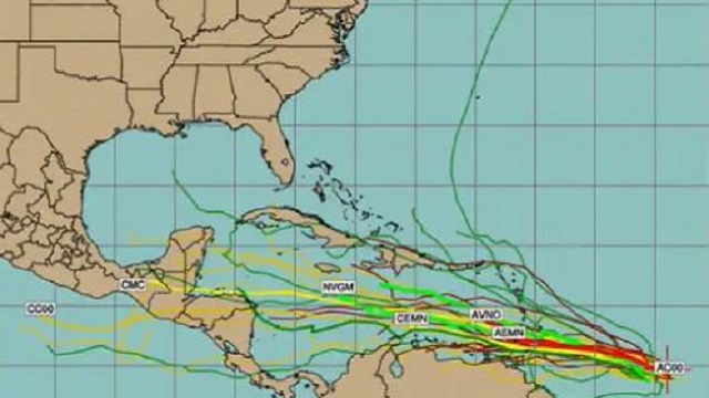
Of more interest is a tropical wave several hundred miles east of the Windward Islands; showers and storms in the area have changed little in organization during the past several hours. Further development of the wave is possible, however, and a tropical depression could form during the next few days while it moves generally westward at 15 to 20 mph, reaching the Windward Islands and the eastern Caribbean Sea by midweek. Long-range model guidance suggests a continued westward motion toward Central America, but it’s too early to know the final destination or intensity. Just something to watch for now.
 ON THIS DATE IN 1964: Hurricane Hilda made landfall just southeast of Burns Point, Louisiana, around 5 p.m. CT as a Category 2 hurricane with winds of 105 mph. The majority of deaths associated with Hilda in Louisiana were a result of tornadoes spawned by the hurricane in its outer peripheral rain bands and squall lines. The hurricane caused six tornadoes and two waterspouts in Louisiana. Despite tracking for only 1-1.5 miles near Larose, Louisiana, a violent F4 tornado killed 22 people and injured 165 others, destroying 35 homes in the process.
ON THIS DATE IN 1979: An F4 tornado struck the towns of Windsor, Windsor Locks and Suffield in Connecticut, causing an estimated $400 million in property damage. The New England Air Museum, which housed more than 20 vintage aircraft, was destroyed. This tornado also caused a United Airlines flight to abort a landing at the Bradley International Airport because the pilot saw the tornado
BEACH FORECAST: Click here to see the AlabamaWx Beach Forecast Center page.
For more weather news and information from James Spann and his team, visit AlabamaWx.


