James Spann: Rain in Alabama ends from west to east later today
James Spann forecasts a dry period for Alabama after today from Alabama NewsCenter on Vimeo.
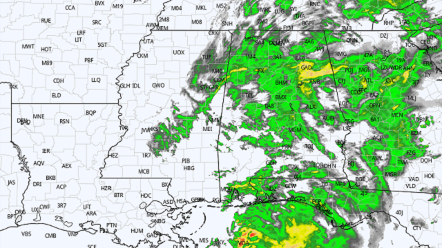
RADAR CHECK: Rain is widespread across Alabama early this morning with temperatures in the upper 40s and low 50s in most spots. Rain will end across west Alabama later this morning, and the final batch of showers should move out of east Alabama by mid-afternoon. Otherwise, today will be cloudy and cool, with a high in the low to mid 50s. The average high for Birmingham on Nov. 15 is 65.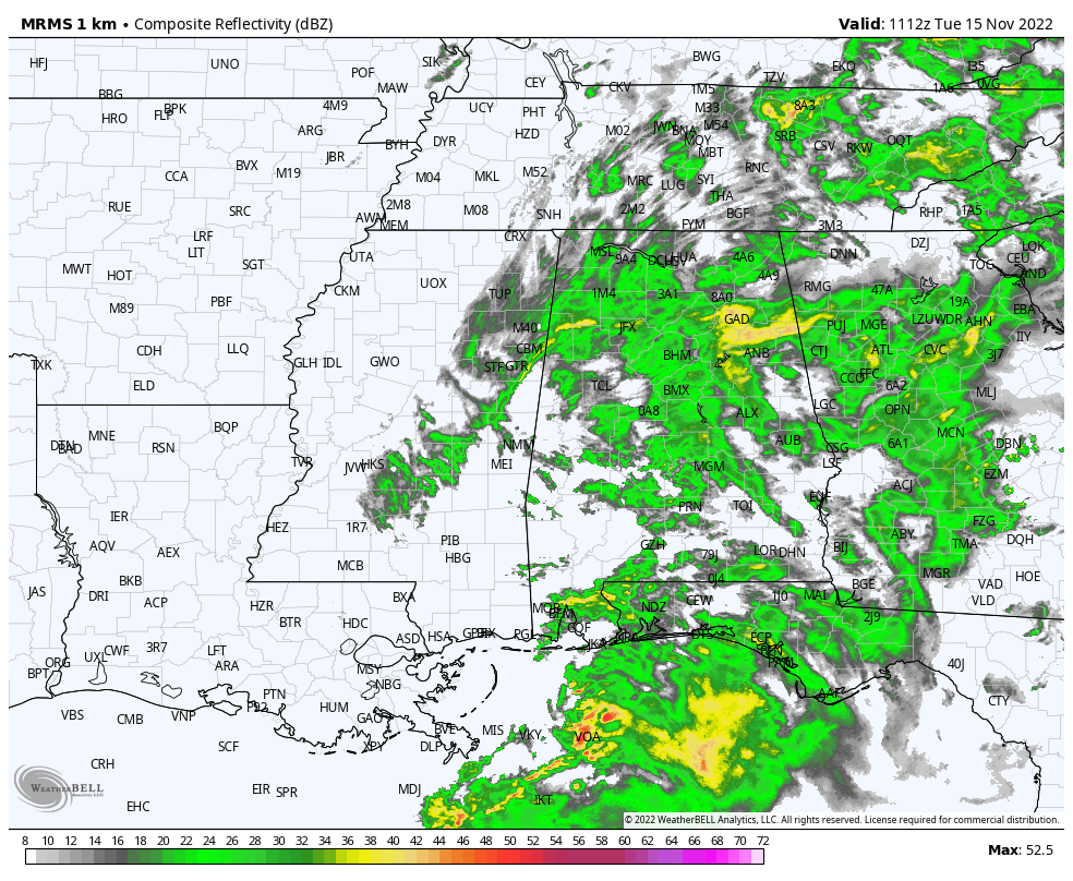 The sky will clear tonight, and Wednesday will be dry with a partly sunny sky and a high between 52 and 56 degrees. Thursday and Friday will feature a sunny sky both days, but temperatures remain well below average. The high will be in the upper 40s Thursday, followed by low 50s Friday; morning lows will be in the 20s.
THE ALABAMA WEEKEND: Expect sunny, cool days and clear, cold nights. Highs will be in the 50s, lows between 24 and 32 degrees.
NEXT WEEK: The weather will stay dry Monday and Tuesday with highs generally in the 50s. We rise into the low 60s over the latter half of the week. Global model data suggests the next rain event will come around Thanksgiving Day (Thursday), but it is way too early to be specific concerning timing, rain amounts, etc.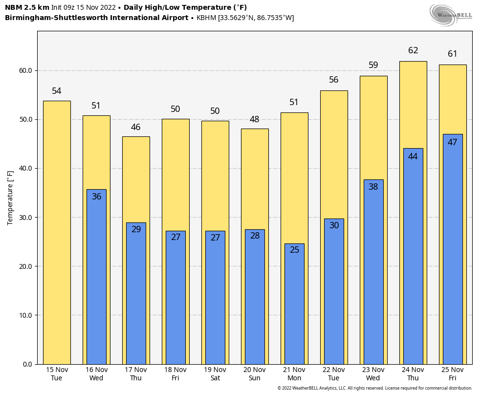 TROPICS: The Atlantic basin is quiet, and tropical storm formation is not expected through the weekend. Hurricane season ends at the end of this month.
ON THIS DATE IN 1989: An F4 tornado tore through southern Huntsville around 4:30 p.m.; it was responsible for 21 deaths and 463 injuries. It touched down near Madkin Mountain on Redstone Arsenal, southwest of Huntsville. The tornado moved northeast toward the heavily populated Airport Road area, where it would destroy or damage 80 businesses, three churches, a dozen apartment buildings and more than 1,000 cars. It moved on, climbing over Garth Mountain, demolishing Jones Valley Elementary School and destroying 259 homes in the Jones Valley area. The tornado was on the ground for just over 18 miles; 12 of the 21 fatalities occurred in automobiles, as many people were homeward bound during the afternoon rush hour.
The tornado warning came late; this was before Doppler Radar was operational.
ON THIS DATE IN 2007: Tropical Cyclone Sidr, a Category 4 storm on the Saffir-Simpson scale, brought torrential rain, 150 mph winds and a 4-foot storm surge to the Bangladesh coast. At least 3,200 people died, and millions were left homeless. Since records began in 1877, Sidr obtained the title of the second-strongest cyclone to make landfall in Bangladesh.
BEACH FORECAST: Click here to see the AlabamaWx Beach Forecast Center page.
For more weather news and information from James Spann and his team, visit AlabamaWx.


