James Spann: Unsettled week ahead for Alabama; a few showers later today
James Spann forecasts a wet week for Alabama from Alabama News Center on Vimeo.
WET AT TIMES: March is the wettest month of the year in Alabama; the average for Birmingham is 5.66 inches. So, it isn’t that odd that we are forecasting multiple chances of rain across the Deep South through Saturday.
Much of today should be dry, with morning clouds giving way to a partly sunny afternoon. A few spotty showers will show up later today; odds of any one spot getting wet are 20-25%. The day will be mild, with a high in the 70s.
TUESDAY: A disturbance will bring rain and thunderstorms into Alabama Tuesday and Tuesday night. We’re not expecting any severe thunderstorms, and rain amounts should be around 1 inch for most of the state. There will be breaks in the rain, but the day looks pretty wet, with a high between 67 and 72 degrees.
WEDNESDAY/THURSDAY: We will mention some risk of showers on these two days, but nothing widespread or heavy. The sun will break out at times, and afternoon highs will be mostly in the mid 70s.
FRIDAY/THE WEEKEND: A dynamic weather system will bring another organized batch of rain and thunderstorms into Alabama Friday, Friday night and into at least part of the day Saturday. With high precipitable water values in place, the rain will be heavy at times, and some flooding is very possible. Rain amounts between now and Saturday night will be 3-6 inches over the northern half of Alabama, with 2-4 inches likely for the southern counties.
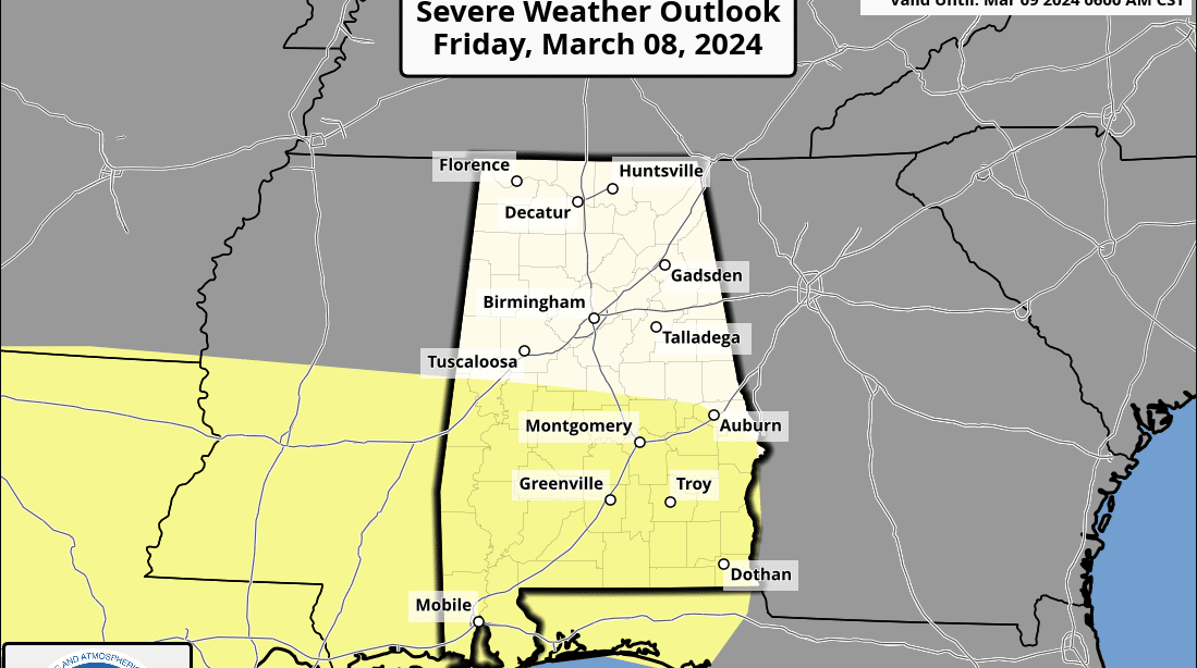
The Storm Prediction Center has defined a risk of severe thunderstorms for south Alabama Friday and Friday night.
This is a conditional threat; a large mass of rain could evolve early in the day, keeping instability values down. Also, the main dynamic support for severe storms seems to be focused north of here. We will watch model trends over the next few days and the forecast will be adjusted as needed. But, for now, it looks like heavy rain and flooding will be the main concern.
Highs Friday and Saturday will be between 67 and 73 degrees.
Dry air returns to the state Saturday night, and Sunday will be mostly sunny and cooler, with a high in the upper 50s and low 60s.
NEXT WEEK: For now, much of next week looks dry. Highs will be in the 60s Monday and Tuesday, followed by 70s over the latter half of the week.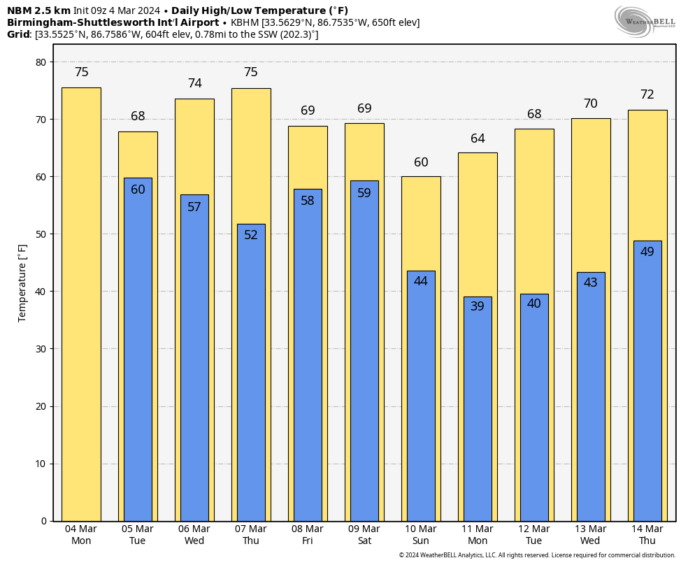
ON THIS DATE IN 1842: A tornado moved through western Tuscaloosa, killing one person and injuring 10 others.
ON THIS DATE IN 1983: Brownsville, Texas, recorded a high of 100 degrees, the earliest the city has ever hit the century mark.
For more weather news and information from James Spann and his team, visit AlabamaWx.


