James Spann: Scattered to numerous showers, storms for Alabama Thursday, Friday
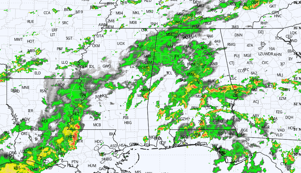
RADAR CHECK: Large areas of rain along with a few strong thunderstorms continue across Alabama this afternoon. Flooding is possible with the heavier storms, thanks to very high precipitable water values. Temperatures are only in the 70s and 80s across the state thanks to clouds and rain. Showers will remain possible through the night.
The weather won’t change much Thursday and Friday. Expect more clouds than sun with scattered to numerous showers and thunderstorms both days. Highs will be generally in the low to mid 80s.
THE ALABAMA WEEKEND: Showers and storms remain possible Saturday and Sunday, but they should be a little fewer in number as the upper ridge begins to rebuild. Most but not all of the showers will come from noon to midnight, and the chance of any one spot seeing rain both days is 50-60%. With a mix of sun and clouds, highs will be in the upper 80s for most places.
NEXT WEEK: A fairly typical summer pattern is setting up for next week, with partly sunny, humid days and scattered, mostly afternoon and evening showers and thunderstorms daily. Highs will be close to 90 for the first half of the week, followed by low 90s Thursday and Friday.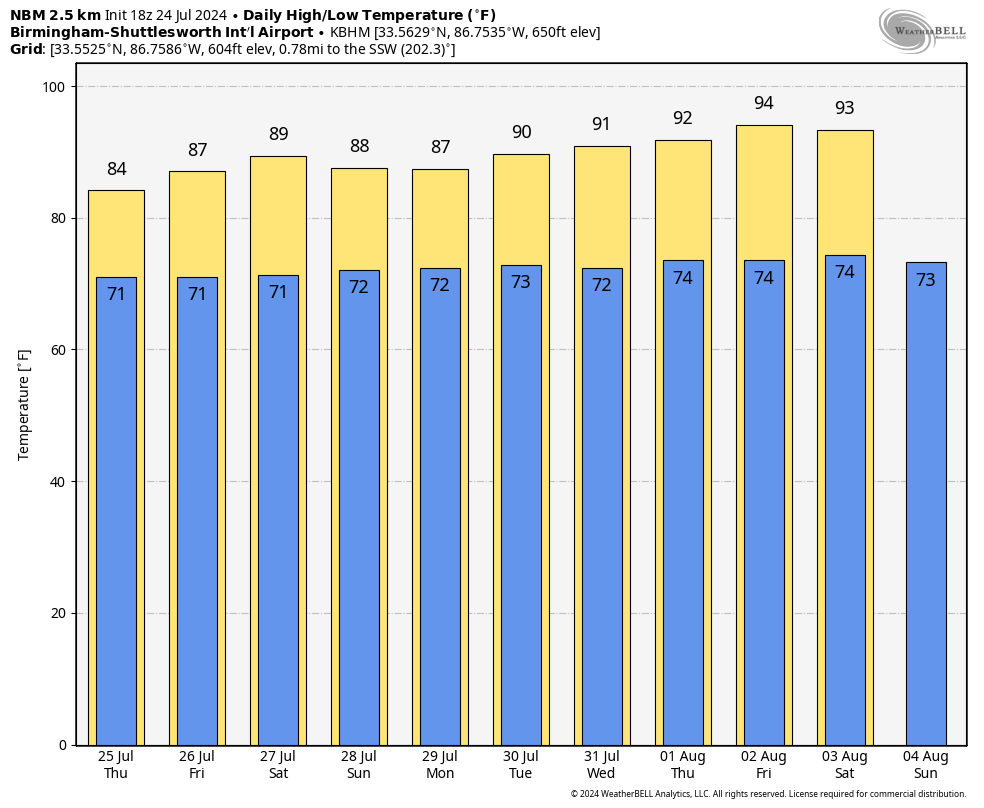 TROPICS: The Atlantic basin remains very calm, and tropical storm formation is not expected for the rest of July.
ON THIS DATE IN 1930: An estimated F5 tornado tore through Montello, Veneto and Friuli in Italy, killing 23 people along its 50-mile path.
ON THIS DATE IN 1952: The temperature at Louisville, Georgia, soared to 112 degrees to establish a state record.
For more weather news and information from James Spann and his team, visit AlabamaWx.


