James Spann: Showers for north Alabama today; mostly dry weekend ahead
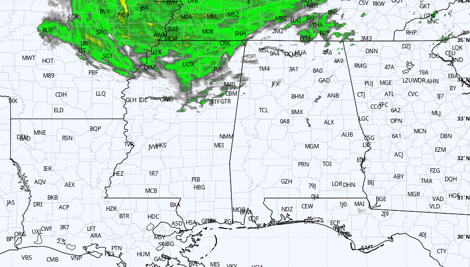
THIS AFTERNOON: South Alabama is enjoying a sunny, warm afternoon, with temperatures in the low to mid 80s. The northern counties are mostly cloudy, but there is nothing on radar at midafternoon. A band of showers over west Tennessee and north Mississippi will likely rotate into north Alabama tonight, but rain amounts should be light. Wind gusts to 25-30 mph are possible over the northern third of the state through the evening with a tight pressure gradient in place.
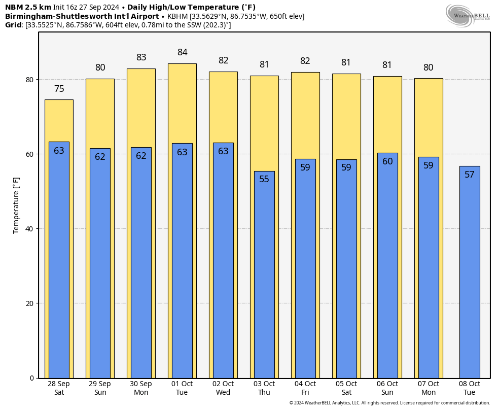
THE ALABAMA WEEKEND: Clouds will linger across the northern half of Alabama Saturday, and we will mention some risk of isolated showers during the afternoon and evening on the south side of the upper low over Tennessee and Kentucky. The rain won’t be heavy or widespread, and south Alabama will be dry. Sunday looks generally dry statewide with only a few isolated showers over the far northern counties. South Alabama will see highs in the low to mid 80s both days; the northern counties will hold in the 70s Saturday, followed by low 80s Sunday.
At this point most of next week looks warm and dry, with highs in the low to mid 80s.
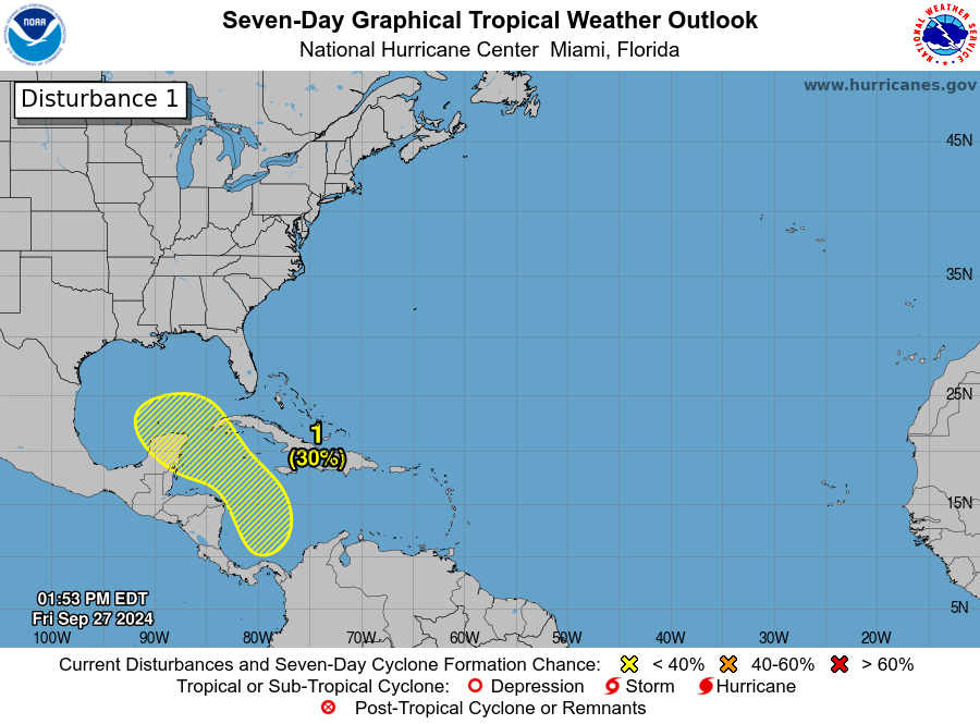
 TROPICS: The circulation of former Hurricane Helene is 125 miles south of Louisville, Kentucky, this afternoon; it will dissipate Saturday and be absorbed by an upper low over the region. The system has produced historic and catastrophic flooding over the southern Appalachians and parts of the Southeast, in areas east of Alabama. There are two other named systems:
- Tropical Storm Joyce formed this morning in the eastern Atlantic; it is expected to stay under hurricane strength and turn north in a few days. It is basically in the middle of nowhere and will stay in the middle of nowhere — no threat to land.
- Hurricane Isaac is in the middle of the North Atlantic and is moving east/northeast away from the U.S., posing no threat to land.
An area of low pressure could form over the western Caribbean Sea by the middle of next week. Environmental conditions are expected to be conducive for slow development thereafter while the system moves generally northwestward, potentially entering the Gulf of Mexico by the end of the week. There is no skill in forecasting the intensity or placement of a tropical cyclone seven to 10 days in advance. We will watch it closely, as always.
FOOTBALL WEATHER: For tonight’s high school games, some rain is possible, if not likely, over the northern third of the state (north of I-20), but the central and southern counties will be dry. It will be rather windy tonight over north Alabama, with potential for gusts to 25-30 mph. Temperatures will be in the low 70s.
On Saturday, UAB hosts Navy (11 a.m. kickoff at Protective Stadium). The sky will be mostly cloudy, and there is a small risk of a shower during the game. Temperatures will be in the low to mid 70s.
Auburn hosts Oklahoma Saturday at Jordan-Hare Stadium (2:30 p.m. kickoff). Expect a partly sunny sky with temperatures in the mid to upper 70s.
Alabama will host Georgia at Bryant-Denny Stadium Saturday (6:30 p.m. kickoff). We will mention a small risk of a shower during the first half of the game; otherwise, the sky will be mostly fair with temperatures around 70 degrees.
ON THIS DATE IN 1985: Hurricane Gloria swept over the Outer Banks, then rushed across Long Island, New England and Canada. It was the first significant hurricane to hit New England in 25 years and brought heavy rains and high winds to the Mid-Atlantic states as well.
For more weather news and information from James Spann and his team, visit AlabamaWx.


