James Spann: Scattered showers, storms for Alabama through Wednesday; drier Thursday, Friday

RADAR CHECK: Large areas of rain and a few thunderstorms continue to move across the northern two-thirds of Alabama this afternoon. Some communities are seeing heavy rain, and we have small hail in a few spots. South Alabama is generally dry, with only isolated showers.
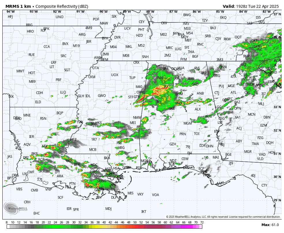
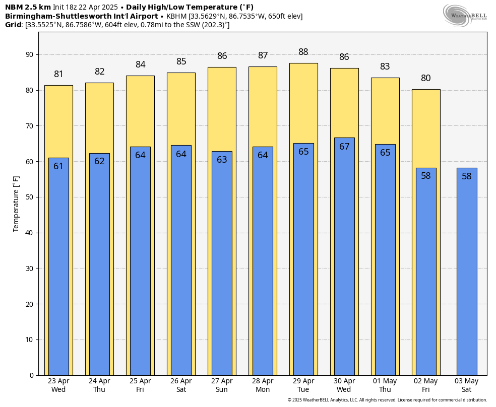
We will maintain the chance of scattered showers and storms through Wednesday, mainly over the northern and central counties, as a stalled front hangs around just to the north. The high Wednesday will be between 78 and 84 degrees.
Showers become fewer in number Thursday as the front lifts northward and dissipates. By the time we get to Friday and the weekend, most of Alabama will be warm and dry, with only isolated afternoon showers over the northern third of the state. Temperatures will stay above average, with highs in the 80s and lows in the 60s.
NEXT WEEK: The weather looks warm and mostly dry Monday through Wednesday; global models suggest we will have rain with a cold front Thursday, followed by cooler air at the end of next week.
RACE WEEKEND: The weather will be warm and mostly dry at Talladega Friday through Sunday. The chance of an afternoon shower is 20% or less, and highs will be in the 80s.
ON THIS DATE IN 1997: An F2 tornado tore through Rainsville, in DeKalb County, injuring 10 people. Eleven of 12 police cars in Rainsville were either damaged or destroyed, and several of the city’s firetrucks were damaged.
ON THIS DATE IN 2003: Tropical Storm Ana became the first Atlantic tropical storm since records began in 1871 to form during April. Maximum sustained winds reached 55 mph.
For more weather news and information from James Spann and his team, visit AlabamaWx.


