James Spann: Alabama could get a good rain beginning this weekend
James Spann: Cool, dry weather returns to Alabama, but more rain is coming from Alabama NewsCenter on Vimeo.
COOL, DRY WEATHER: The sky is clear over Alabama this morning; temperatures are mostly in the 30s at sunrise. With sunshine in full supply, we expect a high in the upper 50s this afternoon. Tomorrow morning will bring a light freeze for most, and dry air means another sunny day with a high close to 60 tomorrow afternoon.
WEEKEND CHANGES: Clouds move back into Alabama Saturday ahead of a developing weather system to the west, and rain arrives Saturday night. In fact, rain could begin over West Alabama late Saturday afternoon. Sunday looks cool and wet, with periods of rain through the day. Some North Alabama communities could hold in the 40s all day with a warm front over far South Alabama.
NEXT WEEK: The warm front will lift northward Monday, with rain continuing. The latest GFS shows a rapidly deepening surface low moving into western Kentucky by early Tuesday. If this is correct the state gets into the warm sector, and we will have another chance of strong to severe storms Monday night into Tuesday. We will keep a close eye on the potential in coming days.
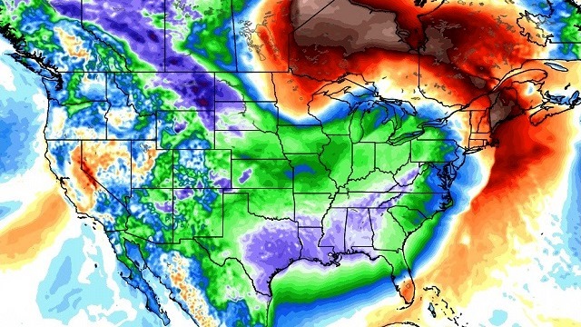
Late next week, we are still seeing signals that the coldest air so far this season will blow into Alabama and much of the continental U.S.; by Friday, some places could very well hold in the 30s all day.

STORM SURVEYS: Eight tornadoes have been confirmed by National Weather Service survey teams so far from the storms Tuesday night into Wednesday morning. The NWS in Huntsville has rated the Ider (DeKalb County) tornado as EF-3; three EF-2 tornadoes were also identified, one from Franklin County into Colbert County, another in Madison County and a third in Jackson County at Rosalie, where three people were killed. The NWS in Birmingham has confirmed four tornadoes: one in Lamar County, one in Pickens County, one in the Helicon community (Winston County) and another near Ashridge (also in Winston County). Preliminary data suggests these will be rated EF-1.
Survey results are not complete, and more tracks will likely be identified. I would not be surprised if around 15 tornadoes are ultimately identified.
RAIN AMOUNTS: Here are some storm totals from our team of Skywatchers this week:
- Coker, 4.02 inches
- Helena, 3.06 inches
- Jemison, 3.04 inches
- Locust Fork, 3.02 inches
- Bessemer, 2.96 inches
- Heflin, 2.84 inches
- Cottondale, 2.79 inches
- Concord, 2.68 inches
- Black Creek (near Gadsden), 2.12 inches
At the Birmingham Airport, where the records are kept, the storm total was 2.07 inches, and the rain deficiency for the year is still 11.35 inches.
WEATHER BRAINS: You can listen to our weekly 90-minute netcast anytime on the web, or on iTunes. This is the show all about weather featuring many familiar voices, including meteorologists at ABC 33/40.
CONNECT: You can find me on all of the major social networks:
Facebook
Twitter
Google Plus
Instagram
For more weather news and information, visit AlabamaWX.


