James Spann: Unsettled weather pattern for Alabama
James Spann: Wet weather for Alabama at times through Friday from Alabama NewsCenter on Vimeo.
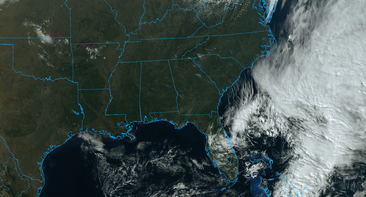
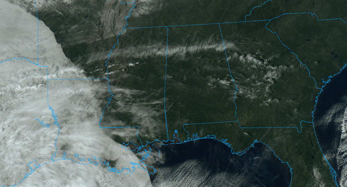
RADAR CHECK: We have a number of showers and storms in progress across Alabama early this morning in the moist environment. Some communities across northwest Alabama are getting heavy rain.
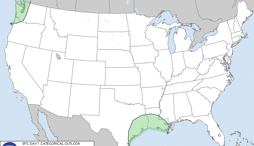
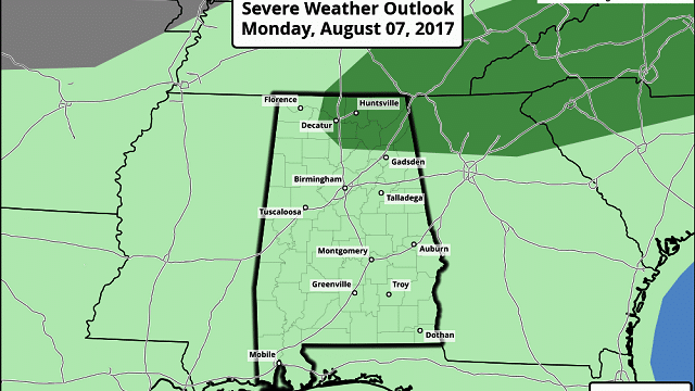
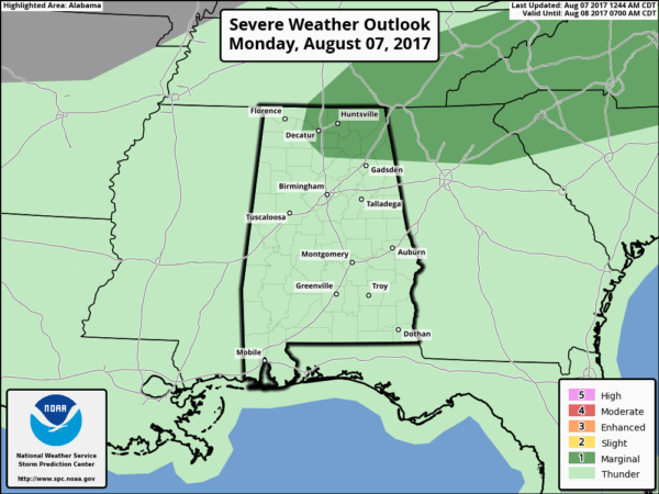
A deep layer of tropical moisture is over Alabama with high precipitable water values, and a broad upper trough will provide an unstable airmass. We forecast occasional showers and thunderstorms across the state today and tonight with potential for heavy rain in spots. The Storm Prediction Center has a “marginal risk” of severe storms defined for the eastern part of the Tennessee Valley, where some hail is possible along with strong, gusty winds this afternoon.
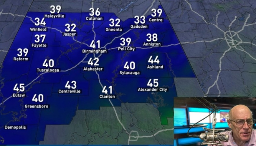
We won’t get out of the 80s today due to clouds and showers; the average high for Aug. 7 (at Birmingham) is 91.
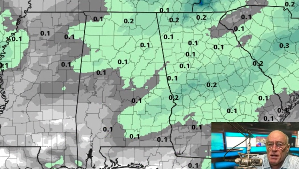
REST OF THE WEEK: The weather won’t change much as a wet, unsettled pattern continues. A surface front will stall out over north Alabama tomorrow and dissipate, so an airmass rich in moisture is expected to linger through Friday. We will forecast scattered to numerous showers and storms daily, with only a limited amount of sun from time to time. It is impossible to give you exact rain start/stop times for any given location; be ready for a shower or storm at just about any hour of the day, including late night and morning.
Flash flooding could very well become a concern over the latter half of the week as the ground becomes saturated. Rain amounts over the next five days will be in the 2- to 4-inch range for most of the state. No drought worries this year.
The intense summer heat we usually deal with in August will be a no-show; highs will remain only in the mid 80s most days because of a limited amount of sun.
THE ALABAMA WEEKEND: Still no real change — high precipitable water values, colder air aloft. Scattered to numerous showers and storms are likely Saturday and Sunday with more clouds than sun. Highs hold in the 80s. The rain won’t be continuous, but a shower or storm will be possible at just about any hour of the day or night.
NEXT WEEK: Still no sign of any strong upper high or excessively hot weather. Scattered to numerous showers and storms will continue at least for the first half of the week with highs in the 80s. Models suggest no 90s for the next 10 to 15 days, which is remarkable for the hottest part of summer.

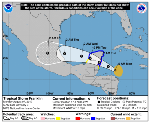
TROPICAL STORM FRANKLIN FORMS: Franklin formed in the western Caribbean last night; it has sustained winds of 45 mph early this morning, and will cross the Yucatan Peninsula tomorrow. From there, the system will move into the Bay of Campeche in the far southwest Gulf of Mexico, and then make a second landfall on the Mexican coast, well south of Brownsville, Texas, on Thursday. Franklin is no threat to the northern Gulf of Mexico.
INVEST 99L: A second disturbance in the central Atlantic is fighting shear and dry air, but if it survives there is some chance of slow development late this week. This will be gaining latitude and for now looks like no threat to the Caribbean or the Gulf of Mexico if anything forms.
BEACH FORECAST: Click here to see the AlabamaWx Beach Forecast Center page.
WEATHER BRAINS: You can listen to our weekly 90-minute netcast anytime on the web, or on iTunes. This is the show all about weather featuring many familiar voices, including meteorologists at ABC 33/40. We will produce this week’s show tonight at 8:30. You can watch it live here.
CONNECT: You can find me on all of the major social networks:
Facebook
Twitter
Google Plus
Instagram
Pinterest
Snapchat: spannwx
For more weather news and information, visit AlabamaWx.