Opening round of storms likely for early afternoon across central Alabama
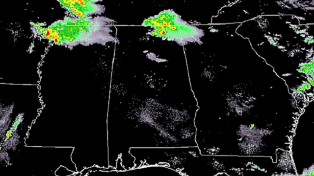

RADAR CHECK: A little earlier in northeast Alabama, there was a batch of rain and thunderstorms moving eastward mainly over Madison and Jackson counties, affecting Hazel Green, New Market, Moores Mill, Hytop and Stevenson. These should be moving out of the state shortly.

ACROSS THE SOUTHEAST: There are a few areas of showers and thunderstorms across the Southeast at this point; the good news is that most have not reached severe criteria.
The center of low pressure that will be responsible for our threat for severe storms later today is over the Oklahoma/Kansas state line starting to move into the southwestern parts of Missouri, with an associated cold front draping back through the extreme western portions of Arkansas and down into the northwestern corner of Louisiana and into eastern Texas. There is a stalled front over the southern parts of Alabama and Mississippi that will start moving northward, which will bring more moist and warmer conditions later this morning and into the afternoon.
THINKING ON THE SEVERE WEATHER THREAT: Our mesoscale models are consistent in their treatment of the storm development this afternoon. The High Resolution Rapid Refresh and 3km North American Mesoscale both point to a wave of convection developing around noon across central Alabama. The HRRR is a little farther east, developing storms around 11 a.m. near and just west of I-65, while the NAM starts firing over west Alabama around 1 p.m. and spreading east.
The NAM shows storms becoming heavy in the Birmingham area before 3 p.m., while the HRRR waits until they are in eastern Alabama before getting them really going.
So we have moved our time frame for the start of severe weather up to noon-3 p.m. The tornado threat will not be as high as it will be tonight, but we can’t rule out tornadoes occurring with this first wave of storms, especially if they get started over west Alabama. Over east central Alabama, these first storms could produce large hail as well as damaging winds. Areas that could be affected include Coosa, Tallapoosa, Chambers, Elmore, Macon and Lee counties. We will be watching.
The main activity will occur ahead of the cold front, forming over western Tennessee and down into northern Mississippi around noon or 1 p.m. Those storms will push into northwest Alabama between 3 and 5 p.m. and fire east and southeast. The storms will have plenty of instability, although that instability will begin to wane after sunset and the storms may gradually weaken. They undoubtedly will have tons of bulk shear, so they will organize into supercells. There will be pockets of higher low-level helicity as well, so tornadoes will be possible in the enhanced risk area, including the possibility of strong tornadoes (EF2 or greater).
Timing for the main wave of storms looks like:
- Hamilton, 2 p.m.-6 p.m.
- Huntsville, Jasper, Cullman and Tuscaloosa, 4 p.m.-8 p.m.
- Birmingham and Gadsden, 5 p.m.-9 p.m.
- Anniston and Clanton, 8 p.m.-midnight
Keep in mind that this timing can change.
The storms will be scattered in nature, so not everyone might get storms. But the storms that do form could be intense.
The National Weather Service in Birmingham will release a special balloon sounding at 1 p.m. This will give us a better idea about atmospheric profiles.
DON’T PANIC: But stay aware and prepared. Review your safety plan for any places you will be this afternoon and evening. Have your safety kit handy near your safe place including helmets, hard-soled shoes and air horns. Make sure everything is charged up.
AlabamaWx will have frequent updates throughout the day and night, along with the latest watches and warnings.


