James Spann: Alabama stays cold, dry through Friday
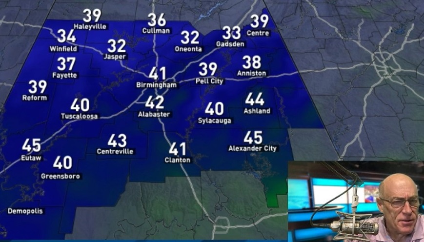
SUNNY BUT COLD: We pretty much have a case of “severe clear” across Alabama this afternoon with temperatures in the 40s. A secondary surge of cold air arrives tonight, mostly in dry fashion, although a snow flake or two might be seen somewhere across north Alabama after midnight. Temperatures will fall into the 20s early Friday morning; then the daytime hours will be sunny and a bit colder, with a high between 40 and 45 degrees across the northern half of the state.
THE ALABAMA WEEKEND: Saturday morning will be cold; we project a low between 22 and 27 for most communities. We warm into the low 50s Saturday afternoon with a partly sunny sky. On Sunday, a clipper will bring the risk of a little scattered light rain to the Tennessee Valley of far north Alabama; otherwise the state will be dry with a mix of sun and clouds and a high in the mid 50s.
Monday will be dry and fairly pleasant with a high in the 55- to 60-degree range.
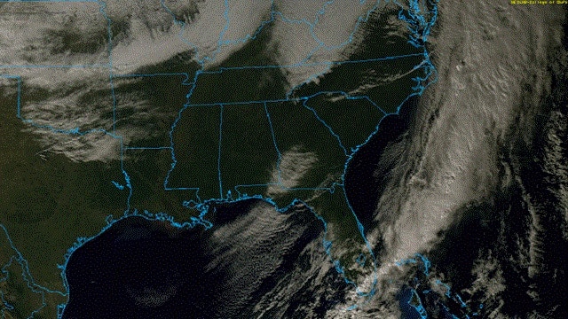
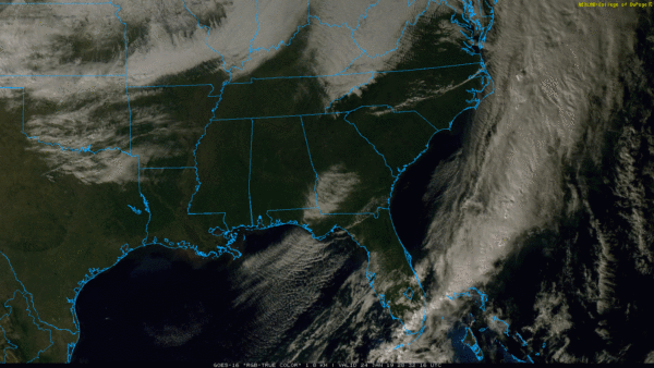
ARCTIC FRONT TUESDAY; SOME SNOW??? An Arctic cold front will pass through Alabama Tuesday morning, followed by temperatures falling through the 30s. Some light rain will likely precede the front, and there is a chance the rain will change to light snow in the colder air. There is decent support from global models on this idea. Some notes:
- Systems like this usually don’t have much moisture to work with, so precipitation tends to be pretty light.
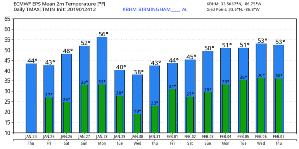
- The mean of the European model ensemble suggests potential for some light snow accumulation over north Alabama by Tuesday evening. But keep in mind a number of the members of the ensemble show no significant snow at all over Alabama.
- There is no skill in a specific snow forecast (amount, placement, etc.) this far out. You will see all kinds of deterministic model output smeared across social media, but that means very little right now. Once we get within 72 hours, confidence will be high enough to answer the questions you are asking.
- Regardless of any snow, the incoming cold air is the big story. I would expect much of north Alabama to be in the teens early Wednesday and Thursday mornings, with highs in the 30s. To the north, cold weather records are likely to be shattered in cities like Chicago, Minneapolis, Bismarck and Milwaukee. It will be brutally cold with very dangerous wind chill values.
A warming trend begins next Friday.
ON THIS DATE IN 1967: A tornado outbreak across the Central U.S. was the farthest north ever recorded in the winter up to that time. Severe weather occurred across a good portion of southeast and east-central Iowa. Two-inch hail fell at Armstrong, and more than two dozen tornadoes were reported. Five miles north of Fort Madison, one fatality and six injuries occurred from a tornado. Another tornado causing F4 damage killed three people and injured 216 in St. Louis County, Missouri. Storms also affected parts of northern and central Illinois. One strong tornado in Mason County killed one person and injured three others. Another tornado moved across the Champaign-Urbana metropolitan area, injuring five people. Other strong tornadoes were reported across Carroll County in Mt. Carroll, where 12 people were injured, and near Gladstone in Henderson County. Funnel clouds were reported across the southwest section of Chicago.
BEACH FORECAST: Click here to see the AlabamaWx Beach Forecast Center page.
WEATHER BRAINS: You can listen to our weekly 90-minute show any time on your favorite podcast app. This is the show all about weather featuring many familiar voices, including meteorologists at ABC 33/40.
CONNECT: You can find me on all of the major social networks:
Facebook
Twitter
Instagram
Pinterest
Snapchat: spannwx
For more weather news and information from James Spann and his team, visit AlabamaWx.