Scott Martin: Decent but cool weekend for Alabama; snow arrives Tuesday
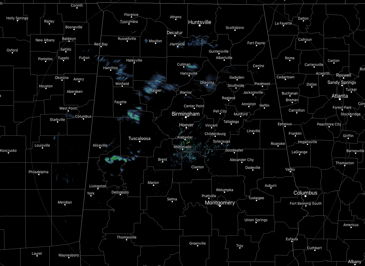
TODAY: We had a few snow flurries showing up across the north and western parts of the state as of 6:45 this morning. As you can see on the satellite image, we have some clouds over the northern half of the state and back over into Mississippi. Temperatures were in the mid-20s to 30 degrees.
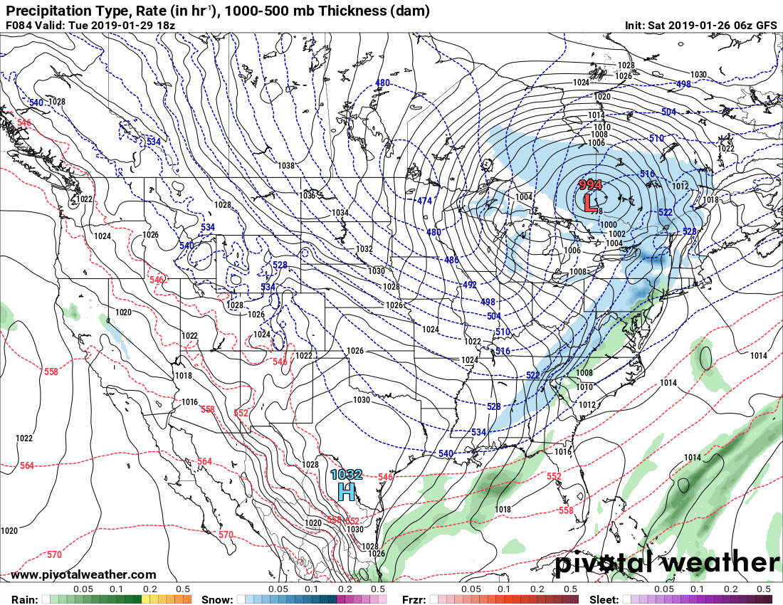
 Taking a look at the run of the Global Forecast System valid today at noon, high pressure will be centered just to our west in northeastern Mississippi. After the snow flurries dissipate, we’ll have partly cloudy skies in the north, mostly clear in the south. Afternoon highs will be in the upper 40s to the mid-50s. Skies will be partly cloudy tonight with overnight lows in the upper 20s to the mid-30s.
SUNDAY: We’ll be between a high to the north and a low out over the Gulf of Mexico. That means we’ll have a mix of sun and clouds throughout the day, but those clouds will mostly clear out by the late afternoon and into the evening. Highs will be in the lower 50s to near 60 degrees, with lows in the lower to mid-30s.
MONDAY: A low will be centered up in the Great Lakes region and an associated cold front will begin to approach the state, but we’ll stay dry during the daylight with mostly sunny skies and highs in the upper 50s to the lower 60s. The cold front will be close enough that showers will begin to move into northwestern Alabama at or just before midnight.
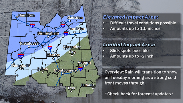
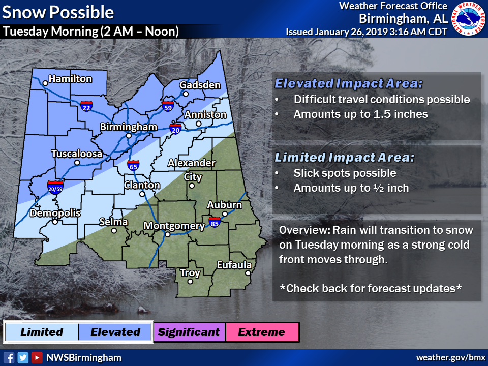
SNOW ON TUESDAY: As temperatures begin to fall below freezing, we’ll see snow falling in Alabama as early as 2 a.m. in the northwest and leaving the eastern parts of the state by noon or just after. Temperatures will start off at midnight in the upper 20s to the lower 40s from northwest to southeast, falling into the upper 20s to the mid-40s by 6 a.m. and into the upper 20s to the lower 40s by noon.
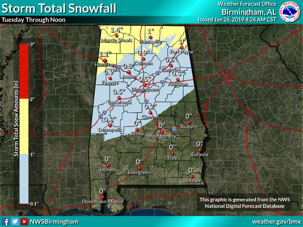
Accumulations look to range from around one-quarter inch from as far south as Demopolis to Clanton to Wedowee, to as much as one-half inch along the I-59 corridor and up to 1.5 inches in the northwest corner of the state.
Understand, we are still around 68 hours away from the start of this event. We’ll continue to get better information as the higher-resolution models start to come in, and we’ll be able to nail down more precise timing and accumulation amounts as we get closer to Tuesday.
Wind will be another factor. It will be quite gusty at times, and that will send those wind chill factors much lower than the actual temperatures. Winds will be out of the northwest at 5-15 mph with gusts as high as 25 mph. Wind chills will be running as much as 10 degrees colder than actual temperatures at times.
Once the wintry precipitation leaves the area those temperatures will continue to fall, and any moisture out on the roadways will likely freeze, leading to icing. Overnight lows will get down into the mid-teens to the lower 20s.
REST OF NEXT WEEK: We’ll have much-improved conditions on Wednesday, but we could have icing issues lingering through much of the morning as most places will not climb above the freezing mark until late morning. We’ll have plenty of sunshine with just one or two clouds and highs reaching the lower to mid-40s, with upper 40s in the extreme southern portions of the state.
Thursday’s weather looks to be relatively nice and a little warmer than Wednesday. We’ll have mostly sunny skies and highs topping out in the lower 40s to the lower 50s.
On Friday, the GFS is keeping central Alabama dry, but the European model shows some shower activity close by. At this point, we’ll go with mostly cloudy skies and a very small chance of a shower or two with afternoon highs in the mid-40s to the lower 50s.
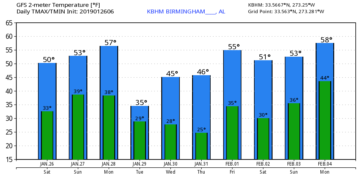
VOODOO LAND: The GFS is showing that the next chance of showers may come on Monday, Feb. 4, and we may stay wet through Tuesday night. Highs start to climb back up to around normal values at the end of the next 10 days, with highs in the 50s and lows in the 30s and 40s.
For more weather news and information from James Spann, Scott Martin and other members of the James Spann team, visit Alabama Wx.


