Scott Martin: Alabama sees more scattered storms for next several days
THROUGH THE WEEKEND: We’ll continue with an active pattern Friday through Sunday. Isolated to scattered showers and storms will be possible Friday, with chances ranging from 30% to 40% from northwest to southeast. Highs will be in the upper 80s to the lower 90s. Rain chances will stay higher Saturday, with a 40% to 50% chance of mainly afternoon, scattered showers and thunderstorms. Highs will be in the upper 80s to the lower 90s. Sunday will be much the same, with the odds of scattered showers and thunderstorms greater during the afternoon hours.
NEXT WEEK: It’s the “wash and repeat” forecast to start next week as we’ll continue with hot, humid conditions and a risk of a few isolated to scattered, mainly afternoon showers and storms each day. Mornings will start with a good bit of sunshine, with clouds building during the main heating of the day. Highs will be in the upper 80s to the lower 90s Monday and Tuesday and back up into the lower to mid-90s Wednesday. Rain chances will be a little higher Monday, in the 30%-50% range, but will drop back to 20%-30% Tuesday and Wednesday.
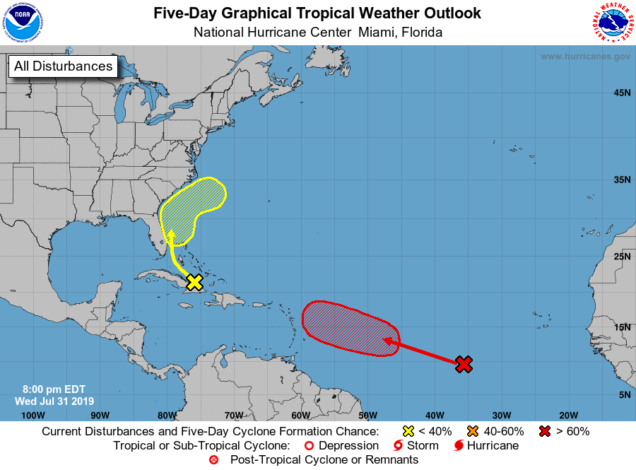
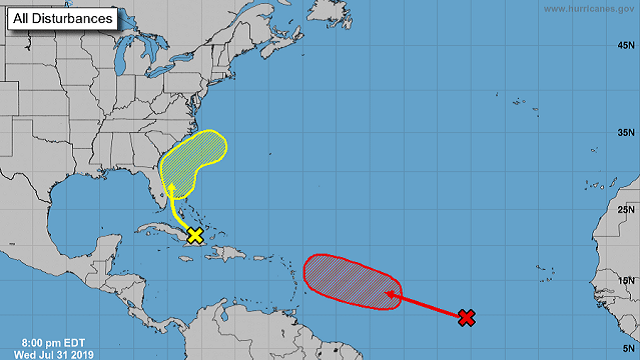
TROPICS: The disturbance over Cuba and the Bahamas that used to be called Invest 95L will move northwest then northward, bringing heavy rain and some gusty winds to the Greater Antilles, the Bahamas and parts of the Florida peninsula over the next few days. Conditions may become marginally conducive for development over the weekend as the system curves back out to the northeast and away from the U.S. mainland, but the National Hurricane Center is giving it only a 10% chance of developing into a depression within the next five days.
Invest 96L is about 900 miles west-southwest of the Cabo Verde Islands over the eastern Atlantic Ocean. Some slow development is possible over the next couple of days as it moves west-northwest at 15 mph. Conditions become more favorable for development over the weekend and a depression is likely to form well east of the Lesser Antilles. The NHC has a 70% chance of tropical depression development within the next five days. Most of the models have this one curving back to the north and northeast well before reaching the U.S. mainland.
Another tropical wave has moved off the African coast just behind Invest 96L and will need to be watched.
ON THIS DAY IN 1989: Hurricane Chantal made landfall along the upper Texas coast about sunrise. Chantal deluged parts of Galveston Island and southeastern Texas with 8 to 12 inches of rain. Unofficial totals ranged up to 20 inches. Winds gusted to 82 mph at Galveston and reached 76 mph in the Houston area. Tides were 5 to 7 feet high. The hurricane claimed two lives and caused $100 million damage.
BEACH FORECAST CENTER: Get the latest weather and rip current forecasts for the beaches from Fort Morgan to Panama City on our Beach Forecast Center page. There, you can select the forecast of the region you are interested in.
WEATHERBRAINS: You can listen to our weekly 90-minute netcast any time on the web at WeatherBrains.com or on iTunes, Stitcher or Spotify. This is the show all about weather featuring many familiar voices, including the meteorologists at ABC 33/40.
For more weather news and information from James Spann, Scott Martin and other members of the James Spann team, visit AlabamaWx.


