James Spann: Dual threat for Alabama from flooding, severe thunderstorms
James Spann has a soggy, stormy midweek forecast for Alabama from Alabama NewsCenter on Vimeo.
ACTIVE WEATHER AHEAD: Alabama will have the dual threat of heavy rain/flooding and strong to severe thunderstorms over the next 36 hours as a dynamic weather system approaches from the west. We have showers and thunderstorms in progress this morning over roughly the northern half of the state, but the core risk of stronger storms will come later today and tonight.
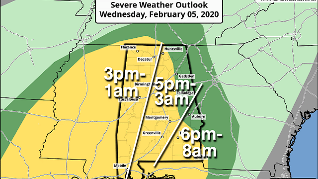
The Storm Prediction Center has defined a slight risk (level 2 out of 5) of severe thunderstorms for much of Alabama — areas west of a line from Huntsville to Lincoln to Tuskegee to Eufaula. A marginal risk (level 1 of 5) covers far east and northeast Alabama.
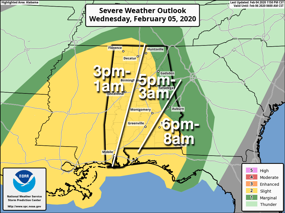
TIMING: The window for organized severe storms opens up in west Alabama around 3 this afternoon; for Birmingham, Anniston and Gadsden after 5, and for far east and southeast Alabama after 6. Storms could linger across southeast Alabama through midmorning Thursday.
THREATS: Stronger storms will be capable of producing small hail, strong straight-line winds and a few tornadoes.
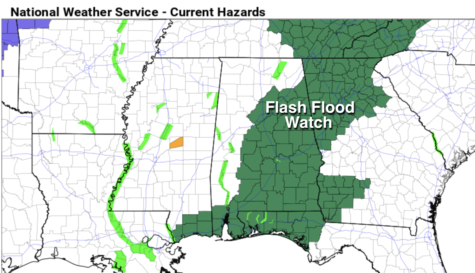
FLOODING: Rain amounts between now and Thursday night will be in the 3- to 4-inch range for much of the state; a flash flood watch is in effect for much of central and east Alabama, where the heavier totals are expected. Pay attention to warnings if you live in a flood-prone area, and don’t drive into flooded roads.
CALL TO ACTION: Be sure you have a good way of hearing severe weather warnings tonight if they are needed. Know your safe place and have helmets for everyone there. If you live in a mobile home, you can’t stay there during a tornado warning. Know where you are going and the quickest way to get there.
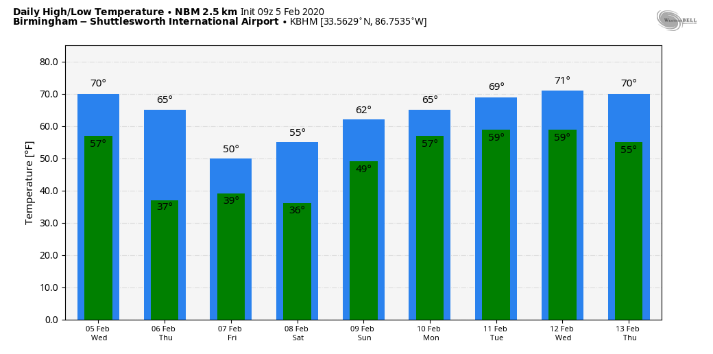
THURSDAY/FRIDAY: Rain continues Thursday, but temperatures will go the wrong way. We start the day in the 60s, but then we fall through the 50s, most likely reaching the 40s by afternoon. It will feel much colder than the recent warmth. Rain finally tapers off Thursday night as drier air pushes into the state.
There could be just enough moisture left over for a few snow flurries over the northern third of Alabama late Thursday night and Friday morning, but we expect no impact. During the day Friday, look for partial clearing with a high close to 50 degrees.
THE ALABAMA WEEKEND: Clouds move back into the state Saturday with a fast-moving weather disturbance, and some scattered light rain is possible during the day — nothing heavy and no thunder. Rain amounts should be less than one-tenth of an inch and the high will be in the mid 50s. Sunday promises to be a very nice day with ample sunshine and a high around 60 degrees.
NEXT WEEK: Clouds increase Sunday night and we expect mild conditions with periods of rain Monday and Tuesday. Highs will be up in the 60s. A cold front will bring thunderstorms Wednesday; it’s too early to know whether severe storms will be an issue. We trend drier toward the end of the week.
ON THIS DATE IN 2008: The Super Tuesday 2008 Tornado Outbreak has been one of the deadliest tornado outbreaks in the U.S., with 59 fatalities reported. So far, it ranks in the top 15 deadly tornado outbreaks. According to the SPC Storm Reports, there were more than 300 reports of tornadoes, large hail (up to 4.25 inches in diameter in Texas, Arkansas and Missouri) and damaging wind gusts from Texas to Ohio and West Virginia. The outbreak produced at least 64 tornadoes, some producing EF-3 and EF-4 damage. There were seven tornadoes in Alabama, including an EF-4 that moved through parts of Lawrence and Morgan counties, killing four people. Another EF-4 tornado touched down in Jackson County, near Rosalie, killing one person.
STORM SPOTTER TRAINING: Our annual storm spotter training is this Saturday, Feb. 8, at the Hoover Met. It begins at 9:30 and there is no cost. We will offer both the basic and advanced training sessions; we expect to wrap up by 2:30. No need to register; just show up with a curious mind. We need more trained storm spotters. Help us make the warning process better.
BEACH FORECAST: Click here to see the AlabamaWx Beach Forecast Center page.
WEATHER BRAINS: You can listen to our weekly 90-minute show any time on your favorite podcast app. This is the show all about weather featuring many familiar voices, including the meteorologists at ABC 33/40.
CONNECT: You can find me on the major social networks:
Facebook
Twitter
Instagram
Pinterest
Snapchat: spannwx
For more weather news and information from James Spann and his team, visit AlabamaWx.


