James Spann: Strong to severe storms possible for Alabama later today
James Spann has the midweek forecast for Alabama from Alabama NewsCenter on Vimeo.
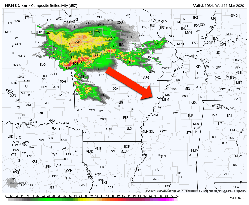
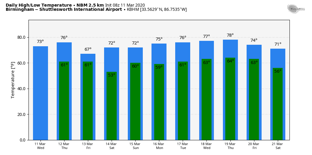
ACTIVE WEATHER LATER TODAY: The weather is quiet early this morning across Alabama; temperatures are mostly in the upper 50s and low 60s. We are watching a mass of thunderstorms over far southern Missouri and northern Arkansas; this mesoscale convective system (MCS) will roll steadily to the southeast and should wind up in Alabama this afternoon.
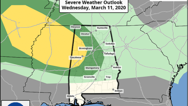
The Storm Prediction Center has defined a slight risk (level 2 of 5) for parts of west Alabama for this afternoon. It includes places like Tuscaloosa, Hamilton, Fayette, Vernon, Reform, Eutaw and Livingston. A marginal risk (level 1 of 5) extends as far east as Oneonta, Pell City, Rockford and Prattville.
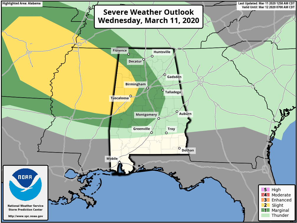
TIMING: Storms could enter northwest Alabama as early as 1 this afternoon; they reach Cullman, Birmingham and Tuscaloosa by 4, then move into east Alabama after 6.
THREATS: The main threats will come from strong, potentially damaging winds, and hail. Forecast wind profiles suggest the tornado threat is very low.
RAIN: The MCS will move quickly, so rain amounts should be one-half inch or less for most places. Flooding is not expected.
Prior to the arrival of the thunderstorms the day will be mostly cloudy and mild, with a high in the low to mid 70s this afternoon.
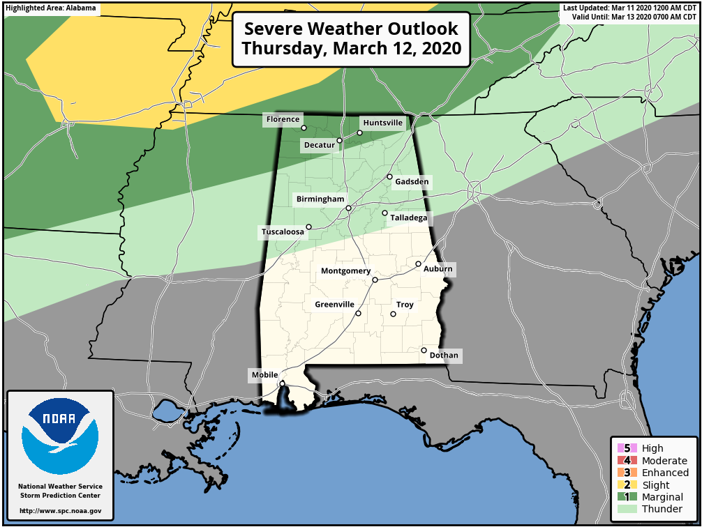
THURSDAY/FRIDAY: A decent part of the day Thursday should be dry; the best chance of showers and storms will be over the Tennessee Valley of far north Alabama, where the SPC has a marginal risk (level 1 out of 5) of severe storms defined.
The high Thursday will be in the mid 70s with more clouds than sun. On Friday, a few passing rain showers are likely as a surface front drops down near the Alabama/Tennessee state line and becomes stationary. Friday’s high will be in the mid to upper 60s.
THE ALABAMA WEEKEND: We have introduced the chance of a few isolated showers Saturday, but still most of the day will be dry with a mix of sun and clouds and a high around 70. Scattered showers are more likely Sunday, but the day won’t be a washout. The sky will be generally cloudy Sunday with a high at or just over 70.
NEXT WEEK: Mild weather continues; afternoon highs will be well up in the 70s. Some parts of the state could flirt with 80 degrees on a day or two. A most air mass will stay in place, and there will be some risk of showers on most days, but no sign of any severe thunderstorms or flooding.
ON THIS DATE IN 1990: Forty-four cities in the central and eastern U.S. reported record high temperatures for the date. Record highs included 71 degrees at Dickinson and Williston, North Dakota, and 84 degrees at Lynchburg, Virginia, Charleston and Huntington, West Virginia. Augusta, Georgia, and Columbia, South Carolina, tied for honors as the hot spot in the nation with record highs of 88 degrees.
BEACH FORECAST: Click here to see the AlabamaWx Beach Forecast Center page.
WEATHER BRAINS: You can listen to our weekly 90-minute show any time on your favorite podcast app. This is the show all about weather featuring many familiar voices, including the meteorologists at ABC 33/40.
CONNECT: You can find me on all of the major social networks:
Facebook
Twitter
Instagram
Pinterest
Snapchat: spannwx
For more weather news and information from James Spann and his team, visit AlabamaWx.


