James Spann: Friday will be cooler in Alabama, with some rain at times
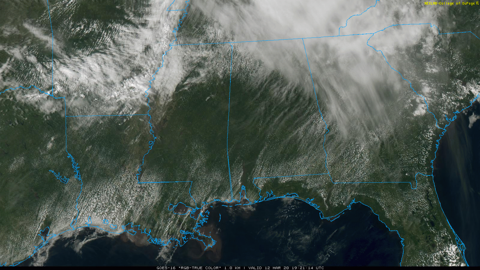
WARMEST SO FAR: The sky is partly to mostly sunny across much of Alabama this afternoon, with temperatures in the 75- to 80-degree range. Evergreen, in South Alabama, hit 82 degrees at 2 p.m. As I write this, Birmingham’s high so far is 77; until today our warmest temperature in 2020 came on Feb. 12, when the high was 76. There is nothing on radar, and the weather will remain dry across Alabama through the evening.
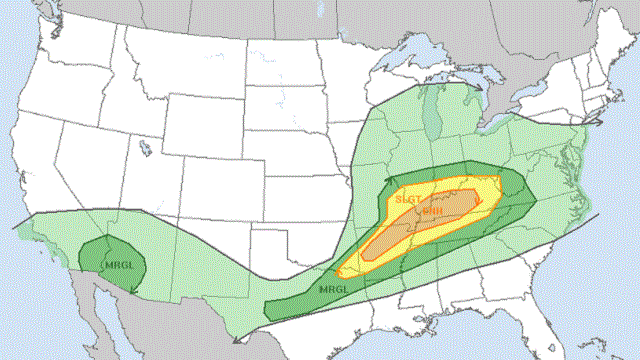
TO THE NORTH: Severe thunderstorms continue to develop in a broad zone from northeast Texas to Kentucky and Tennessee; the Storm Prediction Center maintains an enhanced risk (level 3 out of 5) of severe storms in this region. A few tornadoes are possible there through tonight — possibly a strong tornado or two.
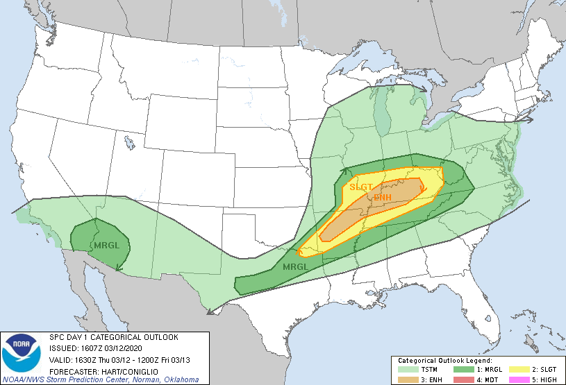
The storms will drift down into north Alabama late tonight, mainly after midnight. But they should be weakening and there is just a low-end, marginal risk (level 1 of 5) defined for the Tennessee Valley. A few storms there could produce gusty winds, but the overall severe weather risk for north Alabama is low.
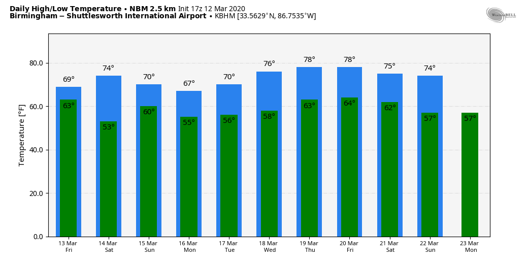
COOLER FRIDAY: Cooler air will slip into north Alabama. We start the day in the mid 60s, but temperatures will slowly fall, reaching the upper 50s by afternoon. Communities across the northern third of the state will slip into the mid 50s, a good 20 degrees colder than where we are today. The sky will be cloudy and a few periods of light rain are likely.
THE ALABAMA WEEKEND: Saturday looks mostly dry; with a mix of sun and clouds, we project a high back in the low 70s with only a small risk of any spot seeing a shower. On Sunday, the sky will be occasionally cloudy with a few scattered showers possible. Sunday’s high will be close to 70.
NEXT WEEK: Mild, showery weather will continue. There will be some risk of showers just about daily; highs will be in the 70s. There are still no signs of any flooding or severe thunderstorm potential at this point.
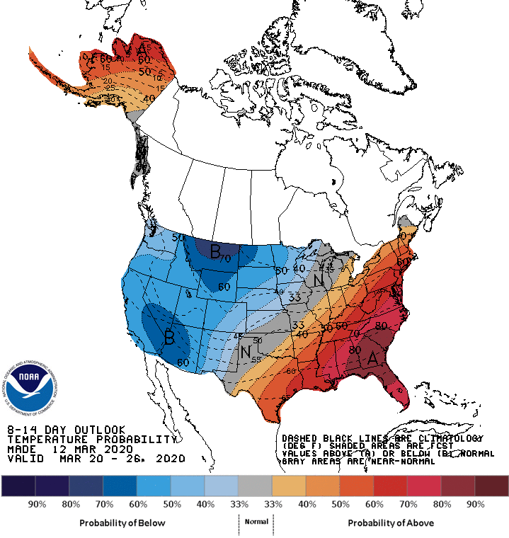
And the new Climate Prediction Center outlook for March 20-26 continues to show above-average temperatures for the Southeast.
But, remember, we almost always have a late-season cold snap in Alabama during the first half of April. The chance is high we are not done with freezing temperatures over the northern half of the state for the season.
ON THIS DATE IN 1993: The generational “Blizzard of ’93” was underway. All 67 Alabama counties had measurable snow; winds gusted to nearly hurricane force on ridges with white-out conditions. Snow amounts of 1 to 2 feet were common over the northern half of the state, with drifts to 4 feet. There was a lot of eerie green lightning followed by the muffled sound of thunder during the peak of the storm. With the atmosphere overloaded with big snowflakes, part of the sound of thunder was absorbed. Some had no power for more than a week. We forecast 6 to 16 inches of snow going into the event, but many didn’t listen since it was mid-March, the flowers were blooming and the high on March 10, 1993, two days before the blizzard, was 75.
The storm dropped 13 inches at the Birmingham International Airport, where the records are kept, and almost 2 feet of snow across parts of southern Jefferson and northern Shelby counties. The heaviest snow across the Southeast was recorded at Newfound Gap, where U.S. 441 crosses the Tennessee and North Carolina border, with 5 feet.
BEACH FORECAST: Click here to see the AlabamaWx Beach Forecast Center page.
WEATHER BRAINS: You can listen to our weekly 90-minute show any time on your favorite podcast app. This is the show all about weather featuring many familiar voices, including the meteorologists at ABC 33/40.
CONNECT: You can find me on all of the major social networks:
Facebook
Twitter
Instagram
Pinterest
Snapchat: spannwx
For more weather news and information from James Spann and his team, visit AlabamaWx.


