James Spann: Rain tapers off in Alabama tonight; strong storms early Thursday morning
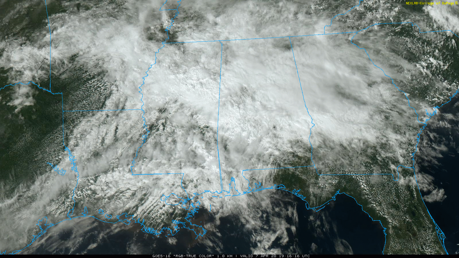
WET AFTERNOON: Rain is fairly widespread across north and central Alabama this afternoon. There isn’t much lightning showing up, and the risk of severe storms remains very low through the evening. Temperatures are mostly in the 60s where rain is falling, with 70s elsewhere. The rain will taper off from west to east this evening.
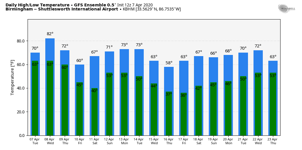
WEDNESDAY/THURSDAY: Wednesday will be a very warm April day; with a mix of sun and clouds we project a high between 82 and 85 degrees for most communities. A few scattered showers or storms are possible, but much of the day will be dry.
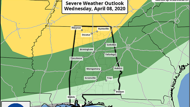
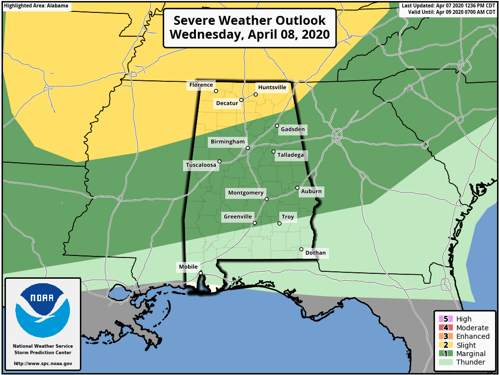
Then, late Wednesday night, an approaching cold front will bring a band of showers and strong storms into the state. The Storm Prediction Center has defined a slight risk (level 2 out of 5) of severe storms as far south as Vernon, Cullman and Fort Payne, with a marginal risk (level 1 of 5) all the way down to Grove Hill, Greenville and Phenix City. This outlook runs through 7 a.m. Thursday.
The main window for strong to severe storms will come from 2 until 7 a.m. Thursday. Storms will be capable of producing hail, damaging winds and a few tornadoes. This will be a middle-of-the-night kind of event, so it is very important for everyone to have a good, working, properly programmed NOAA Weather Radio in your home so you won’t miss any warnings if they are needed.
During the day Thursday the sky becomes partly to mostly sunny with a high in the mid 70s.
FRIDAY/SATURDAY: Friday will be cool and dry; with a good supply of sunshine the high will be in the 60s. Saturday morning will feature a low between 38 and 44 degrees; we can’t rule out a touch of light frost for colder pockets across north Alabama. During the day Saturday, the sky will be partly sunny with a high between 67 and 70. Clouds will increase late in the day.
EASTER SUNDAY: Global models show a pattern favorable for strong to severe thunderstorms across parts of the Deep South on Easter. Strong winds aloft, a deep surface low to the northwest and moist, unstable air will all be present. It’s still too early to determine the magnitude of the threat, but Sunday looks like an active day. The high Sunday afternoon should be in the 70s; rain amounts of 1-2 inches are likely.
NEXT WEEK: Much cooler air rolls into Alabama Monday, and we will have the threat of a freeze and frost on at least one midweek morning. Growers need to monitor temperature forecasts as we get closer.
ON THIS DATE IN 1926: Lightning started a disastrous oil fire at San Luis Obispo, California, which lasted for five days, spread over 900 acres and burned more than six million barrels of oil. Flames reached 1,000 feet, and the temperature of the fire was estimated at 2,500 degrees. The fire spawned thousands of whirlwinds, with hundreds the size of small tornadoes. One vortex traveled one mile to the east-northeast of the blaze, destroying a small farmhouse and killing two people. Damage totaled $15 million.
ON THIS DATE IN 1980: Severe thunderstorms spawned tornadoes that ripped through central Arkansas. The storms also produced high winds and baseball-sized hail. Five counties were declared disaster areas by President Jimmy Carter. A tornado causing F3 damage also affected St. Louis and St. Charles counties in Missouri, producing $2.5 million in damage.
ON THIS DATE IN 2006: Severe thunderstorms produced more than a dozen tornadoes across Alabama, including EF-1 twisters at Gardendale and Roebuck.
WEATHER BRAINS: You can listen to our weekly 90-minute show any time on your favorite podcast app. This is the show all about weather featuring many familiar voices, including the meteorologists at ABC 33/40.
CONNECT: You can find me on all of the major social networks:
Facebook
Twitter
Instagram
Pinterest
Snapchat: spannwx
For more weather news and information from James Spann and his team, visit AlabamaWx.


