James Spann: Another cold night ahead for Alabama
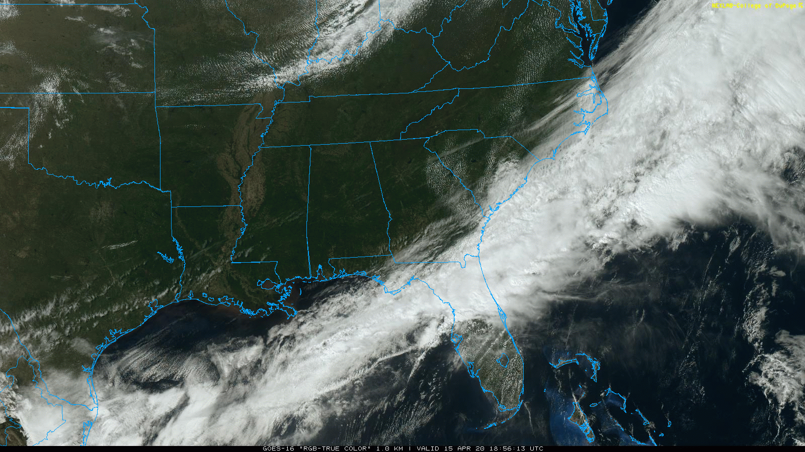
BLUE SKY: Nothing but sunshine across Alabama this afternoon; temperatures are only in the 58- to 63-degree range. The average high for Birmingham on April 15 is 74. Tonight will be clear and cold with a low between 34 and 40; frost is likely again for places where the wind goes calm. Colder valleys will see a freeze.
Thursday will be another sunny day and a warming trend begins during the afternoon, with a high around 70.
FRIDAY AND THE WEEKEND: The day Friday will be dry with a partly sunny sky; we are forecasting a high in the mid to upper 70s. Clouds roll in Friday night, and a cold front will bring some light rain. The best chance of rain will come from about 9 p.m. Friday through 9 a.m. Saturday; amounts should be less than one-quarter inch for most communities because of limited moisture. During the day Saturday, the sky becomes partly sunny with a high between 67 and 70.
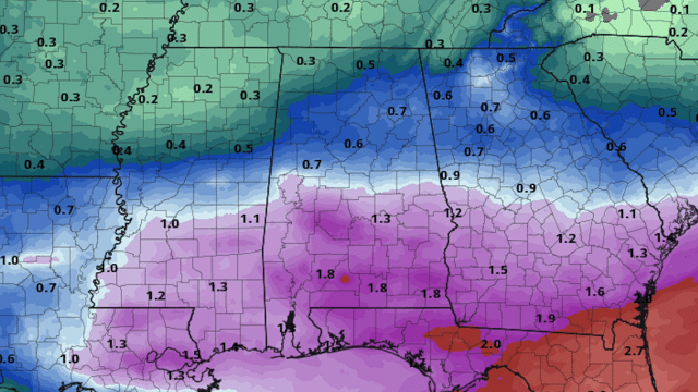
The front will back up Sunday and begin to move northward in response to a wave to the west, and we will forecast periods of rain statewide Sunday and Sunday night. A few thunderstorms are possible near the Gulf Coast, but for now the odds of severe storms there look low. The high Sunday will be close to 70, and rain amounts of around one-half inch are likely.
NEXT WEEK: Rain should end early in the day Monday, followed by afternoon clearing. Tuesday will be dry and pleasant with a high in the 70s. Then, a significant storm system will bring rain and thunderstorms into the state at some point in the Wednesday-Thursday time frame; it’s still too early to know if this will bring severe storms, heavy rain or both. Drier air returns on Friday.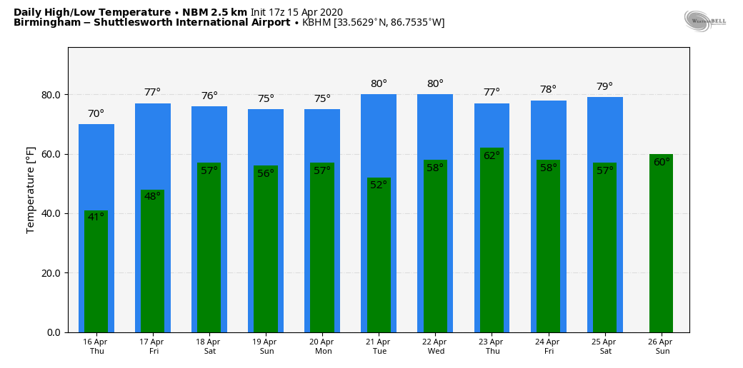
STORM SURVEYS: A total of 23 tornadoes have now been confirmed across Alabama on Easter, and the total for the Deep South is 86. One violent EF-4 tornado in Mississippi was more than two miles wide at one point, one of the largest tornadoes on record in the U.S. in terms of width.
MORNING CHILL: Lows across Alabama this morning included:
- Haleyville — 32
- Meridianville — 32
- Cullman — 33
- Decatur — 33
- Black Creek — 33
- Crestwood — 36
- Birmingham Airport — 37
- Hueytown — 37
- Heflin — 38
ON THIS DATE IN 2011: The “forgotten” tornado outbreak. One of the large EF-3 tornadoes to strike central Alabama on that day created a swath of damage from northeastern Greene County, just southeast of the community of Ralph, to just south of Veterans Memorial Parkway, east of Tuscaloosa in south-central Tuscaloosa County. Winds with this monster were estimated at 140 mph, mainly uprooting and snapping trees. A few homes and businesses received damage as the twister moved north of Shelton State Community College, crossed Alabama Highway 69 near Taylorville and crossed I-20/59 near Alabama Highway 82.
Throughout the day, 45 tornado warnings and 19 severe thunderstorm warnings were issued for central Alabama. Of the 29 confirmed tornadoes, the total damage path length was more than 244 miles, with 10 of those tornadoes having damage paths more than 10 miles long. The event was forgotten by many because of what would happen 12 days later, on April 27, 2011, when a generational tornado outbreak would kill 252 people in our state.
BEACH FORECAST: Click here to see the AlabamaWx Beach Forecast Center page.
WEATHER BRAINS: You can listen to our weekly 90-minute show anytime on your favorite podcast app. This is the show all about weather featuring many familiar voices, including the meteorologists at ABC 33/40.
CONNECT: You can find me on all of the major social networks:
Facebook
Twitter
Instagram
Pinterest
Snapchat: spannwx
For more weather news and information from James Spann and his team, visit AlabamaWx.


