James Spann: More storms, possibly severe, for Alabama this afternoon
James Spnn forecasts a stormy day for Alabama from Alabama NewsCenter on Vimeo.
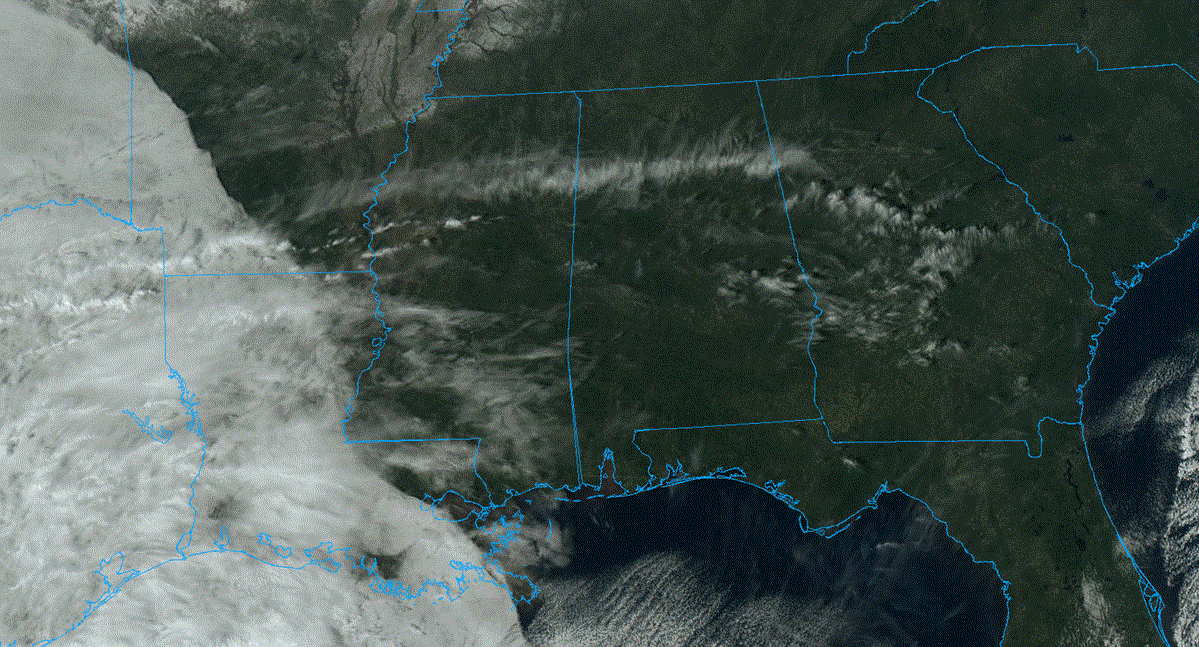
EARLY MORNING SOAKER: A large mass of rain with a few embedded thunderstorms has been moving across Alabama this morning. The air is cool and stable over the northern half of the state, but some have experienced strong winds in spots, along with some loud thunder. Trees have been blown down in scattered parts of Tuscaloosa and Hale counties.
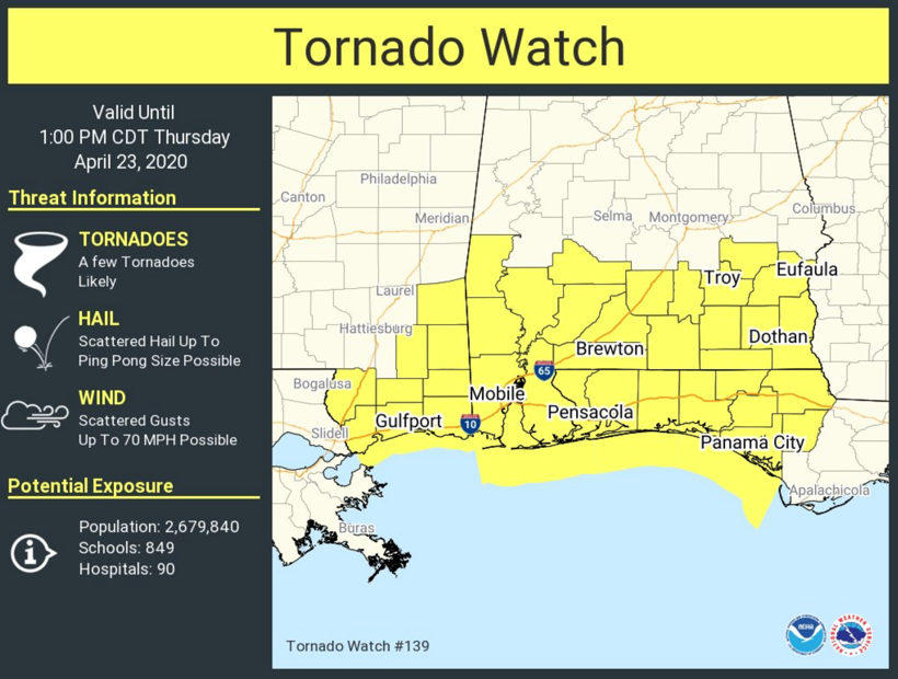
A tornado watch is in effect for the southern quarter of Alabama until 1 p.m.
Rain will end from west to east over the next few hours, and north and central Alabama will have a lull during the mid to late morning. Severe storms will remain possible over south Alabama, where unstable air is in place.
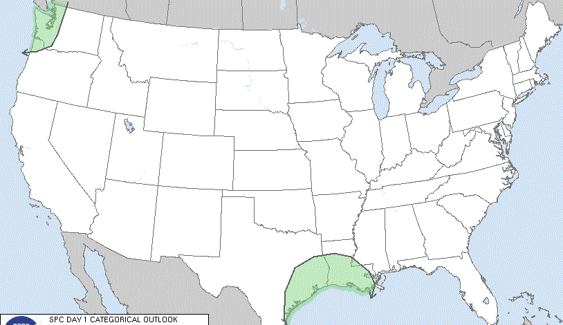
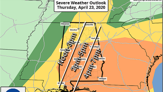
THIS AFTERNOON: Unstable air is expected to move northward during midday, and the latest high-resolution model data suggests there will be sufficient instability by the afternoon for new thunderstorm development ahead of an approaching cold front. The Storm Prediction Center maintains an enhanced risk (level 3 of 5) for areas in Alabama along and south of I-20, with a slight risk (level 2 of 5) up to the Tennessee state line.
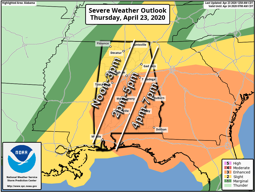
TIMING: Storms will likely begin to develop sometime in the noon to 3 p.m. time frame over west Alabama, then move east during the late afternoon and evening. All of the storms should be into Georgia by 8 p.m.
THREATS: Storms that form will be capable of producing large hail, damaging winds and a few tornadoes. The highest tornado threat is south and east of Birmingham this afternoon, where a strong tornado (EF2 or higher) can’t be ruled out.
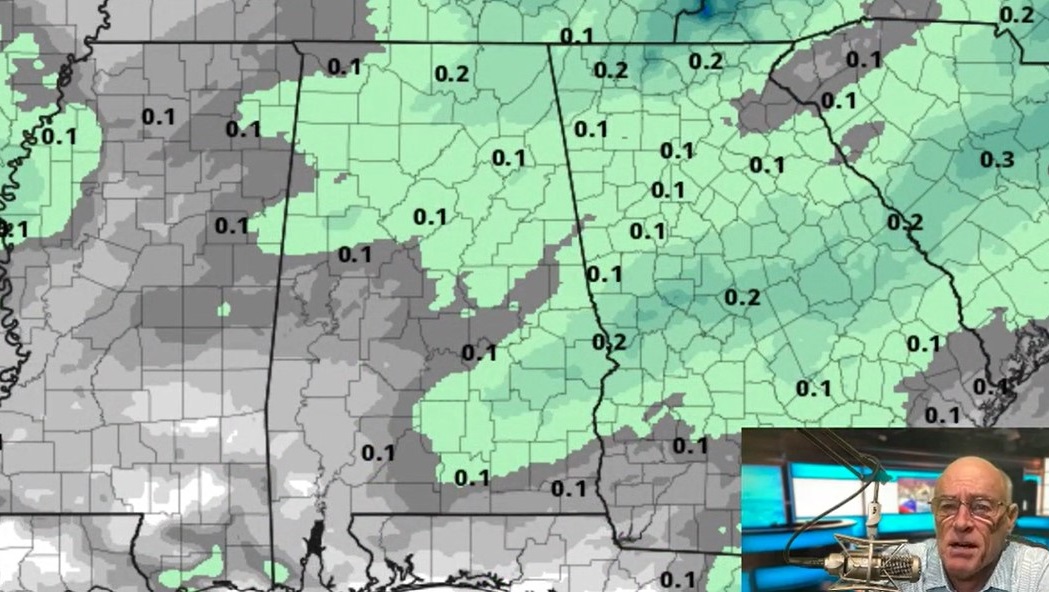
FLOODING: A flash flood watch remains in effect this morning for parts of central and west Alabama. The afternoon thunderstorm activity will be more scattered (unlike the widespread rain we have this morning), so additional flooding this afternoon and evening are unlikely.
Be sure you have a good way of hearing severe weather warnings this afternoon (never a siren), and in your safe place have helmets for everyone in the family. If you live in a mobile home, know your shelter location and how to get there quickly.
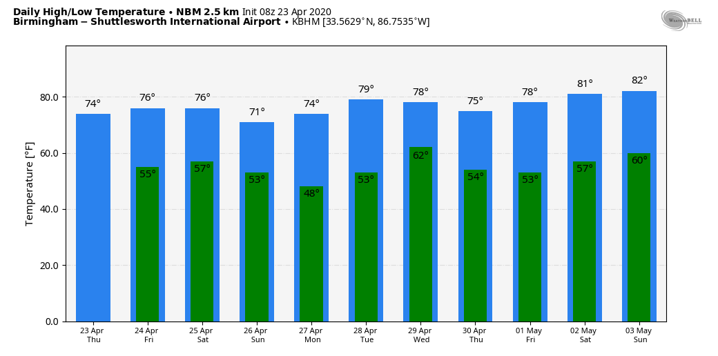
FRIDAY AND THE WEEKEND: Friday will be dry with ample sunshine and a high between 75 and 80 degrees. A fast-moving weather system will bring a few showers and thunderstorms to the northern half of the state late Friday night into early Saturday morning, but for now severe storms are not expected. The sky becomes partly sunny Saturday afternoon with a high in the mid 70s. Then, for a change, Sunday will be dry with sunshine in full supply. The high will be in the low 70s.
NEXT WEEK: For now we are not expecting any severe weather next week, but showers are likely Wednesday as a cold front passes through. Highs through the week will be seasonal, mostly in the 70s.
ON THIS DATE IN 1999: A horrific hailstorm moved southeast from Pennsylvania across Garrett County, Maryland, and into the eastern panhandle of West Virginia. By the time it reached Capon Bridge in eastern Hampshire County, West Virginia, the size of the hail had grown from golf balls to baseballs. As it moved into Frederick County, Virginia, the hail storm continued to grow in a swath from north of Winchester south to Stephen City, about 10 miles. Hailstones grew to the size of grapefruit east of Winchester.
WEATHER BRAINS: You can listen to our weekly 90-minute show anytime on your favorite podcast app. This is the show all about weather featuring many familiar voices, including the meteorologists at ABC 33/40.
CONNECT: You can find me on the major social networks:
Facebook
Twitter
Instagram
Pinterest
Snapchat: spannwx
For more weather news and information from James Spann and his team, visit AlabamaWx.