James Spann: Warming trend ahead for Alabama
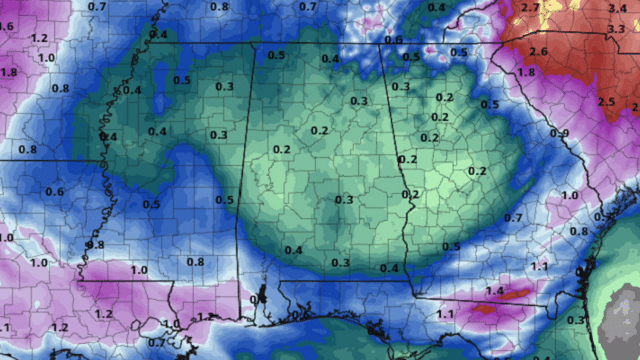
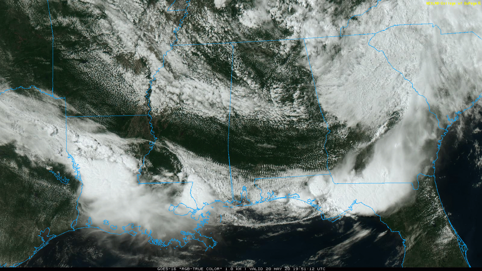
RADAR CHECK: There’s not much on radar across Alabama this afternoon — just a few sprinkles over the northeast corner of the state. Otherwise, we have a mix of sun and clouds with temperatures mostly in the 75- to 80-degree range, still below average for mid to late May in Alabama.
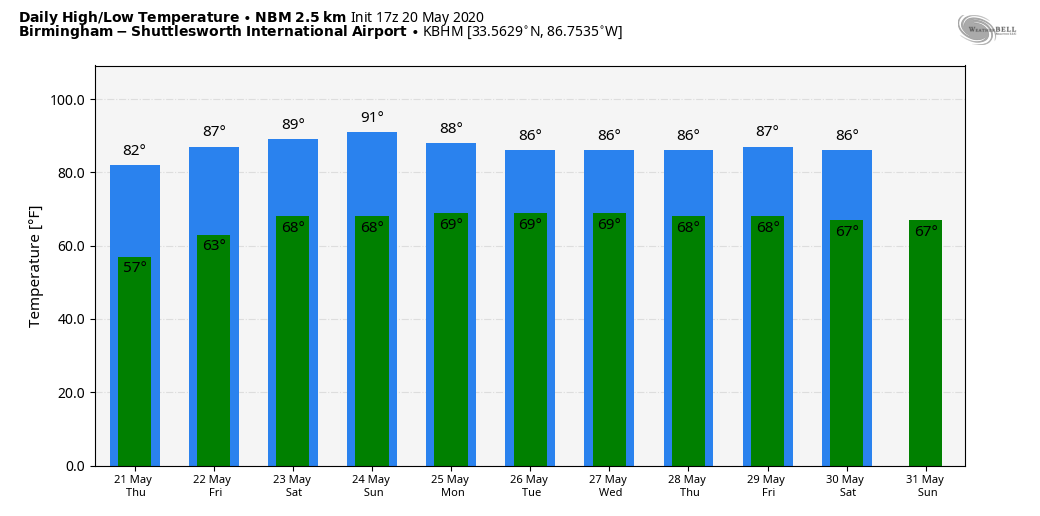
The upper low that has been nearly stationary over Tennessee for the past 36 hours will weaken and lift away from the region on Thursday, setting the stage for a warming trend. Look for a high in the low 80s Thursday, followed by mid 80s Friday. Showers will remain isolated Thursday but should be a little more numerous Friday afternoon as the air becomes more unstable in response to the warmth. The chance of any one spot getting wet is 20% Thursday and 40% Friday.
THE ALABAMA WEEKEND: We are expecting warm, humid weather Saturday and Sunday with a mix of sun and clouds both days. We will have to dodge the usual round of scattered, mostly afternoon and evening showers and thunderstorms; most of the showers will come from 1 until 9 p.m. The chance of your front yard getting wet both afternoons will remain around 40%. Highs will be in the mid to upper 80s.
NEXT WEEK: Not much change — warm, humid days with sun at times, and the daily opportunity of scattered afternoon storms. Highs will remain mostly in the upper 80s.
RAIN UPDATE: Here are rain totals for the year so far, and the departure from average:
- Birmingham — 39.94 inches, 17.86 inches above average
- Muscle Shoals — 37.81 inches, 16.29 above average
- Anniston — 37.68 inches, 16.31 above average
- Tuscaloosa — 37.44 inches, 15.6 above average
- Huntsville — 36.93 inches, 14.39 above average
- Montgomery — 28.09 inches, 5.98 above average
- Mobile — 15.94 inches, 8.83 below average
ON THIS DATE IN 1957: A tornado touched down southwest of Kansas City and traveled 71 miles, cutting a swath of near destruction through the southeastern suburbs of Ruskin Heights and Hickman Mills. The tornado claimed the lives of 45 people and left hundreds homeless. It was the worst weather disaster on record for Kansas City.
ON THIS DATE IN 2013: A large, extremely powerful EF5 tornado ravaged Moore, Oklahoma, and adjacent areas, with peak winds estimated at 210 mph, killing 24 people and injuring 212 others. The tornado touched down just northwest of Newcastle and stayed on the ground for 37 minutes over a 17-mile path, crossing through a heavily populated section of Moore. The tornado was 1.08 miles wide at its peak. It followed a roughly similar track to the deadlier 1999 Bridge Creek-Moore tornado, which was smaller but just as severe; however, very few homes and neither of the stricken schools in the area had built storm shelters in the intervening years since the earlier tornado struck Moore.
BEACH FORECAST: Click here to see the AlabamaWx Beach Forecast Center page.
WEATHER BRAINS: You can listen to our weekly 90-minute show any time on your favorite podcast app. This is the show all about weather featuring many familiar voices, including the meteorologists at ABC 33/40.
CONNECT: You can find me on the major social networks:
Facebook
Twitter
Instagram
Pinterest
Snapchat: spannwx
For more weather news and information from James Spann and his team, visit AlabamaWx.com.


