James Spann: Sun, scattered showers and storms for the Alabama weekend
RADAR CHECK: Several bands of showers and thunderstorms are across Alabama this afternoon, southeast of the circulation of former Hurricane Laura, which is turning eastward through Tennessee and Kentucky. So far there have been no tornadoes in Alabama, but the risk of brief, isolated spin-up tornadoes will continue through the evening, especially over the northwest part of the state. Be weather aware and pay attention to warnings if any are needed.
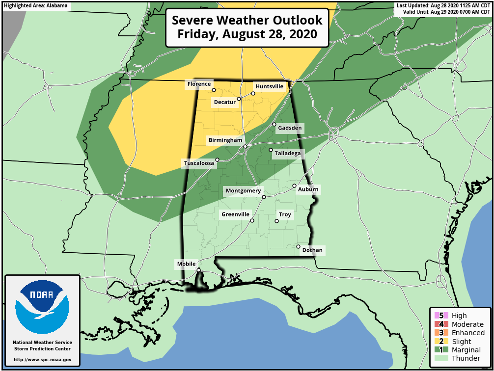
A Flash Flood Watch is in effect for parts of central and northwest Alabama through tonight, as these tropical showers are very efficient rain producers.
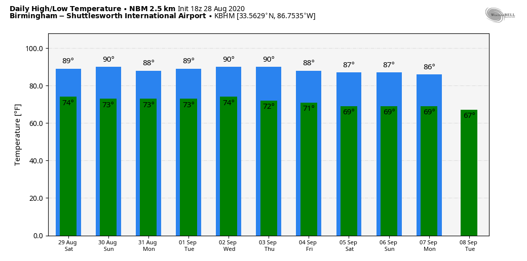
THE ALABAMA WEEKEND: Drier air creeps into the northern half of the state Saturday, so showers will become fewer in number. With a partly sunny sky, temperatures should reach the 87- to 90-degree range. On Sunday moisture surges northward again, and the sky will be occasionally cloudy with scattered to numerous showers and thunderstorms. Sunday’s high will be in the upper 80s.
NEXT WEEK: A few showers and thunderstorms are a good bet Monday; then, for the rest of the week, we expect partly sunny days with just a few scattered showers and storms each afternoon and evening. Highs throughout the week will be between 86 and 90 degrees for most communities.
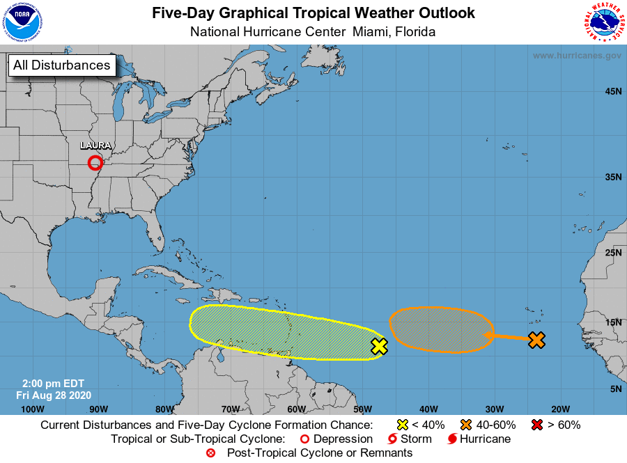
TROPICS: The National Hurricane Center is monitoring two tropical waves in the main development region of the Atlantic, one in the eastern Atlantic and another between the coast of Africa and the Lesser Antilles. The easternmost wave now has a 40% chance of becoming a depression or storm within the next five days; the lead wave has a 30% chance. There’s no way of knowing whether they will affect the U.S. — just something to watch for now. The Gulf of Mexico will be quiet through the weekend.
ON THIS DATE IN 1990: Between 3:15 p.m. and 3:45 p.m. a devastating F5 tornado ripped a 16.4-mile-long path through portions of Kendall and Will counties in northern Illinois. A total of 29 people were killed and 350 more were injured.
ON THIS DATE IN 2005: Hurricane Katrina attained Category 5 status in the morning and reached its peak strength at 1 p.m., with maximum sustained winds of 175 mph and a minimum central pressure of 902 millibars.
BEACH FORECAST: Click here to see the AlabamaWx Beach Forecast Center page.
WEATHER BRAINS: You can listen to our weekly 90-minute show anytime on your favorite podcast app. This is the show all about weather featuring many familiar voices, including the meteorologists at ABC 33/40.
CONNECT: You can find me on the major social networks:
Facebook
Twitter
Instagram
Pinterest
Snapchat: spannwx
For more weather news and information from James Spann and his team, visit AlabamaWx.