James Spann: Long dry spell ahead for Alabama
DRIER AIR MOVING IN: After morning clouds, the sky is now partly sunny across Alabama; temperatures are in the low to mid 80s in most communities, close to seasonal averages for mid-September. Tonight will be mostly fair with a low in the mid 60s.
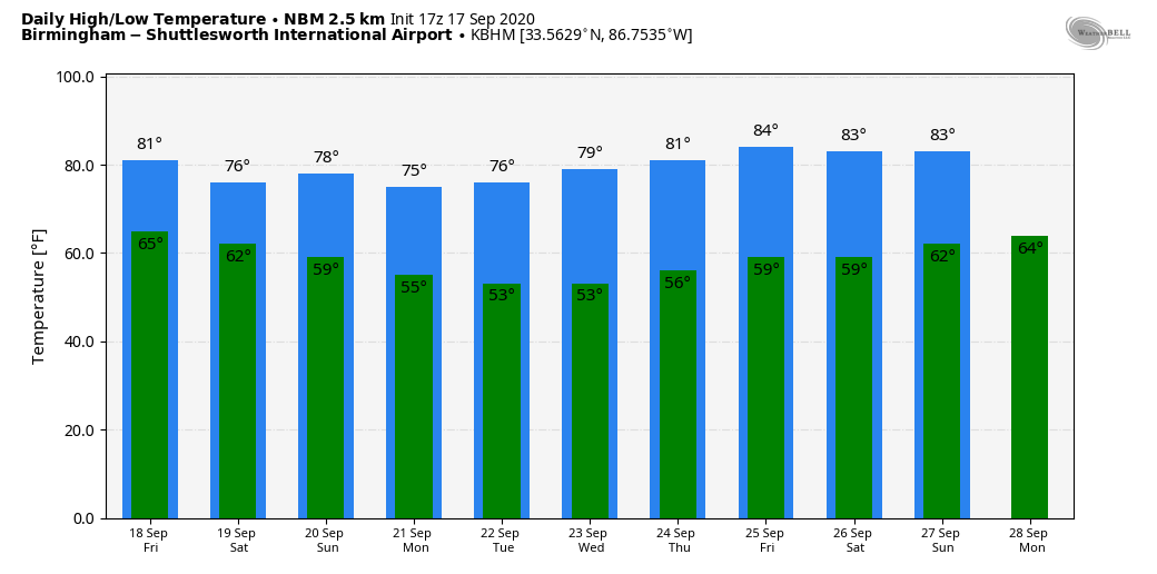
FRIDAY THROUGH THE WEEKEND: Dry weather will continue. Friday will be partly sunny with a high between 82 and 85, but cooler air drops into the state just in time for the weekend. Saturday will feature a mix of sun and clouds, and then we will see sunshine in full force Sunday. Highs over the weekend will be between 76 and 80 degrees; morning lows will be close to 60 degrees. Humidity will be low and it will feel like fall.
NEXT WEEK: The week will feature some really great early autumn weather — sunny, pleasant days and clear, cool nights. Highs will be in the upper 70s Monday through Wednesday, followed by low 80s Thursday and Friday. Lows will be mostly in the 50s, but some of the colder pockets across north Alabama could dip into the upper 40s early Tuesday and Wednesday mornings. Most of Alabama will experience dry weather for the next seven to 10 days.
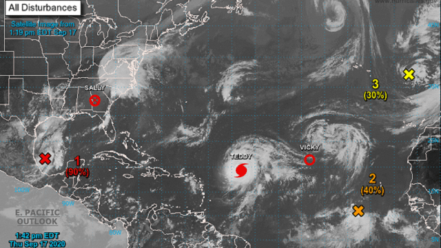
TROPICS: The remnant circulation of Sally is producing lots of rain this afternoon across parts of the Carolinas and Virginia, where flash flood watches are in effect. Out in the eastern Atlantic, Vicky is now a tropical depression and should dissipate soon. Invest 98L is a tropical wave that has a medium chance of becoming a tropical depression over the next five days; if anything develops there, it should turn north before reaching the Lesser Antilles or the U.S. and seems to be no threat to land.
Teddy is forecast to become a major hurricane tonight as it churns over the open Atlantic. It will begin to weaken a bit late in the weekend as it gains latitude and will be very close to Bermuda Monday. Then, it curves back into the North Atlantic and is not a threat to the U.S.
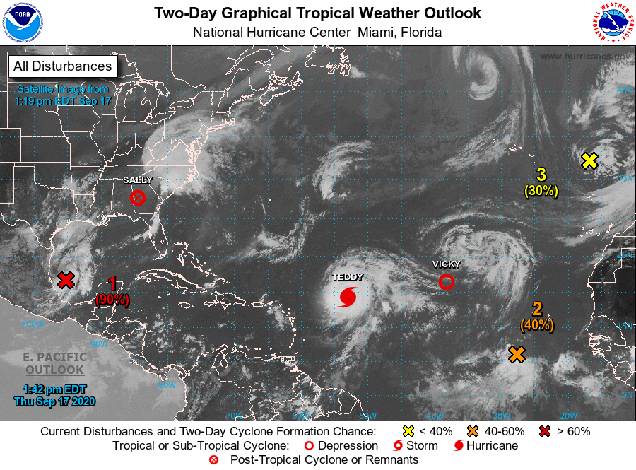
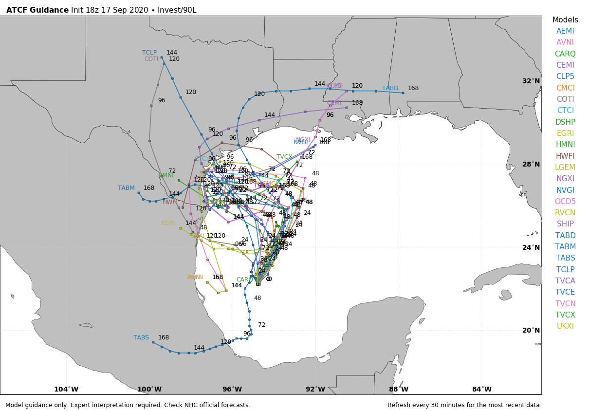
Invest 90L, in the southwest Gulf of Mexico, is expected to become Tropical Storm Wilfred within the next day or two. It will initially move northward, and then it will be forced westward by the same pattern that will bring cooler air down into the southern U.S. this weekend and early next week. It will be close to the southern tip of Texas, or the coast of Mexico, most likely in five days or so. For now the threat to the central Gulf Coast seems very low.
ON THIS DATE IN 1989: Hurricane Hugo hit the Virgin Islands, producing wind gusts to 97 mph at Saint Croix. Hugo passed directly over Saint Croix, causing complete devastation and essentially cutting off the island from communications. A storm surge of 5 to 7 feet occurred. The only rain gauge left operating, at Caneel Bay, indicated 9.4 inches in 24 hours. Hurricane Hugo claimed the lives of three people at Saint Croix and caused more than $500 million damage. The hurricane would strike the South Carolina coast a few days later.
BEACH FORECAST: Click here to see the AlabamaWx Beach Forecast Center page.
WEATHER BRAINS: You can listen to our weekly 90-minute show anytime on your favorite podcast app. This is the show all about weather featuring many familiar voices, including the meteorologists at ABC 33/40.
CONNECT: You can find me on the major social networks:
Facebook
Twitter
Instagram
Pinterest
Snapchat: spannwx
For more weather news and information from James Spann and his team, visit AlabamaWx.


