James Spann: Alabama gets very cold again tonight; rain by Wednesday night
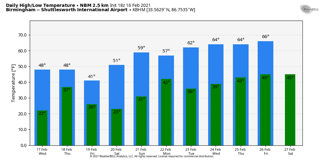
THIS AFTERNOON: The sky has become partly to mostly sunny across Alabama this afternoon; the exception is the northwest part of the state, where clouds and a few snow flurries linger. Temperatures are only in the 20s over most of north and central Alabama; the average high for Feb. 16 at Birmingham is 59. Tonight will be fair and cold with a low between 15 and 25 degrees.
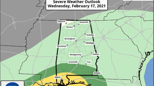
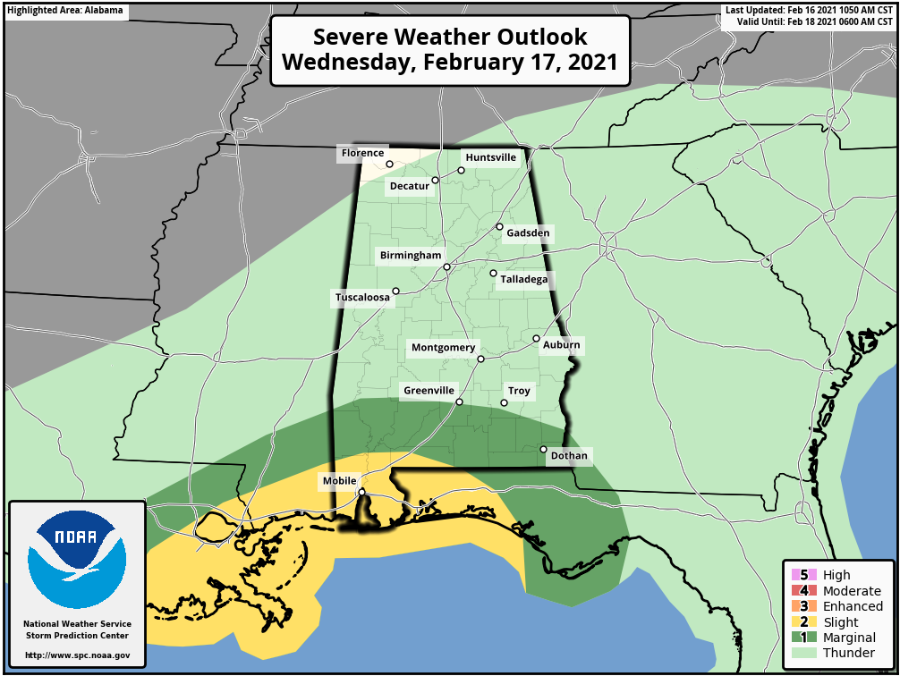
ANOTHER SYSTEM ON THE WAY: Clouds will increase Wednesday, and temperatures rise into the 35- to 45-degree range for most areas by mid-afternoon. A large mass of rain will move into the state Wednesday evening, and unfortunately it looks like the precipitation will begin as sleet and freezing rain over northwest Alabama, where temperatures will likely remain below freezing. This could add to the ice accumulation already in place across Lauderdale, Colbert, Lawrence, Marion, Winston and northern Lamar counties. A Winter Storm Watch is in effect for north Mississippi, and a watch or advisory could be required for northwest Alabama for this potential.
On the positive side, warm air advection will likely change the sleet and freezing rain over to rain late Wednesday night across northwest Alabama. For most of the state, the system will bring a soaking rain Wednesday night into early Thursday morning. Rain amounts of around 1 inch are likely. To the south, strong to severe thunderstorms are possible over the southern quarter of Alabama, where unstable air will work into the area from the Gulf of Mexico.
Thursday will be cloudy and cold with some lingering light rain; there could even be a few snow flurries over north Alabama late Thursday and Thursday night. Temperatures will likely hold in the 30s over north Alabama, with 40s and 50s to the south. On Friday, the day will be partly sunny with a high between 38 and 45 degrees for north and central Alabama.
THE ALABAMA WEEKEND: Saturday morning will be cold with a low between 18 and 25, but a warming trend begins Saturday afternoon with a high in the mid 50s and a good supply of sunshine. Sunday will be mostly sunny with a high in the low 60s.
NEXT WEEK: A cold front brings a chance of showers Monday, especially during the morning. More showers are possible later in the week, but on the positive side temperatures will likely be in the 60s through the week as the flow of cold, Arctic air is shut down in our region.
ON THIS DATE IN 1995: A pre-dawn F3 tornado tore through parts of Cullman and Marshall counties in north Alabama, killing five people in the communities of Joppa and Arab.
BEACH FORECAST: Click here to see the AlabamaWx Beach Forecast Center page.
WEATHER BRAINS: You can listen to our weekly 90-minute show anytime on your favorite podcast app. This is the show all about weather featuring many familiar voices, including the meteorologists at ABC 33/40.
CONNECT: You can find me on the major social networks:
For more weather news and information from James Spann and his team, visit AlabamaWx.


