Don’t let your guard down yet; more severe weather possible in Alabama tonight
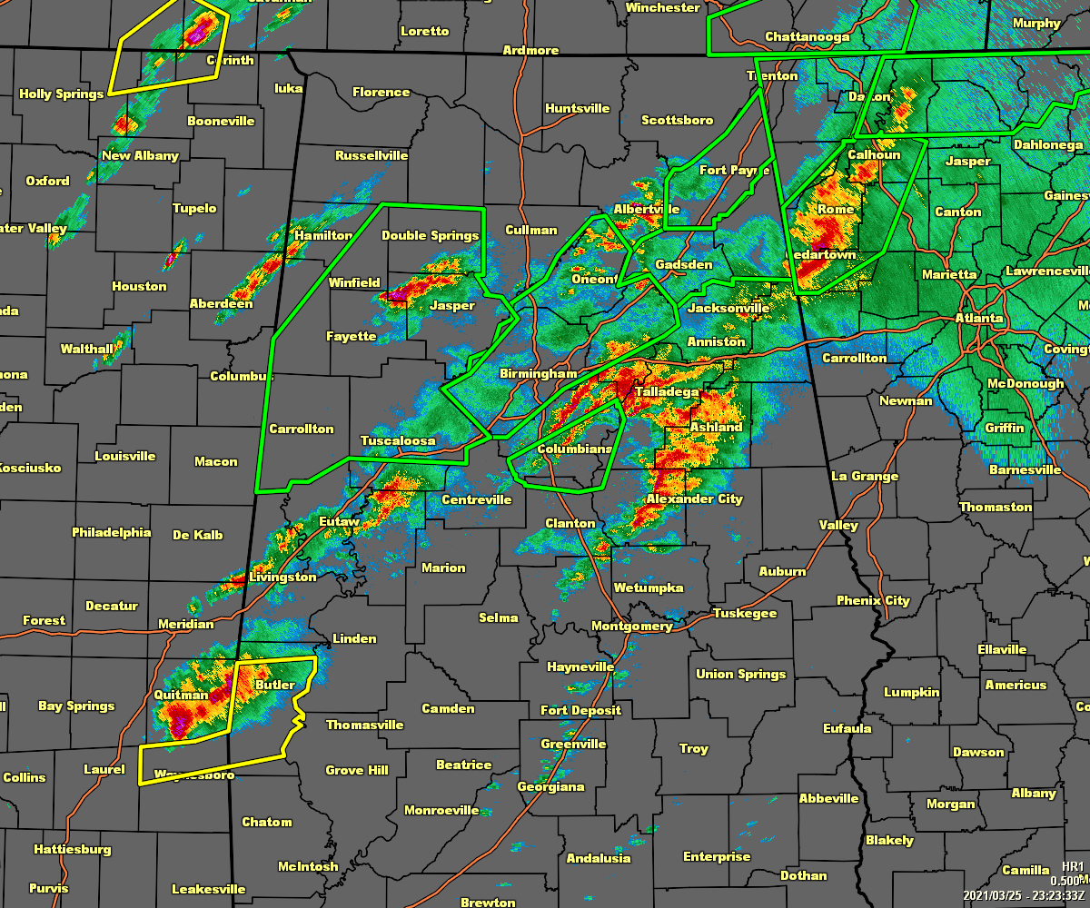
There are numerous reports of damage along both of the major tornado tracks that have occurred so far today and, unfortunately, we’ve had a reported five deaths from the Ohatchee area.
Conditions still remain favorable for further severe storm development with the potential for strong long-track tornadoes, damaging winds up to 80 mph and large hail up to golf ball size in diameter.
Instability remains elevated and could continue to rise a little more before the cold front moves in later tonight.
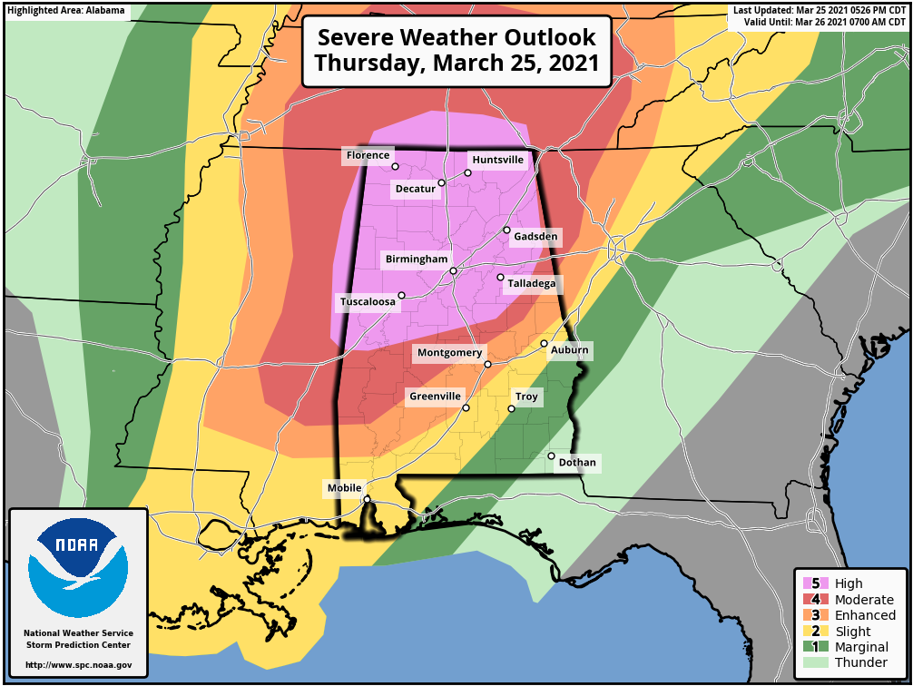
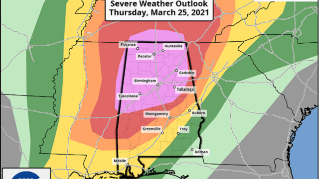
The high risk (level 5 out of 5) has been expanded to include nearly all of the northern half of Alabama. The moderate (level 4 out of 5) and enhanced (level 3 out of 5) risks have also been expanded eastward slightly.
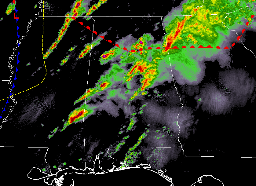
The cold front has crossed the Mississippi River and storms will continue to develop out ahead of it as the atmosphere continues to destabilize for a little while longer.
We are not out of the woods yet. Timing of the threat for severe storms for the western half of the state is from now through 11 p.m., and for the eastern half from now through 2 a.m.
Stay weather aware.
For more weather news and information from James Spann, Scott Martin and other members of the James Spann team, including warnings for specific areas, visit AlabamaWx.


