James Spann: Alabama trends drier Friday, Saturday
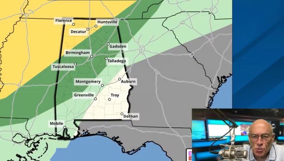
RADAR CHECK: Showers and thunderstorms persist across Alabama this afternoon, mostly south of I-59. Heavier storms are capable of producing small hail and strong, gusty winds along with very frequent cloud-to-ground lightning. The Storm Prediction Center maintains a marginal risk of severe thunderstorms through the evening for areas east of a line from Florence to Montgomery to Eufaula.
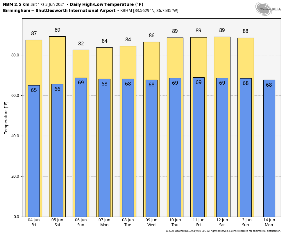
Away from the storms, we have a mix of sun and clouds with temperatures in the 80s this afternoon. Showers and storms will fade away late tonight.
FRIDAY THROUGH THE WEEKEND: Lower precipitable water values will move into the northern half of Alabama Friday, meaning few, if any, showers there. A few scattered showers and storms are possible Friday afternoon over south Alabama; otherwise, the sky will be partly to mostly sunny with a high in the mid 80s. Saturday will be relatively dry statewide, with only isolated showers; the high will be between 85 and 89 degrees.
On Sunday moisture levels begin to rise again, and scattered, mostly afternoon and evening showers and thunderstorms are possible statewide with a high in the mid 80s. Odds of any one spot getting wet Sunday afternoon are 30-40%.
NEXT WEEK: A warm, humid air mass will cover the state through the week, meaning scattered showers and storms each day. The best chance of showers will come from 1 to 11 p.m., but a rogue late-night or morning shower can’t be ruled out. Highs will be mostly in the mid 80s, close to seasonal averages for mid-June in Alabama.
TROPICS: All remains quiet across the Atlantic basin, and tropical storm formation is not expected through the weekend.
ON THIS DATE IN 1860: Iowa’s infamous Camanche Tornado, likely an F5 storm, killed 92 and injured 200. Every home and business were destroyed. It was one of the most damaging families of tornadoes ever to strike the U.S. and resulted in more farm fatalities than any other tornado except for the Tri-State tornado.
ON THIS DATE IN 1993: Early morning severe thunderstorms dumped huge hailstones across northern Oklahoma. Hail, up to 6 inches in diameter in Enid, went through roofs of homes, damaged three jets at Vance Air Force Base and did $500,000 in damage at a car dealership.
BEACH FORECAST: Click here to see the AlabamaWx Beach Forecast Center page.
WEATHER BRAINS: You can listen to our weekly 90-minute show any time on your favorite podcast app. This is the show all about weather featuring many familiar voices, including the meteorologists at ABC 33/40.
CONNECT: You can find me on the major social networks:
For more weather news and information from James Spann and his team, visit AlabamaWx.