Scott Martin: Increased shower, storm chances for Alabama each day through Tuesday
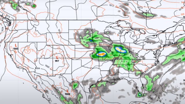
THE ALABAMA WEEKEND: Both days will feature a decent bit of sunshine to start, but with a very moist atmosphere in place across the Southeast, showers and thunderstorms will fire up during the afternoon to the early evening hours. An upper low will develop Saturday that will help the convective development. While no widespread severe weather is expected, don’t be surprised if a storm or two briefly goes severe with strong downdraft winds or some hail up to 1 inch in diameter. Highs will be in the mid-80s to the lower 90s both days.
NEXT WEEK: With a trough over the Southeast, overall rain chances for Monday and Tuesday across Alabama will be 70% and above. While a few rays of sunshine will be possible, expect skies to be mostly cloudy both days. No widespread severe weather is expected, but a few storms may have strong downdraft winds and small hail. Highs will be in the upper 70s to the upper 80s Monday, reaching the lower 80s to the lower 90s Tuesday.
The trough moves out by Wednesday, which will make rain chances drop to around 40% for Wednesday and Thursday. Both will be typical summertime days — a good bit of sunshine to start, with a few scattered showers and storms developing during the afternoon and early evening hours. Highs on both days will be in the mid-80s to the lower 90s.
On Friday, scattered showers and storms will be possible during the afternoon and early evening. Before those form, it will be very warm to hot and very humid with a good bit of sunshine. Highs will be in the mid-80s to the lower 90s.
TROPICS: Elsa became post-tropical late Friday afternoon and has moved away from the U.S. For now, the North Atlantic Ocean, Caribbean Sea and Gulf of Mexico are free from any tropical mischief, and no new tropical cyclones are expected over the next five days.
Two separate waves of Saharan dust will move over the tropical hot spots where you would expect tropical development to happen. The dust causes the air to become much drier than tropical cyclones need to become organized and strengthen. Stronger vertical wind shear is usually present in the dusty air, which would also cause trouble for any tropical cyclones.
ON THIS DATE IN 1913: The mercury hit 134 degrees at Greenland Ranch in Death Valley, California, the hottest reading of record for North America. Sandstorm conditions accompanied the heat. The high the previous day was 129 degrees, following a morning low of 93 degrees.
ON THIS DATE IN 1926: A lightning bolt struck an ammunition magazine in northern New Jersey and a big, red ball of fire leaped into the air, triggering a series of explosions. All buildings within a half-mile radius were destroyed, and debris fell as far as 22 miles away. Sixteen people were killed and property damage was $70 million.
ON THIS DATE IN 1989: Severe thunderstorms spawned 17 tornadoes in the northeastern U.S. A powerful F-4 tornado struck Hamden and New Haven, Connecticut, causing $100 million damage at Hamden and $20 million damage around New Haven. Forty people were injured in the tornado. Seventy people were injured in a tornado that traveled from Watertown to Waterbury, Connecticut, and another F-4 tornado touched down near Ames, New York, injuring 20 people along its 43.5-mile track. It was the strongest tornado of record for eastern New York State.
BEACH FORECAST CENTER: Get the latest weather and rip-current forecasts for the beaches from Dauphin Island to Panama City Beach, Florida, on our Beach Forecast Center page. There, you can select the forecast of the region you are interested in.
For more weather news and information from James Spann, Scott Martin and other members of the James Spann team, visit AlabamaWx.


