James Spann: Scattered to numerous showers, storms for Alabama through Friday
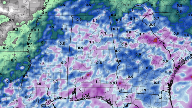
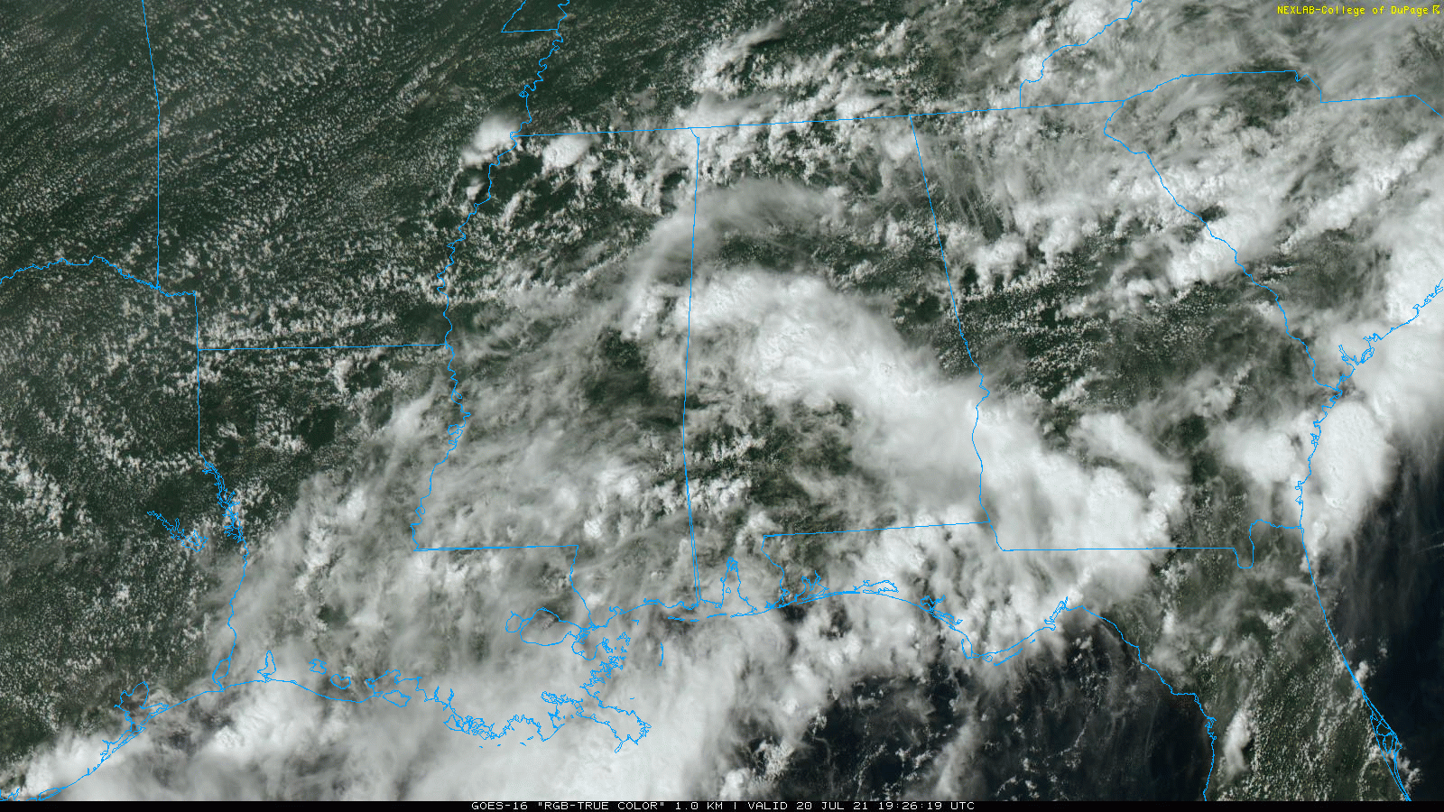
RADAR CHECK: As expected, we have a number of showers and thunderstorms across Alabama this afternoon in the moist, unstable air mass in place. The most widespread rain is in a broad band from Tuscaloosa and Birmingham to Montgomery and Phenix City at mid-afternoon, Heavier storms are producing torrential rain, and a Flash Flood Watch remains in effect for much of north and central Alabama through tonight. Temperatures are in the 70s where rain is falling; we see low to mid 80s elsewhere.
Rain will taper off late tonight, but showers will remain possible in spots after midnight.
REST OF THE WEEK: Don’t expect much change Wednesday through Friday — more clouds than sun, with scattered to numerous showers and thunderstorms daily. Highs will be generally in the low to mid 80s, almost 10 degrees below average for late July in Alabama. Like today, some isolated flooding is possible where the heavier downpours develop, thanks to the saturated soil conditions.
THE ALABAMA WEEKEND: A pattern flip begins as an upper ridge starts to build across the Deep South. This means increasing amounts of sun, fewer showers and higher heat levels. The chance of any one spot getting wet is 25-30% Saturday and around 20% Sunday afternoon. The high will be close to 90 Saturday, followed by low 90s Sunday.
NEXT WEEK: The upper ridge will stay in place, meaning the trend toward hotter, drier weather will continue. Each day we will experience a good supply of sunshine with highs up in the low 90s, maybe even mid 90s in spots. You always have the risk of a pop-up storm on a hot summer afternoon around here, but they should be few and far between.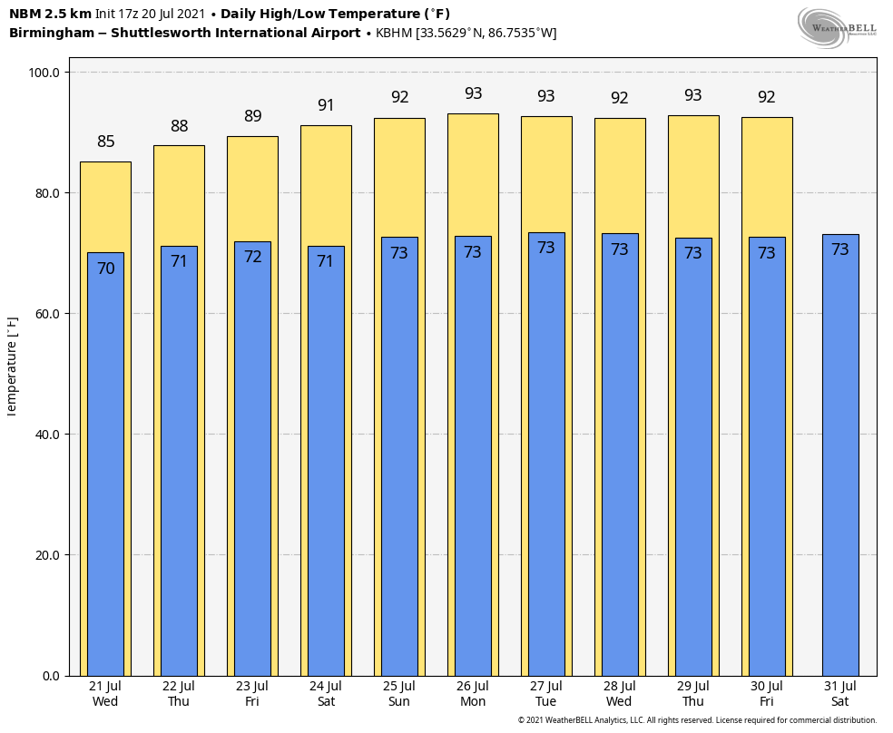
TROPICS: All remains quiet across the vast Atlantic basin, and tropical storm formation is not expected through the weekend.
HOW DOES THIS JULY COMPARE? Birmingham’s official rain total Monday was 2.24 inches — not a daily record. The record rain for July 19 came in 1897, when the total was 2.95 inches.
The total for July is up to 6.07 inches. Are we headed for the wettest July on record? Probably not even close. Here are our wettest months of July on record since 1900:
- July 1916 — 20.12 inches
- July 1950 — 13.7
- July 1910 — 10.8
- July 1941 — 10.33
- July 1961 — 10.17
- July 1985 — 10.07
TROPICS: All remains quiet across the Atlantic basin, and tropical storm formation is not expected through the weekend.
BEACH FORECAST: Click here to see the AlabamaWx Beach Forecast Center page.
WEATHER BRAINS: You can listen to our weekly 90-minute show any time on your favorite podcast app. This is the show all about weather featuring many familiar voices, including the meteorologists at ABC 33/40.
CONNECT: You can find me on the major social networks:
For more weather news and information from James Spann and his team, visit AlabamaWx.


