James Spann: Alabama gets wet at times through Friday; drier, hotter weekend ahead
James Spann has the midweek forecast for Alabama from Alabama NewsCenter on Vimeo.
SCATTERED TO NUMEROUS SHOWERS AND THUNDERSTORMS: The overall weather pattern won’t change much across Alabama through Friday. Expect warm, humid days, intervals of sun and a number of showers and storms each day, especially during the afternoon and evening. Stronger storms will dump heavy amounts of rain, and isolated flooding is possible. Temperatures remain below average, with highs in the low 80s Wednesday and mid to upper 80s Thursday and Friday.
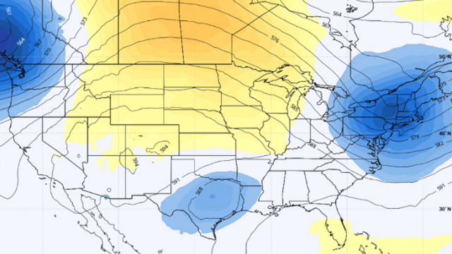
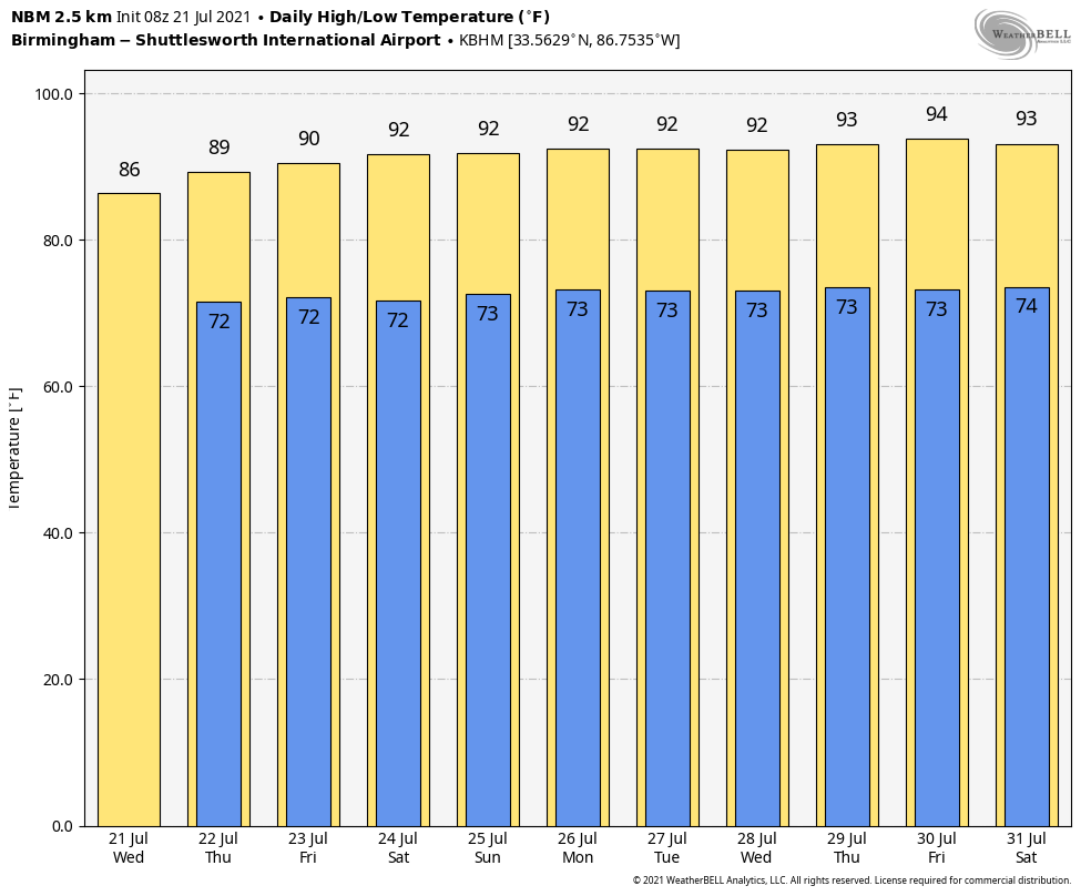
THE ALABAMA WEEKEND: The long-awaited pattern flip begins as a strong upper ridge begins to nose into Alabama from the west. This means a trend toward hotter, drier weather Saturday and Sunday. The sky will be partly to mostly sunny both days with only a few widely scattered showers and storms. The chance of any one spot getting wet is around 30% Saturday, dropping to 15-20% Sunday. The high will be around 90 Saturday, followed by low 90s Sunday.
NEXT WEEK: The upper ridge stays in place, meaning hot, mostly dry weather. There will be a few showers and thunderstorms every afternoon, but they will be widely spaced. Afternoon highs will be in the low 90s, maybe even reaching the mid 90s in spots. It will feel like summer in Alabama.
TROPICS: The Atlantic basin will remain quiet through Thursday. However, a broad, non-tropical low-pressure system is forecast to develop off the coast of the southeastern United States by late Friday or early Saturday. Environmental conditions are expected to be marginally conducive for some gradual development over the weekend while the system meanders off the coasts of South Carolina, Georgia and northeastern Florida. For now the chance of tropical development is only 20%. The main development region of the Atlantic will remain quiet through early next week.
RAIN UPDATE: These are rain totals for July so far this year, and the wettest Julys on record. This is data from the larger cities in the state with long-term climate records. No records are in danger despite all the recent rain.
- Huntsville so far this month — 7.34 inches; Huntsville’s wettest July was in 1967, with 14.81 inches.
- Mobile so far this month — 6.17 inches; Mobile’s wettest July was in 1916, with 20.5 inches.
- Birmingham so far this month — 6.07 inches; Birmingham’s wettest July was in 1916, with 20.12 inches.
- Montgomery so far this month — 3.8 inches; Montgomery’s wettest July was in 1916, with 13.34 inches.
ON THIS DATE IN 1987: An F4 tornado ravaged the Teton Wilderness and Yellowstone National Park in Wyoming. The tornado’s violent winds destroyed millions of trees on a 24.3-mile track that traversed the Continental Divide at an elevation of 10,170 feet.
BEACH FORECAST: Click here to see the AlabamaWx Beach Forecast Center page.
WEATHER BRAINS: You can listen to our weekly 90-minute show any time on your favorite podcast app. This is the show all about weather featuring many familiar voices, including the meteorologists at ABC 33/40.
CONNECT: You can find me on the major social networks:
For more weather news and information from James Spann and his team, visit AlabamaWx.


