James Spann: Mostly dry day for north, central Alabama
James Spann has a split forecast for Alabama from Alabama NewsCenter on Vimeo.
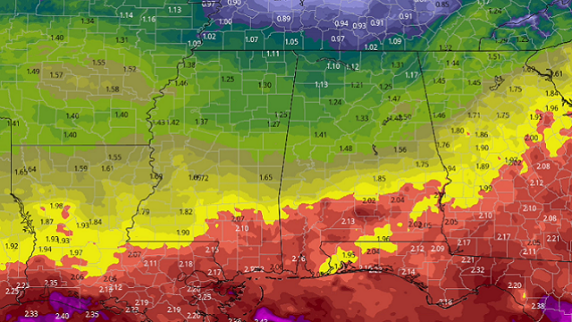
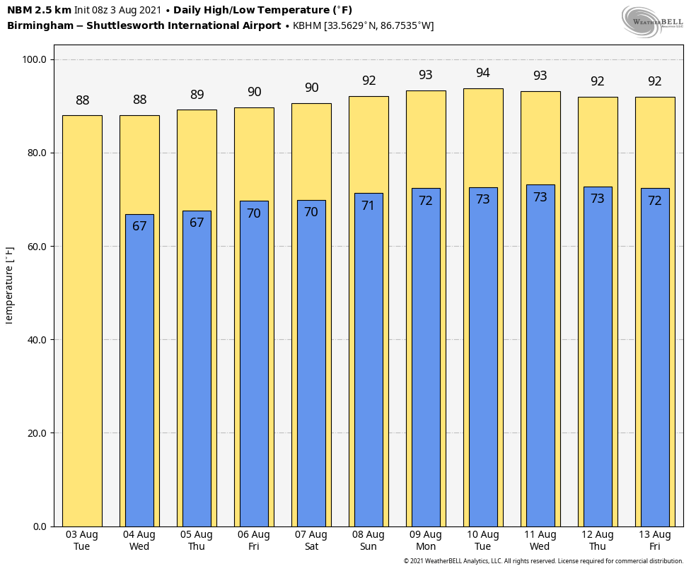
TRENDING DRIER: A rare August “cold” front is sagging southward across Alabama this morning, and drier air covers the northern half of the state. With the lower precipitable water values, most of north and central Alabama will experience a dry day with just a small risk of a shower. With a partly sunny sky, we expect a high between 84 and 87 degrees; the average high for Aug. 3 at Birmingham is 91. Scattered showers and storms will remain possible over south Alabama today, especially south of U.S. 84.
REST OF THE WEEK: The front over south Alabama will slowly wash out, and we will mention the chance of a few widely scattered showers and thunderstorms Wednesday through Friday, but nothing really widespread. The chance of any one spot getting wet on these three days is 15-25%; otherwise expect partly sunny days with highs between 85 and 89 degrees.
THE ALABAMA WEEKEND: We are seeing some evidence moisture could be a little deeper Saturday with an increase in the number of scattered showers and storms, but still no washout. Expect a mix of sun and clouds both days with a high around 90 degrees. Showers should be fewer in number Sunday.
NEXT WEEK: An upper ridge builds over the region, so heat levels will tick up a bit, with highs mostly between 90 and 93 degrees. Look for partly sunny days and the usual risk of scattered, mostly afternoon and evening showers and thunderstorms daily, very routine weather for August.
TROPICS: A surface trough of low pressure over the far eastern Atlantic Ocean, centered a few hundred miles south of the Cabo Verde Islands, continues to produce a large region of disorganized showers and thunderstorms. Some slow development of this system is possible during the next day or two while it moves northward or northwestward before the system moves over cooler waters by Thursday. Locally heavy rainfall and gusty winds are possible over portions of the Cabo Verde Islands through Wednesday. The rest of the Atlantic basin remains very quiet, and tropical storm formation is not expected through the rest of the week near the U.S.
ON THIS DATE IN 1970: Hurricane Celia made landfall near Port Aransas as a major hurricane, Category 3 on the Saffir-Simpson scale with sustained winds of 130 mph. Celia was the costliest tropical cyclone in Texas history until Hurricane Alicia in 1983.
ONE YEAR AGO TODAY: Hurricane Isaias was a Category 1 hurricane that made landfall at Ocean Isle Beach, North Carolina, with maximum sustained winds near 85 mph.
BEACH FORECAST: Click here to see the AlabamaWx Beach Forecast Center page.
WEATHER BRAINS: You can listen to our weekly 90-minute show any time on your favorite podcast app. This is the show all about weather featuring many familiar voices, including the meteorologists at ABC 33/40.
CONNECT: You can find me on the major social networks:
For more weather news and information from James Spann and his team, visit AlabamaWx.


