James Spann: More showers for Alabama Tuesday; cool, dry air rolls in Wednesday
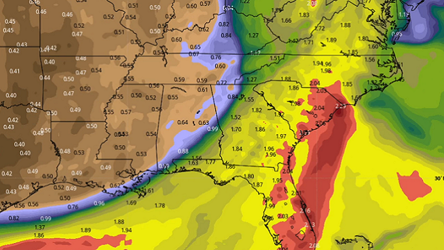
RADAR CHECK: The most widespread rain this afternoon is across northeast Alabama; otherwise showers are widely scattered across the state with a mix of sun and clouds. Temperatures are mostly between 80 and 85 degrees. The average high for Sept. 20 at Birmingham is 85. We will maintain the chance of scattered showers across the state tonight; the Flash Flood Watch for the northern half of Alabama is set to expire at 7 this evening.
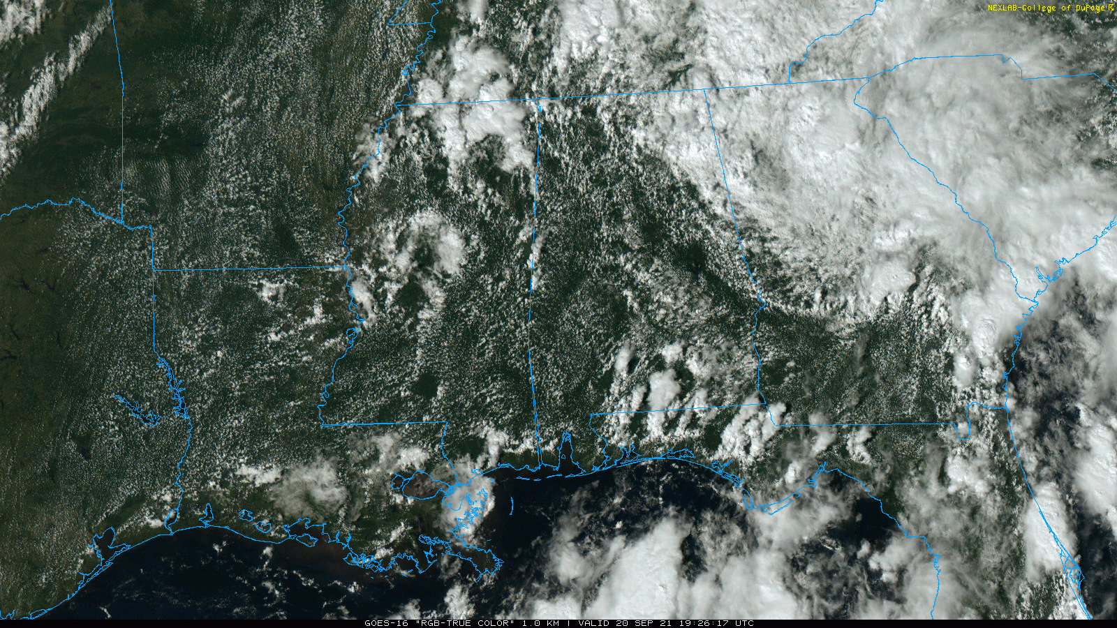 Tuesday will be another day with more clouds than sun, and a few passing showers or storms are likely during the day. The high will be in the low to mid 80s.
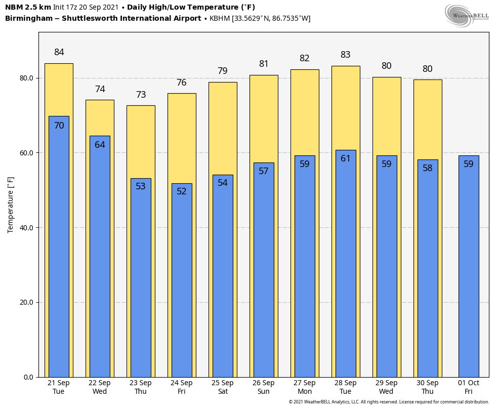
BIG CHANGE: A cold front will blast through Alabama early in the day Wednesday; showers will end by midmorning, and the sky becomes mostly sunny by afternoon with lowering humidity levels and a fresh north wind of 10-20 mph, gusting at times to 25-30 mph. The big change happens right on cue; the autumnal equinox is Wednesday afternoon at 2:20 p.m. This is when the sun is directly over the equator, and we have approximately 12 hours of daylight and 12 hours of darkness — the official beginning of fall.
This cool, dry air mass will settle into the state and set the stage for delightful early fall weather Thursday through the weekend — no rain; sunny, pleasant days and clear, cool nights. Temperatures will drop into the 45- to 55-degree range Thursday morning, and most places across north Alabama will be in the 40s early Friday, easily the coolest air so far this season. The highs will be in the mid 70s Thursday and Friday, followed by low 80s Saturday and mid 80s Sunday, perfect weather for high school and college football games across the Deep South.
NEXT WEEK: Dry weather will likely continue through the week. A cold front could bring a few isolated showers late Wednesday or Thursday, but with limited moisture it looks like most places will stay rain-free. Highs during the week will be mostly in the low 80s, with lows in the 50s and low 60s.
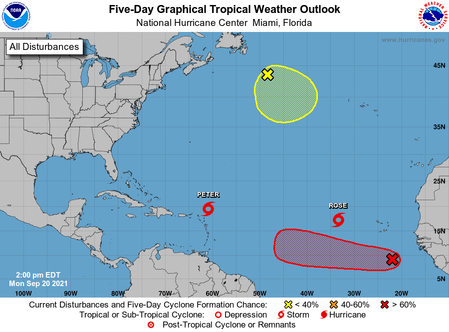
TROPICS: Tropical Storms Peter and Rose in the Atlantic are weak, disorganized and no threat to land. A tropical wave in the eastern Atlantic has a high chance of becoming a tropical depression or storm during the next few days as it moves to the west/northwest, but this one is expected to gain latitude late this week and seems to be no threat to the U.S.
We see no systems threatening the U.S. or the Gulf of Mexico over the next seven to 10 days.
 ON THIS DATE IN 1909: A large, deadly Category 3 hurricane made landfall near Grand Isle, Louisiana, during the late evening. The states of Louisiana and Mississippi showed catastrophic damage resulting in 371 deaths.
BEACH FORECAST: Click here to see the AlabamaWx Beach Forecast Center page.
WEATHER BRAINS: You can listen to our weekly 90-minute show any time on your favorite podcast app. This is the show all about weather featuring many familiar voices, including the meteorologists at ABC 33/40.
CONNECT: You can find me on the major social networks:
For more weather news and information from James Spann and his team, visit AlabamaWx.


