James Spann: Strong to severe storms for Alabama today; cooler Tuesday
James Spann forecasts a stormy day for Alabama as cold front moves in from Alabama NewsCenter on Vimeo.
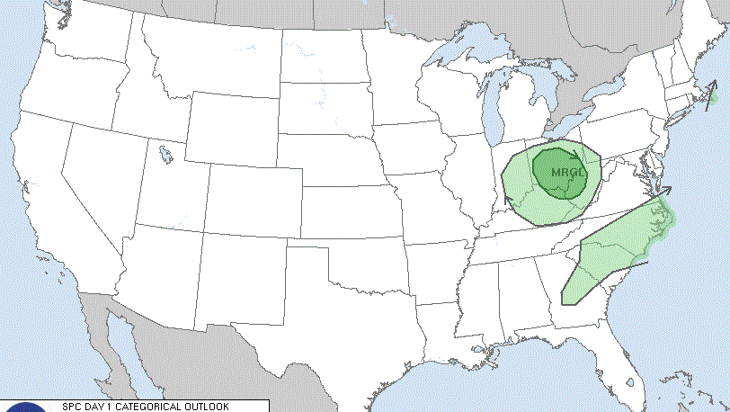
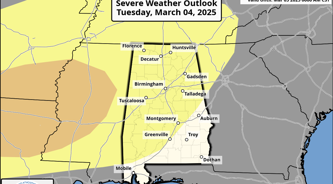
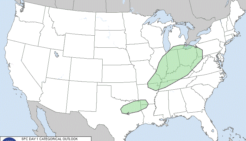
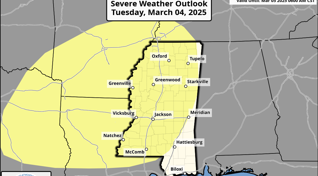
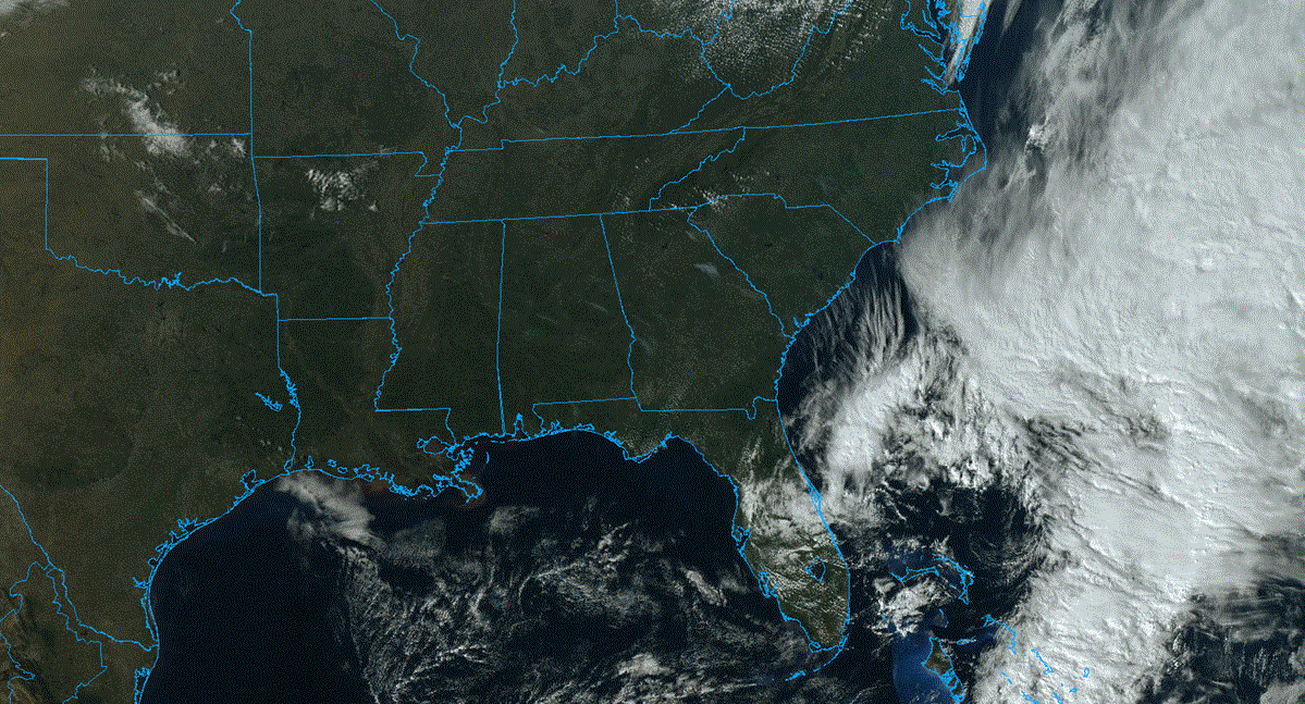
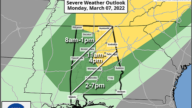
ACTIVE DAY: A cold front pushes into Alabama today, and it will bring a band of showers and thunderstorms to the state. There is a low-end risk of severe storms; the Storm Prediction Center has defined a slight risk (level 2 of 5) for areas east of I-65 and north of I-85. Much of the rest of the state is in a marginal risk (level 1 of 5), but no severe storms are expected for places like Mobile and Dothan.
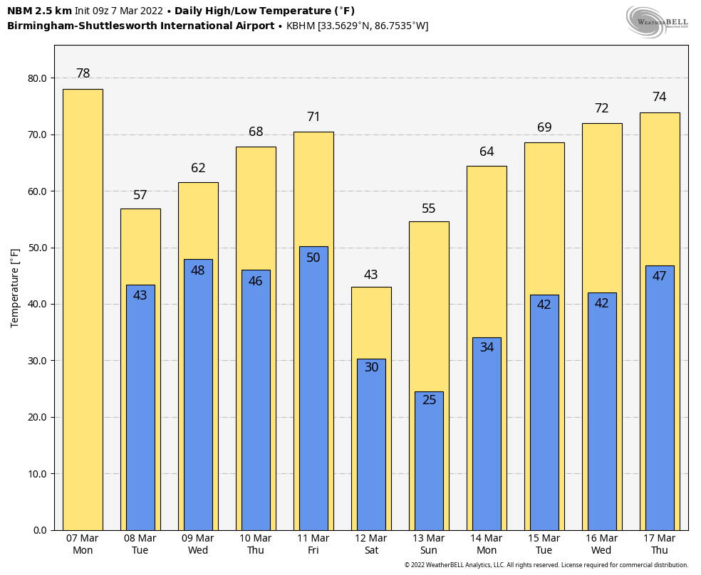
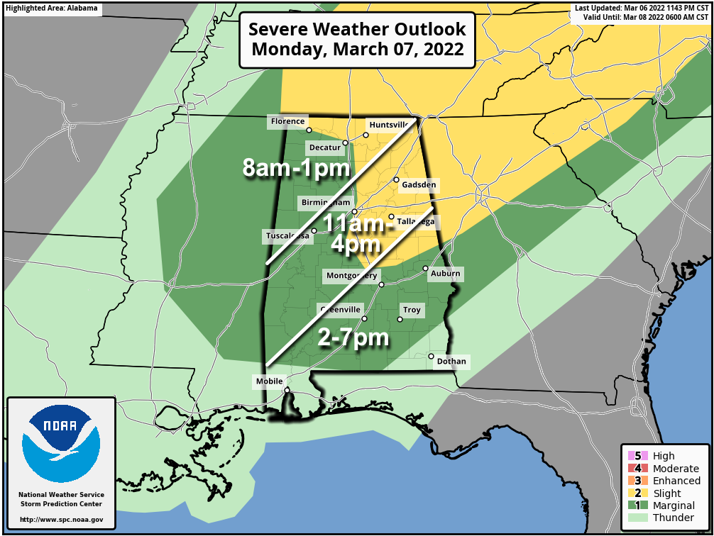 TIMING: Stronger storms will enter the northwest corner of the state around 7 a.m. and the line will move eastward during the day. The window for the heavier storms for places like Tuscaloosa, Birmingham, Anniston and Gadsden will come from about 11 a.m. until 4 p.m. Storms arrive in south Alabama by mid to late afternoon.
THREATS: The main threat from stronger storms today will come from gusty straight-line winds. Some hail is possible as well. The overall tornado threat is low; a brief tornado can’t be totally ruled out but isn’t likely with marginal instability, low shear and weak dynamic support.
RAIN: Rain totals through midnight should be less than 1 inch, and flooding is not expected.
While this is not a major severe weather threat, still be weather aware today and pay attention to warnings if they are needed. Temperatures will begin to fall behind this front over north Alabama by late morning and this afternoon.
REST OF THE WEEK: The front will become nearly stationary over far south Alabama tonight. Showers will remain possible there tonight and Tuesday, but the rest of the state will be dry and cool. The high will be in the 50s over the northern half of the state Tuesday. A wave of low pressure forms on the front, and rain will spread back into the state by mid to late afternoon. That rain will continue Tuesday night into Wednesday morning.
Much of the state will be dry Wednesday afternoon into Thursday, but clouds linger. The high will be around 60 on Wednesday, followed by low to mid 60s Thursday.
Another cold front will push into the state Friday evening; if unstable air can return ahead of the front, this could bring another chance of strong to severe thunderstorms to the state.
COLD WEEKEND AHEAD: Following the front, much colder air rolls into Alabama Friday night. A few snow flurries are possible in the colder air early Saturday morning, but no impact is expected. The sky will clear during the day, but it will be cold. In fact, temperatures across the Tennessee Valley of north Alabama could hold in the 30s all day with a brisk north wind. The high for the central counties will be in the 40s.
A very significant freeze is likely Sunday morning, with lows between 20 and 26 degrees for most places over the northern half of the state. Low 30s are possible deep into south Alabama. On most March days this would be in record territory, but Birmingham’s record low for March 13 is 12 degrees, set after the great Blizzard of 1993 with 1-2 feet of snow on the ground. It won’t be that cold this year, and there won’t be any snow on the ground Sunday morning.
Sunday will be sunny with a high in the 50s.
NEXT WEEK: For now most of the week looks dry with a warming trend; temperatures reach the low 70s by midweek.
 ON THIS DATE IN 1997: The worst was finally over for states hit hard by the flooding Ohio River. The river crested on March 6 at Louisville, Kentucky, at 15 feet above flood stage, after topping out at nearly 13 feet at Cincinnati, Ohio, and more than 7 feet at Huntington, West Virginia.
BEACH FORECAST: Click here to see the AlabamaWx Beach Forecast Center page.
WEATHER BRAINS: You can listen to our weekly 90-minute show any time on your favorite podcast app. This is the show all about weather featuring many familiar voices, including the meteorologists at ABC 33/40.
CONNECT: You can find me on the major social networks:
For more weather news and information from James Spann and his team, visit AlabamaWx.