James Spann: Warmer this week; rain returns to Alabama Tuesday
James Spann forecasts a warming trend for Alabama from Alabama NewsCenter on Vimeo.
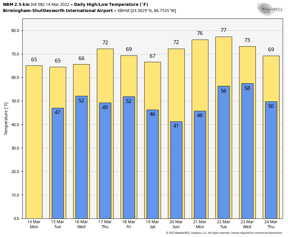
NICE WARM-UP TODAY: Temperatures are mostly between 30 and 40 degrees across Alabama, but a few colder spots over the eastern counties are in the upper 20s. Look for a high in the 60s today with a partly to mostly sunny sky. Clouds increase tonight ahead of an approaching upper trough.
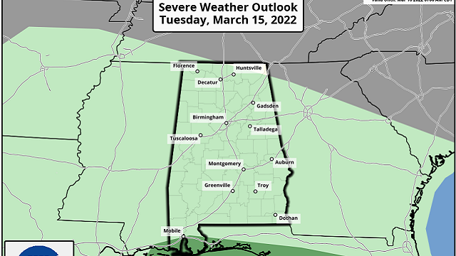
Rain returns to Alabama Tuesday and Tuesday night; amounts of one-half to three-quarters of an inch are likely for most communities. A few strong storms are possible near the Gulf Coast; the Storm Prediction Center has defined a low-end marginal risk (level 1 out of 5) of severe thunderstorms for southern Mobile and Baldwin counties, where strong wind gusts are possible.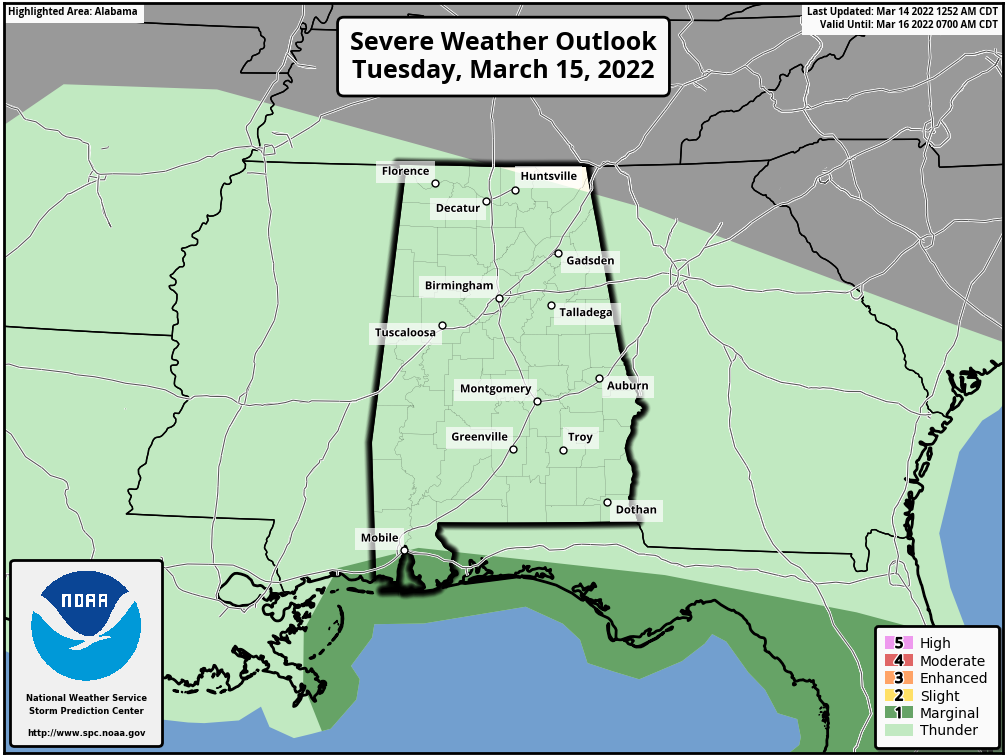 Lingering showers are possible Wednesday with a cloudy sky; the afternoon high will remain in the 60s. Thursday promises to be a nice day, with ample sunshine and a high in the 70s. It will be the warmest day of the week.
FRIDAY AND THE WEEKEND: A cold front will bring showers and thunderstorms to Alabama Friday. A strong thunderstorm can’t be ruled out, but for now the severe weather threat looks low with the main dynamic support far to the north. Then, a very nice weekend is ahead with sunny, mild days and fair, cool nights. Highs will be between 68 and 72 degrees for most communities.
NEXT WEEK: Monday will be dry and pleasant, but showers and storms return Tuesday and Tuesday night; it’s too early to know whether severe thunderstorms will be an issue with this system. Highs will remain mostly in the 70s.
 ON THIS DATE IN 1993: Birmingham’s official low was 2 degrees, by far the coldest March temperature on record. It came just after the generational “Blizzard of ’93”, which dropped more than 1 foot of snow on the city. At one point more than 400,000 people were without power.
ON THIS DATE IN 2008: An EF2 tornado moved through downtown Atlanta, shortly before 10 p.m. ET, damaging the Georgia Dome, where the SEC men’s basketball tournament was underway (Alabama and Mississippi State were playing at the time). The tornado touched down just west of the Georgia World Congress Center, which was heavily damaged. The tornado passed just 100 yards north of the Dome and turned east-southeast on a six-mile path, lifting near I-20 in DeKalb County.
But the real story was the miracle shot by Mykal Riley of Alabama that sent the game into overtime and kept thousands of fans inside the Georgia Dome. Had the game ended in regulation and not gone into overtime, thousands of fans would have been outside the stadium when the tornado struck. Because fans stayed to watch the game in overtime, a tremendous catastrophe was averted.
ON THIS DATE IN 2019: A total of 15 tornadoes touched down across Alabama; most were EF-0 to EF-1 strength. The strongest was an EF-2 that moved through Elmore County, near Holtville.
BEACH FORECAST: Click here to see the AlabamaWx Beach Forecast Center page.
WEATHER BRAINS: You can listen to our weekly 90-minute show any time on your favorite podcast app. This is the show all about weather featuring many familiar voices, including the meteorologists at ABC 33/40.
CONNECT: You can find me on all of the major social networks:
For more weather news and information from James Spann and his team, visit AlabamaWx.


