James Spann: Severe storms, flooding possible in Alabama through late tonight
James Spann forecasts possible severe storms for Alabama from Alabama NewsCenter on Vimeo.
ACTIVE DAY AHEAD: The dynamic storm system that brought severe thunderstorms and tornadoes to parts of Texas and Oklahoma Monday and Monday night will affect Alabama in a big way over the next 24 hours.
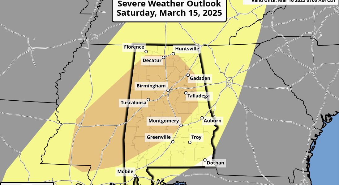
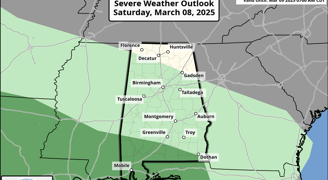
The Storm Prediction Center has extended the moderate risk (level 4 of 5) into far southwest Alabama, including parts of Choctaw, Clarke and Washington counties. An enhanced risk (level 3 of 5) extends as far east as Carrollton, Moundville, Camden and Mobile. A slight risk (level 2 of 5) is defined over to Haleyville, Birmingham and Troy, and the rest of north and east Alabama is in a marginal risk (level 1 of 5).
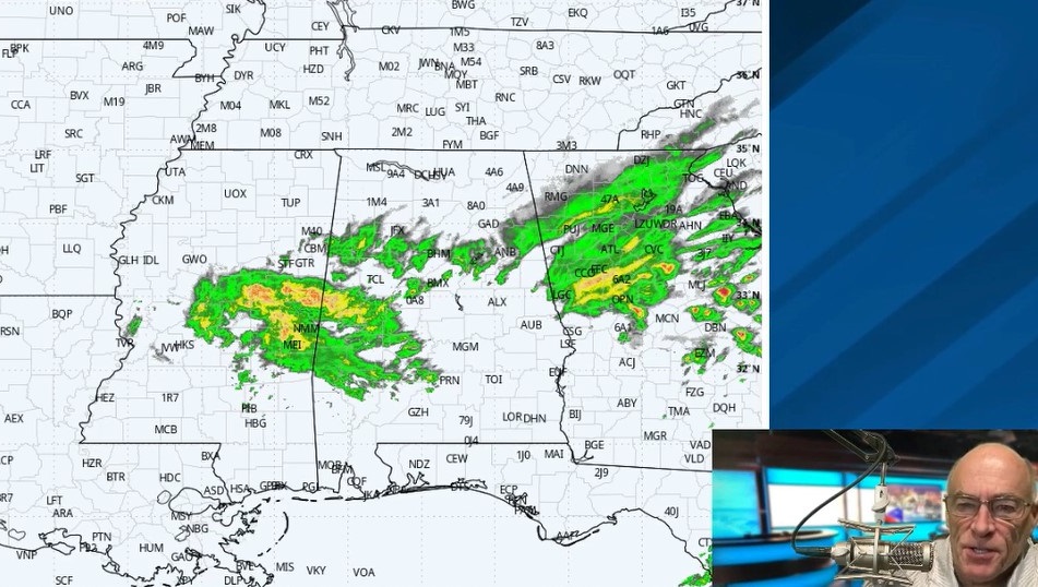
A line of severe thunderstorms will affect the state tonight, but a few discrete cells could form ahead of the main line this afternoon over west Alabama, where there will be a good combination of shear and instability; these will feature the highest tornado potential. Instability values are not especially high for mid-March in Alabama, but certainly sufficient for strong to severe storms. Instability over east Alabama will be very limited tonight.
TIMING: The window for severe storms opens up in far west Alabama around 2 p.m. The window for the I-65 corridor (Huntsville, Birmingham and Montgomery) is from 6 p.m. until 2 a.m., and most of the storms will affect east and southeast Alabama after midnight.
THREATS: Storms will be capable of producing large hail, damaging wind and tornadoes. The highest tornado potential is in the moderate and enhanced risk areas across west and southwest Alabama this afternoon into the evening. The main threat will shift to strong winds tonight as the activity rolls into a long squall line.
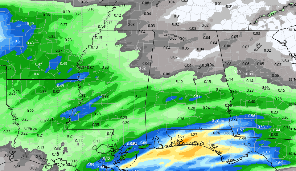
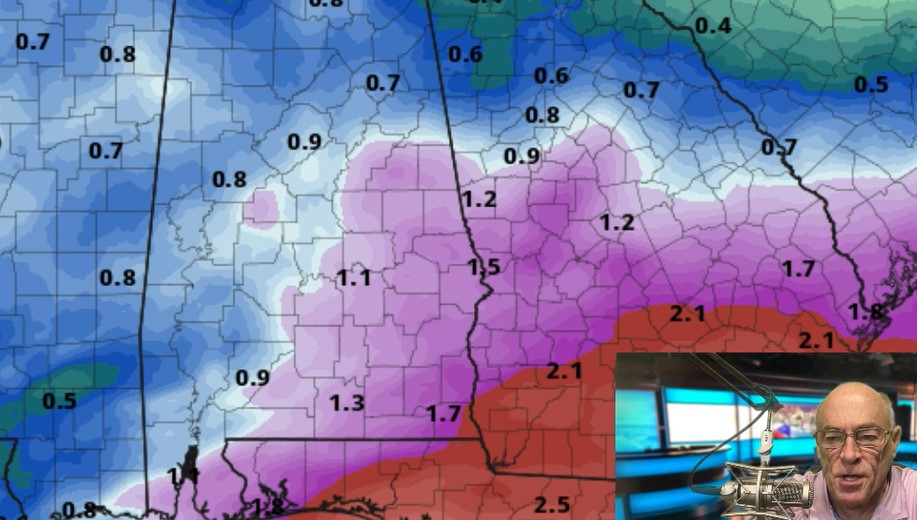
FLOODING: Rain amounts of 2-3 inches are likely across much of the state west of I-65, and a flash flood watch has been issued for this area. It includes places like Huntsville, Birmingham, Selma and points to the west. Rain totals of 1-2 inches are forecast for the eastern half of the state through Wednesday morning.
WIND: Non-thunderstorm gradient winds will gust to 35-40 mph later today and tonight; most of Alabama is in a wind advisory. This could bring a few scattered power outages.
PREPARE: Be sure you have a reliable way of hearing severe weather warnings (never a siren); a NOAA Weather Radio is the baseline. On your phone, be sure emergency alerts are enabled and have the free ABC 33/40 weather app installed. Know the safe place in your home, and in that safe place have helmets for everyone. If you live in a mobile home, know where you are going (community shelter, business, etc.) and have transportation.
WATCH: If tornado warnings are issued, watch us on ABC 33/40. Remember, local TV is free, over the air. You don’t need cable, satellite or an Internet connection. To watch online, the best options are:
- YouTube: http://youtube.com/abc3340
- Facebook: http://facebook.com/abc3340
REMEMBER: Don’t be anxious or worried; events like this are very common in Alabama during our tornado season, especially March and April. Have a way of hearing warnings, have a plan and you will be fine. Odds of any one spot being hit by a tornado are low, but we all have to be ready.
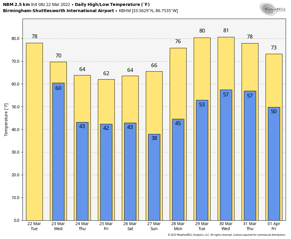
REST OF THE WEEK: Lingering rain and storms will end across east and southeast Alabama Wednesday morning; the sky becomes partly sunny by afternoon as drier air moves into the state. The high will be between 67 and 70 degrees. Dry weather continues Thursday and Friday with a partly sunny sky both days; highs will be in the mid 60s.
THE ALABAMA WEEKEND: Expect a sun-filled sky Saturday and Sunday with highs in the mid 60s. Mornings will be cold; most places will be in the 30s early Sunday morning across the northern half of Alabama, with frost likely. Colder spots will see a freeze; growers beware.
NEXT WEEK: Monday will be dry and warmer, with a high in the 70s. A few showers are possible over far north Alabama Tuesday, but the next significant rain event will likely come by Thursday, when thunderstorms return; it’s too early to know whether this will feature a severe weather threat.
ON THIS DATE IN 1952: A tornado estimated at F4 strength moved through parts of Morgan and Madison counties, from southwest of Hartselle to near Huntsville. A total of 35 homes were destroyed and 39 damaged in Morgan County. Some were “leveled to the ground” in the communities of Massey and Plainview. In Madison County, four buildings were destroyed, six damaged. Many buildings at Redstone Arsenal sustained damage. At least five people were killed.
BEACH FORECAST: Click here to see the AlabamaWx Beach Forecast Center page.
WEATHER BRAINS: You can listen to our weekly 90-minute show any time on your favorite podcast app. This is the show all about weather featuring many familiar voices, including the meteorologists at ABC 33/40.
CONNECT: You can find me on the major social networks:
For more weather news and information from James Spann and his team, visit AlabamaWx.