James Spann: Alabama stays mostly dry Thursday; storms likely Friday
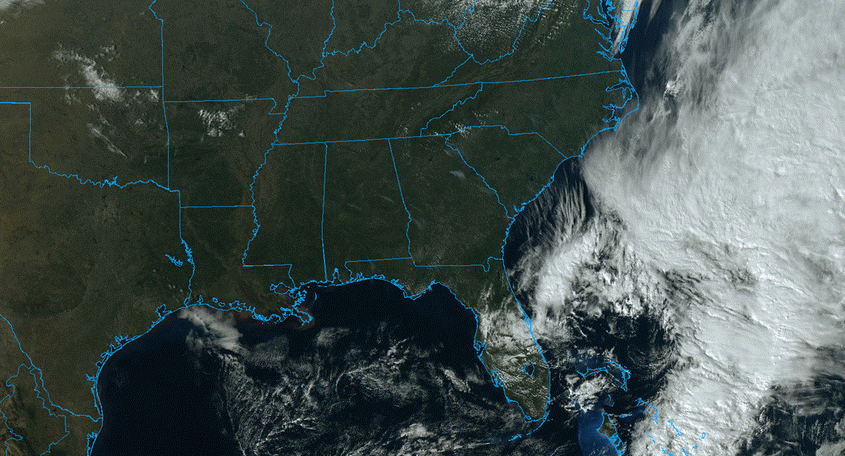
RADAR CHECK: We have a classic case of widely scattered showers and storms on radar this afternoon; the storms are lined up near I-20, with the heavier ones east of Birmingham. Some small hail has been reported around Anniston and near Piedmont in Calhoun County. The rest of the state is dry with a mix of sun and clouds. Temperatures are in the mid to upper 80s; for some places this is the warmest day so far this year. The widely scattered storms will end this evening after sunset, and tonight will be mostly fair with a low in the 60s. Thursday will be warm and mostly dry, with only a small chance of any one spot seeing a shower. The high will be between 86 and 90 degrees.
FRIDAY: Showers and storms are likely Friday ahead of a cold front. The Storm Prediction Center has much of the state in a slight risk (level 2 out of 5) of severe thunderstorms.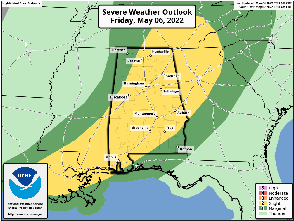 It is looking more and more like we will have two rounds of storms: one during the morning and another one (with the storms being more scattered) during the afternoon. It won’t rain all day, but when storms pass through you will have the chance of large hail and strong winds with the heavier cells. The wind profiles really don’t favor a tornado threat, but a brief, isolated tornado can’t be totally ruled out in this pattern. Rain amounts Friday should be generally one-half inch or less, and the high will be between 79 and 83 degrees.
Most of the storms will be over across the northern half of the state by Friday evening, and lingering storms over south Alabama should be over by midnight.
MOTHER’S DAY WEEKEND: Dry air returns Friday night, and the weekend will feature sunny days. The high will be close to 80 Saturday, followed by mid 80s Sunday.
NEXT WEEK: Most of the week will be dry, with potential for the hottest weather so far this year by midweek as temperatures climb toward the 90-degree mark. Global models suggest a few showers could show up by Friday, May 13.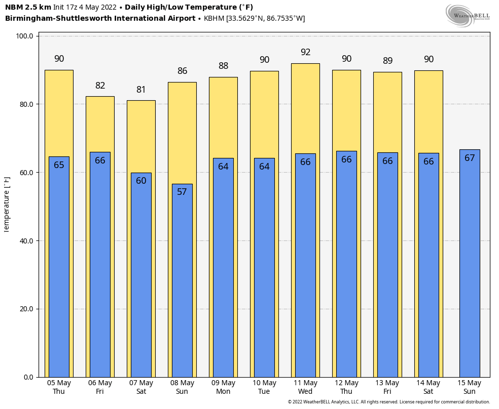 ON THIS DATE IN 2007: A devastating EF5 twister demolished nearly every structure in Greensburg, Kansas, around 9:30 p.m. and killed 10. The mammoth wedge tornado cut a swath 1.7 miles wide and 22 miles long across the Kansas landscape. It was the worst single tornado to touch down in the U.S. in eight years.
ON THIS DATE IN 2021: Rain totals reached 5 to 7 inches in and surrounding Shelby and Jefferson counties. A rare flash flood emergency was issued to highlight the life-threatening nature of the flooding in the Birmingham metro. Many roads were closed, some structures were flooded and water rescues were performed.
BEACH FORECAST: Click here to see the AlabamaWx Beach Forecast Center page.
WEATHER BRAINS: You can listen to our weekly 90-minute show any time on your favorite podcast app. This is the show all about weather featuring many familiar voices, including the meteorologists at ABC 33/40.
CONNECT: You can find me on the major social networks:
For more weather news and information from James Spann and his team, visit AlabamaWx.