Scott Martin: Typical late July weather for Alabama
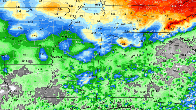
RAINFALL TOTALS: Most locations will see less than 1 inch of rainfall through Friday night. But, as you know, with summertime storms totals can vary greatly, with some places getting none at all and some getting caught under a heavy storm, which could produce in excess of 1 inch.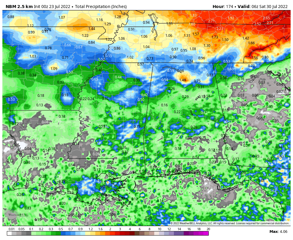
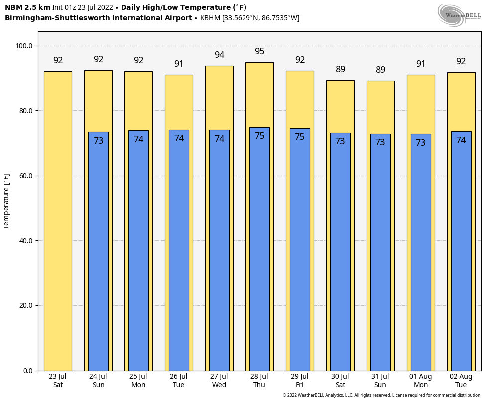
HIGHS AND LOWS: Temperatures for the next 10 days are trending to be close to or slightly above normal for this time of the year. Highs will range from the upper 80s to the mid 90s, while lows will be in the lower to mid 70s.
THIS WEEKEND: Skies will be partly to mostly cloudy today, with scattered, mainly afternoon showers and thunderstorms. Highs will be in the lower to mid 90s. Sunday will be mostly sunny, hot and humid, with a very small chance of an isolated shower or two. Highs will be in the lower to mid 90s. Some locations may have to go under a heat advisory as heat index values could top out at or just over 105 degrees.
THE WORK WEEK AHEAD: Monday will feature typical late July weather — mostly sunny, hot and humid. A few isolated to scattered afternoon showers and storms will be possible, but odds will be slim. Highs will be in the lower to mid 90s. A surface boundary approaches the state from the north that may bring an increase to shower and thunderstorm chances for the northern half of Alabama on Tuesday, while the southern half will continue to have a small chance of a few isolated showers. Highs will be in the upper 80s to the mid 90s.
Much of the state will be dry Wednesday, with only a very small chance of a few isolated afternoon showers. The stalled boundary looks to continue to bring higher rain chances to the Tennessee Valley. Highs will be in the lower to mid 90s. Thursday will be a little hotter as it will be mainly sunny with a chance of a few isolated to scattered afternoon showers and storms. Highs will range from the lower 90s to the upper 90s from northeast to southwest.
On Friday, another boundary will push into the state and bring a much better chance of scattered to numerous showers and storms. At this point, the better rain chances will be over the northern half of the state, but everyone will at least have a decent chance of rain. We’ll have to watch for heavy rain producers, plenty of lightning and gusty winds. Highs will be in the lower to mid 90s.
TROPICS: All is calm across the Gulf of Mexico, the Caribbean Sea and the tropical Atlantic Ocean, and no new tropical systems are expected to form over the next five days.
For more weather news and information from James Spann, Scott Martin and other members of the James Spann team, visit AlabamaWx.


