James Spann: Numerous showers, storms for Alabama through Thursday
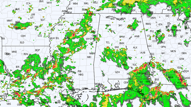
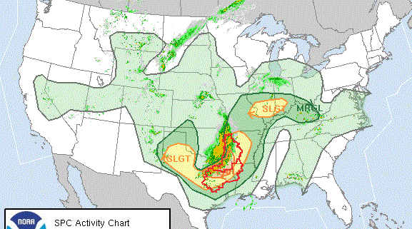
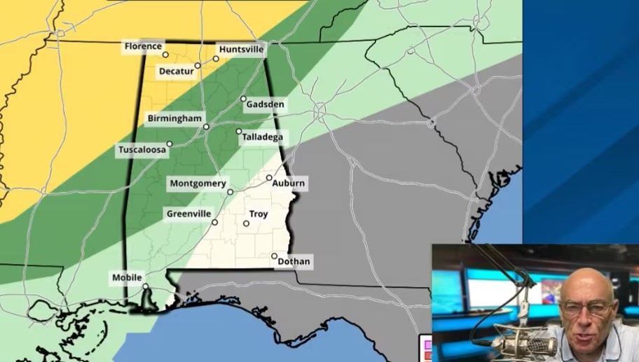
RADAR CHECK: We have more summer soakers on radar this afternoon; some of the heavier storms at mid-afternoon were approaching Tuscaloosa, Brent and Clanton from the south. Others are in scattered spots around the state; showers and storms remain possible anywhere through around midnight tonight. They are producing heavy rain, gusty winds and lots of lightning. Otherwise, we have a mix of sun and clouds with temperatures mostly in the mid to upper 80s, which is below average for mid-August in Alabama.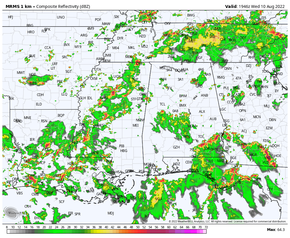 The weather won’t change much Thursday; the sky will be occasionally cloudy with scattered to numerous showers and thunderstorms in the humid air across the Deep South. On Friday, dry air begins to creep into north Alabama, and most of the showers and storms will be over the southern two-thirds of the state (basically from I-20 south).
THE ALABAMA WEEKEND: Unusually dry air for summer will cover much of Alabama over the weekend, meaning mostly sunny days and slightly lower humidity. Showers and storms will be generally confined to the Gulf Coast. Highs Saturday and Sunday will be between 87 and 90 degrees, and morning lows will be in the 60s. Some of the cooler spots over north Alabama could see low 60s Saturday and Sunday mornings.
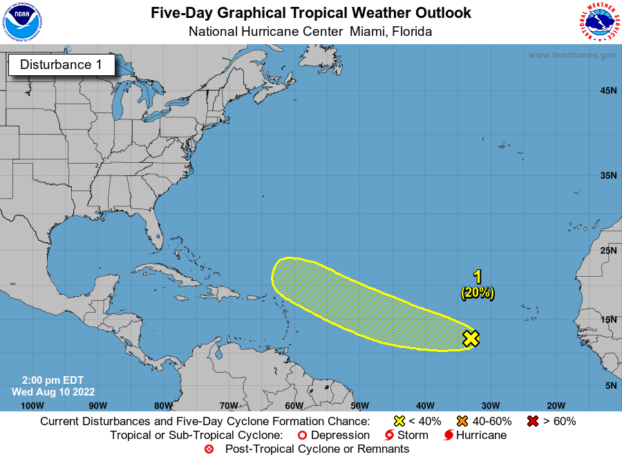
NEXT WEEK: The week is looking pretty quiet based on the latest global model trends. There could be a day or two with scattered storms, but the air looks fairly dry for August. Temperatures will likely remain below average, with highs between 86 and 90 degrees most days.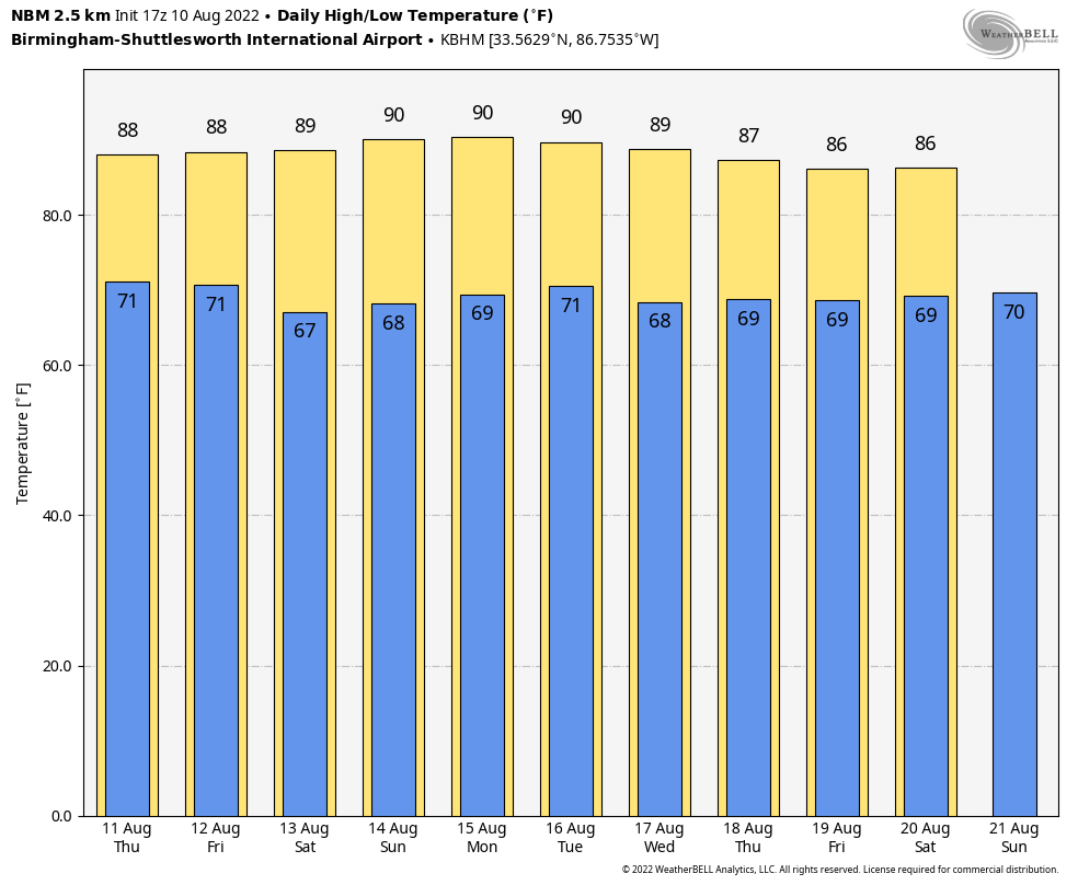 TROPICS: Shower and thunderstorm activity associated with a tropical wave (Invest 97L) several hundred miles west-southwest of the Cabo Verde Islands has decreased since Tuesday. This system is expected to move westward to west-northwestward at 15 to 20 mph across the tropical Atlantic during the next several days.
The chance of development has dropped to 10% over the next 48 hours and 20% through the next five days. The rest of the Atlantic basin remains very quiet this afternoon.
 ON THIS DATE IN 1856: A hurricane destroyed Isle Dernieres or Last Island, a pleasure resort south-southwest of New Orleans. The highest points of the island were under 5 feet of water. The resort hotel was destroyed, along with the island’s gambling establishments. More than 200 people perished; the island lost all its vegetation and split in half. Only one cow remained on the island after the catastrophe. The Last Island is now just a haven for pelicans and other seabirds. The steamer Nautilus foundered during the storm. The lone survivor clung to a bale of cotton and washed ashore sometime later.
ON THIS DATE IN 1980: Hurricane Allen made landfall just north of Brownsville, Texas. The hurricane achieved Category 5 status three separate times (the only Atlantic hurricane to do so). It also ranks as one of the most powerful Atlantic hurricanes with sustained winds near 190 mph at its peak. When Allen made landfall, it had weakened to a Category 3 storm. Still, it brought damaging winds and torrential rainfall. The remnants of the storm caused a brief lapse in the heat wave of 1980 in places like Dallas/Fort Worth, Texas, which had recorded 69 days of 100-degree heat.
BEACH FORECAST: Click here to see the AlabamaWx Beach Forecast Center page.
For more weather news and information from James Spann and his team, visit AlabamaWx.