James Spann: Scattered storms for Alabama Tuesday; drier air arrives Wednesday, Thursday
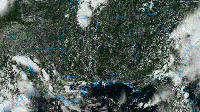
HOT AUGUST AFTERNOON: Temperatures are hovering between 90 and 93 degrees across most of Alabama this afternoon with a partly to mostly sunny sky. Showers are widely spaced; most places are dry. Tonight will be mostly fair with a low in the 70s.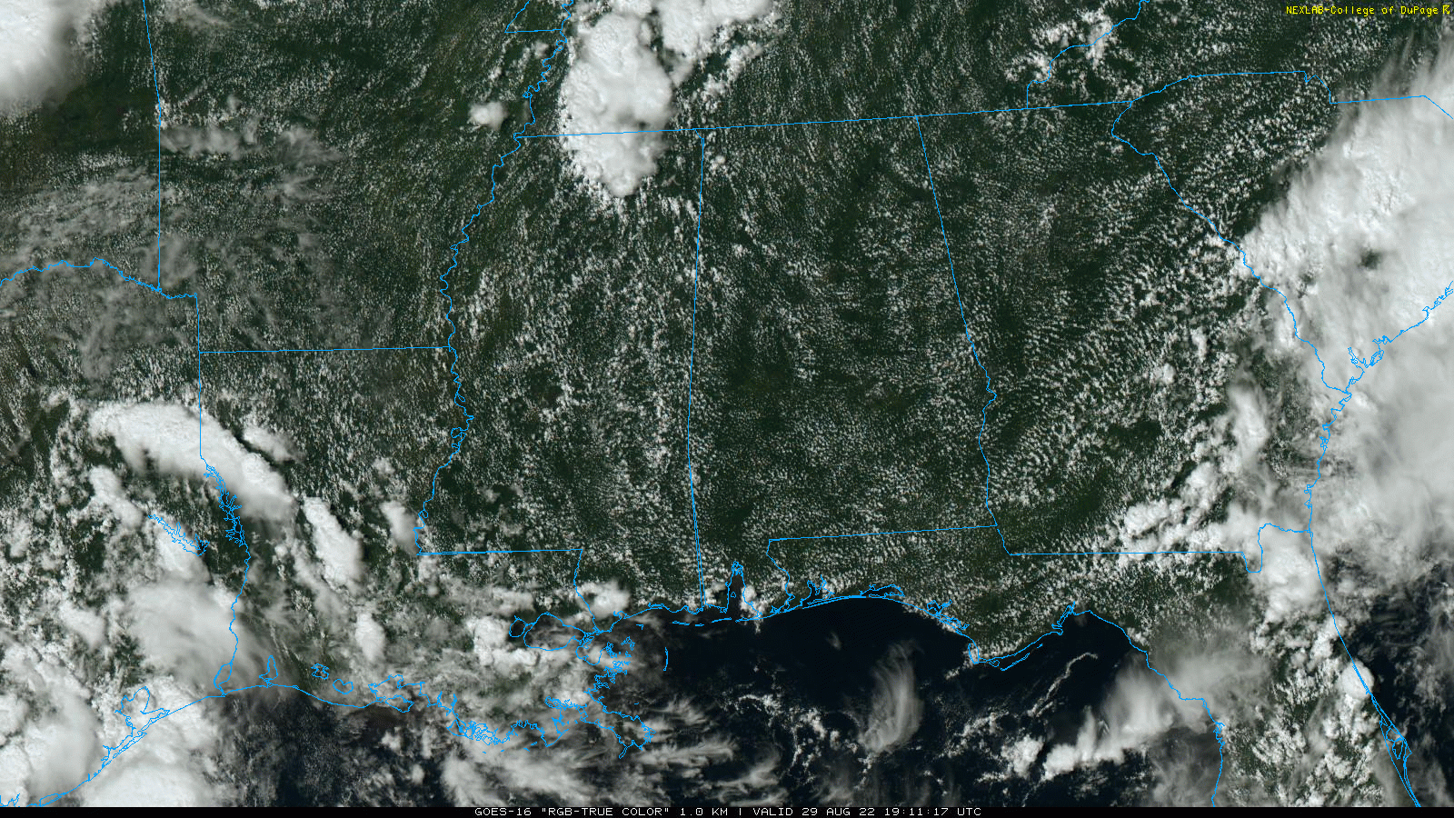
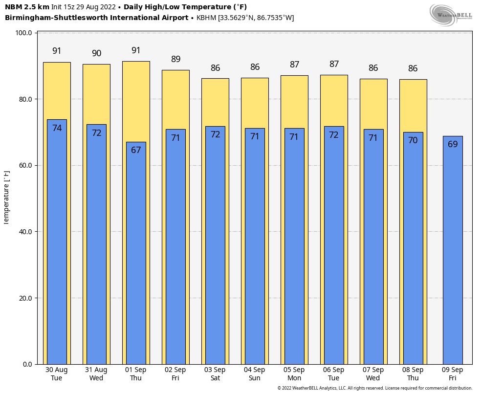
An approaching surface front will bring an increase in the number of showers and storms across the state Tuesday afternoon. It won’t rain everywhere, but any one spot stands a 35-45% chance of seeing a shower. With a mix of sun and clouds look for a high between 87 and 90 degrees.
WEDNESDAY/THURSDAY: Noticeably drier air will invade the northern two-thirds of Alabama on these two days. Humidity levels will come down a bit and nights will be cooler. A few spots will drop into the low 60s early Thursday morning over the northern counties. The sky will be mostly sunny, and showers will be confined to the far southern part of the state. Highs will be close to 90 degrees.
FRIDAY AND THE LABOR DAY WEEKEND: Moisture levels rise Friday, and we will bring back the chance of scattered, mostly afternoon and evening showers and thunderstorms with a partly sunny sky. That classic late summer weather will continue Saturday through Monday. Odds of any one spot getting wet each day are 30-40%, and most of the showers will come generally from noon to midnight. The showers and storms will be random; there’s no way of knowing in advance exactly when and where they form. Highs will be mostly in the upper 80s with a partly sunny sky each day.
REST OF NEXT WEEK: Typical early September weather continues Tuesday through Friday of next week with partly sunny days and scattered, mostly afternoon and evening showers and thunderstorms. Highs will be generally between 85 and 90 degrees; the first meaningful cold front of the fall season usually doesn’t arrive here until late September.
 LABOR DAY BEACH FORECAST: For those planning to spend some time along the central Gulf Coast (Gulf Shores to Panama City Beach) this coming weekend, the weather looks routine for early September, the classic mix of sun and scattered storms. Expect about six to eight hours of sun daily, with a passing shower or storm from time to time. Highs will be between 85 and 90 degrees along the immediate coast; sea water temperatures are in the low to mid 80s. There are no tropical systems to worry about.
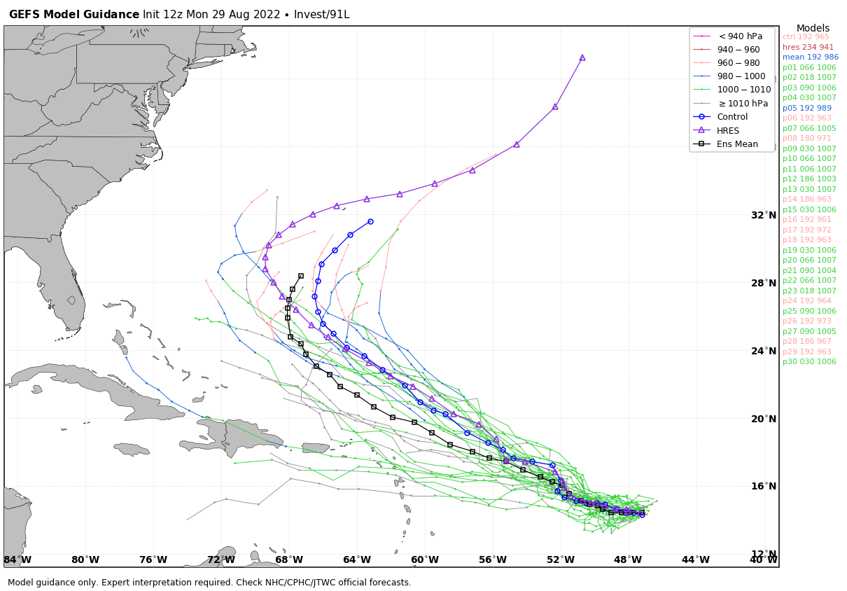
TROPICS: There are several tropical waves across the Atlantic basin; most of them won’t develop. The one with the highest probability of becoming a depression or storm is Invest 91L, about halfway between the Lesser Antilles and the coast of Africa. The National Hurricane Center gives it an 80% chance of development over the next five days. It will gain latitude and pass north of the Leeward Islands, and should turn north and then northeast into the open Atlantic well east of the U.S.
 There is no threat of any tropical system around the central Gulf Coast (Gulf Shores to Panama City Beach) over the next 10 days.
It has been 25 years since we had an August with no named storms in the Atlantic basin, with 1997 being the last time. The other years without an August storm were 1961, 1941 and 1929.
ON THIS DATE IN 2005: Hurricane Katrina made its final landfall near the mouth of the Pearl River about 9:45 a.m., with the eye straddling St. Tammany Parish, Louisiana, and Hancock County, Mississippi. It weakened from a Category 5 to a Category 3 at the time of landfall, but it still caused more than 1,800 fatalities and $125 billion in damage, especially in New Orleans and the surrounding areas.
Flooding, caused largely as a result of fatal engineering flaws in the levees around New Orleans, precipitated most of the loss of lives. Eventually, 80% of the city, as well as large tracts of neighboring parishes, were inundated for weeks. The flooding also destroyed most of New Orleans’ transportation and communication facilities, leaving tens of thousands of people who had not evacuated the city prior to landfall stranded with little access to food, shelter or other basic necessities.
The Gulf coast of Mississippi suffered extremely severe damage from the impact of Hurricane Katrina, leaving 238 people dead, 67 missing and billions of dollars in damage: bridges, barges, boats, piers, houses and cars were washed inland. Katrina traveled up the entire state; as a result, all 82 counties in Mississippi were declared disaster areas for federal assistance, 47 for full assistance.
For more weather news and information from James Spann and his team, visit AlabamaWx.


