James Spann: Warm, humid day for Alabama with a few showers later
James Spann forecasts less widespread rain for Alabama from Alabama NewsCenter on Vimeo.
FOGGY START: There is a dense fog advisory for about the northern third of Alabama early this morning; the fog will dissipate by midmorning. Otherwise, today will be warm and very humid with a mix of sun and clouds. A few scattered showers will form this afternoon, but the rain won’t be as widespread as recent days. The chance of any one spot seeing a shower later today is 20-30%, and the high will be between 85 and 88 degrees. The average high for Birmingham on Sept..6 is 88.
The weather won’t change much Wednesday and Thursday. Look for partly sunny, warm, humid days with a few widely scattered showers or storms, mostly during the afternoon and evening. Highs remain in the mid to upper 80s.
FRIDAY AND THE WEEKEND: Moisture levels rise, and showers and storms become more widespread Friday. The rain could be heavy at times, and some flooding can’t be ruled out with the saturated soil conditions. For the weekend, the weather remains unsettled with scattered to numerous showers and thunderstorms both days. Not a washout, and you will see some sun at times, but occasional showers are likely. Highs will drop into the 78- to 82-degree range due to clouds and showers.
NEXT WEEK: Showers remain a good possibility Monday, but we are seeing evidence that drier, continental air could push into the Deep South by the middle of the week with lower humidity and cooler nights.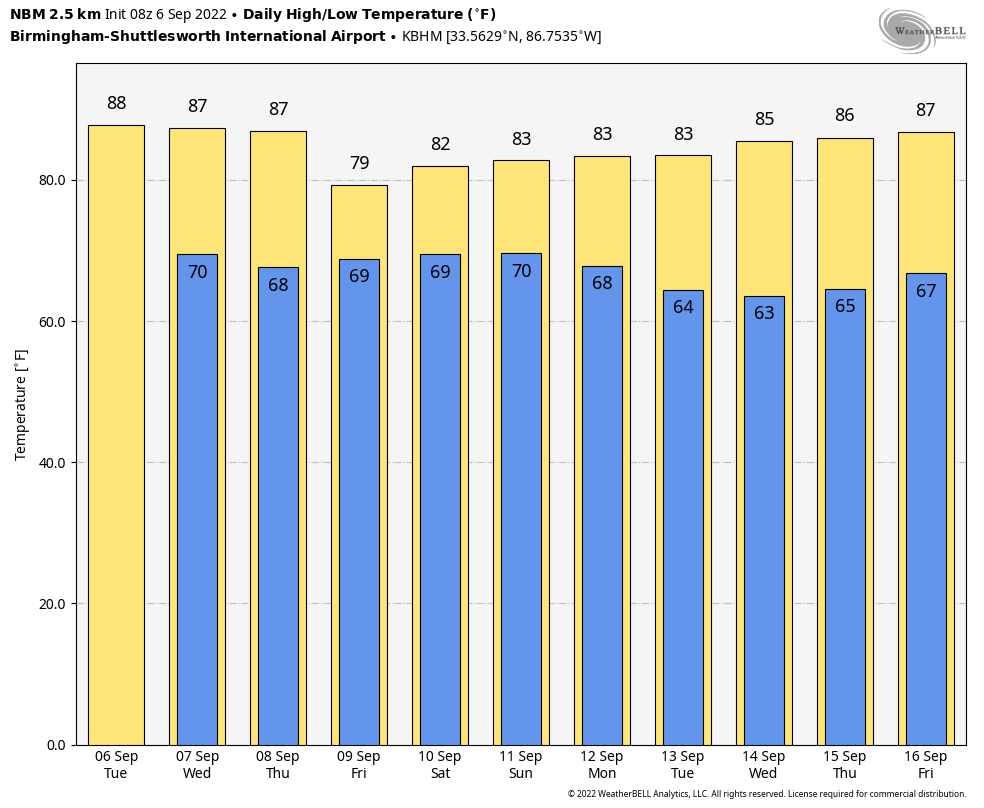 TROPICS: Danielle is barely a hurricane in the North Atlantic with winds of 75 mph. It will move east/northeast over the next few days and will become post-tropical by Thursday night; it will remain far from land. Tropical Storm Earl is packing winds of 65 mph well north of Puerto Rico. It is expected to become a hurricane tonight, passing just east of Bermuda Thursday night. From there it moves into the North Atlantic, far from land.
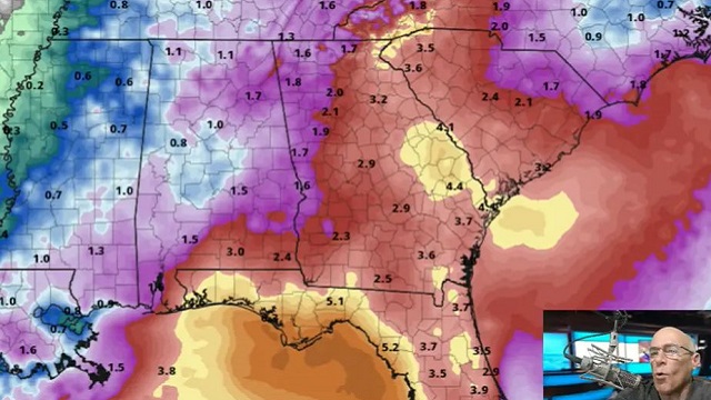
A tropical wave is in the eastern Atlantic; it has a 60% chance of becoming a tropical depression or storm over the next five days, but it will turn northward and is no threat to land. No tropical systems will be close to the U.S. for at least the next seven to 10 days.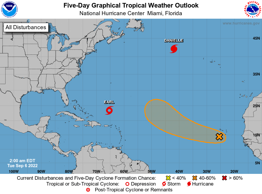 RAIN UPDATE: Here are rain totals for the year so far, and the departure from average:
- Birmingham — 51.45 inches (10.59 inches above average)
- Mobile — 48.9 (0.2 above average)
- Tuscaloosa — 45.61 (8.04 above average)
- Montgomery — 44.07 (7.67 above average)
- Anniston — 39.57 (2.44 above average)
- Huntsville — 38.7 (1.06 above average)
- Dothan — 37.58 (2.32 below average)
- Muscle Shoals — 37.05 (1.12 below average)
ON THIS DATE IN 1933: The remnant low of the Treasure Coast Hurricane dumped 10.33 inches of rain in Charleston, the second-highest 24-hour rainfall total on record for the downtown station. The storm produced wind gusts of 51 mph and also spawned a tornado near the city.
ON THIS DATE IN 2017: Category 5 Hurricane Irma affected the U.S. Virgin Islands and Puerto Rico. Maximum sustained winds were at 180 mph when the storm hit St. Thomas and St. John. Catastrophic damage was reported over the U.S. Virgin Islands and significant damage over Puerto Rico, especially over Culebra.
BEACH FORECAST: Click here to see the AlabamaWx Beach Forecast Center page.
For more weather news and information from James Spann and his team, visit AlabamaWx.


