Scott Martin: Scorching heat for Alabama today; eyes on the tropics
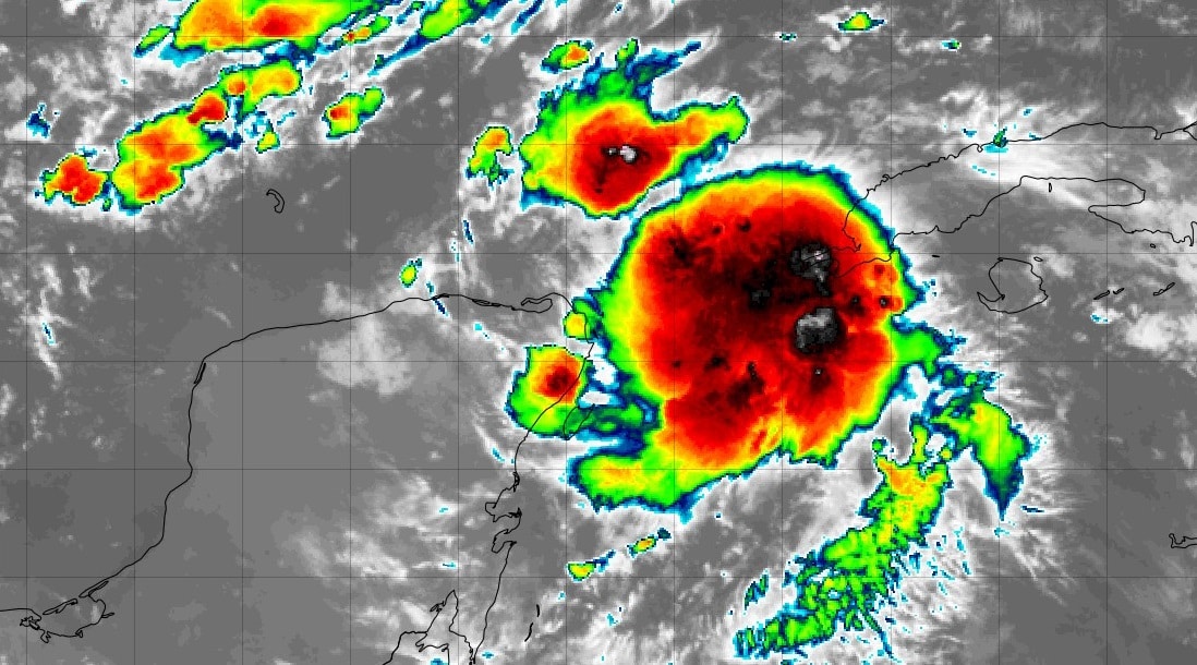
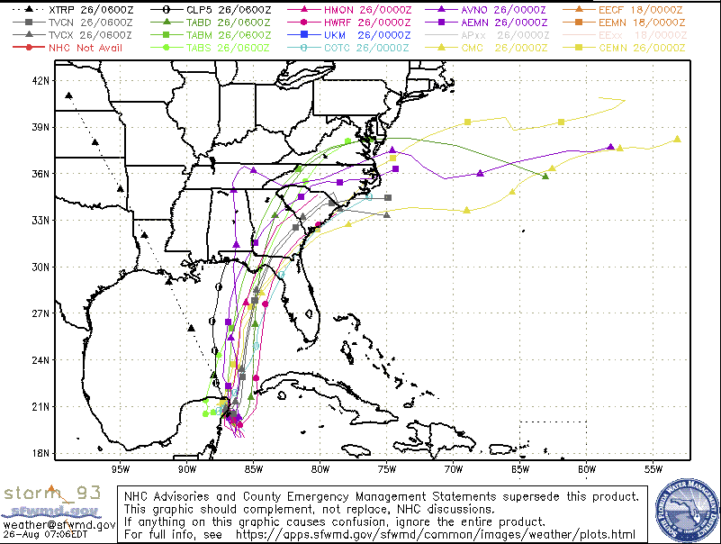
TROPICS: Invest 93L is looking much more organized this morning, and further development is expected as environmental conditions will be favorable. A depression will be likely by the end of the weekend and tropical storm formation soon after. The ensembles are still showing a wide range of potential directions, ranging from Pensacola all the way over to just north of Tampa Bay. Nearly every model keeps this system below hurricane strength due to increasing wind shear from an upper low, but we will have to watch because water temperatures are very warm — almost 90 degrees close to shore along the Florida Panhandle. Once this thing becomes better organized, we’ll have a better idea on what to expect.
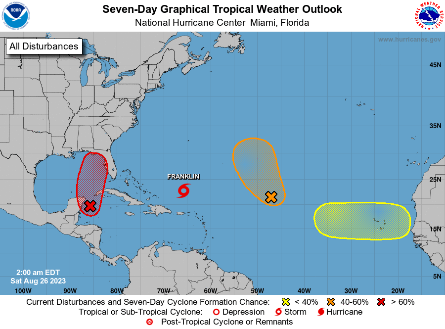
The rest of the systems out there are not a threat to the United States. Tropical Storm Franklin will strengthen into a hurricane and will eventually curve to the northeast, but it will pass just to the west of Bermuda.
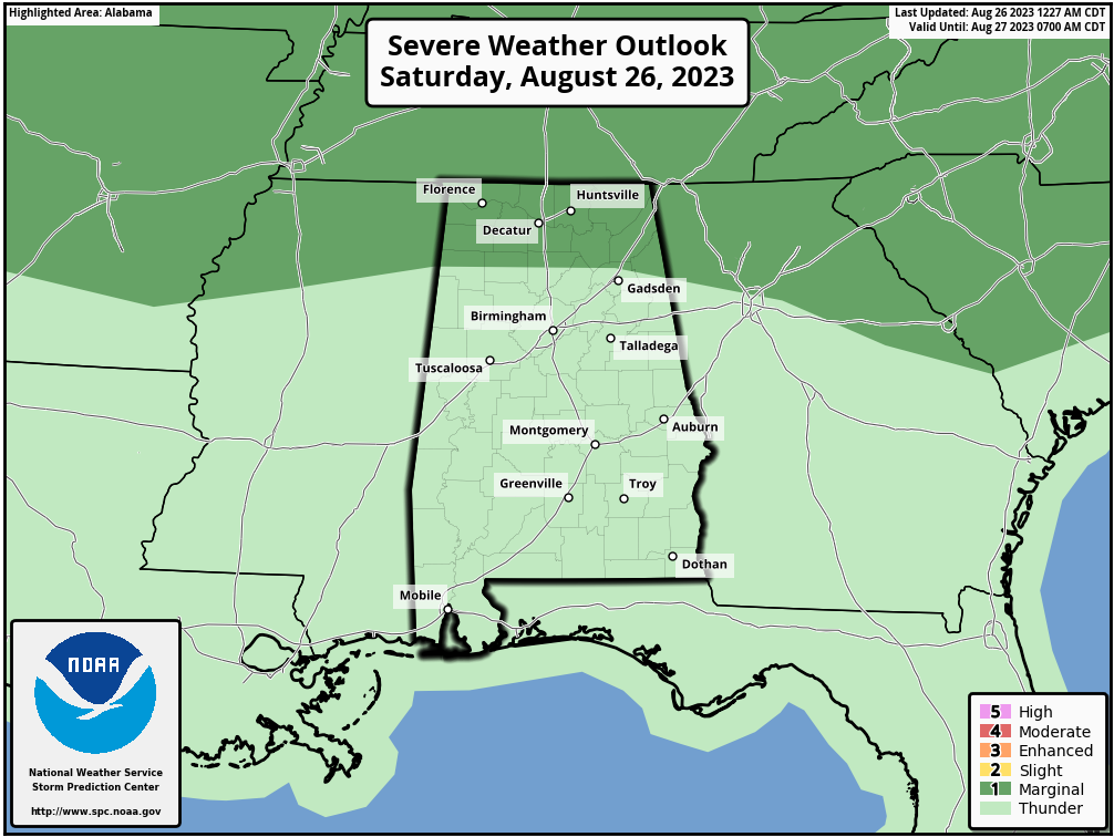
THE ALABAMA WEEKEND: The ridge continues to slowly weaken across the state, which will allow for a few isolated to scattered afternoon showers and storms today. All of Alabama is under a heat advisory today, with highs in the upper 90s to the lower 100s and the heat index reaching as high as 109 degrees. A few storms may become strong to severe over the Tennessee Valley, and the Storm Prediction Center (SPC) has a marginal risk of severe weather up for those locations.
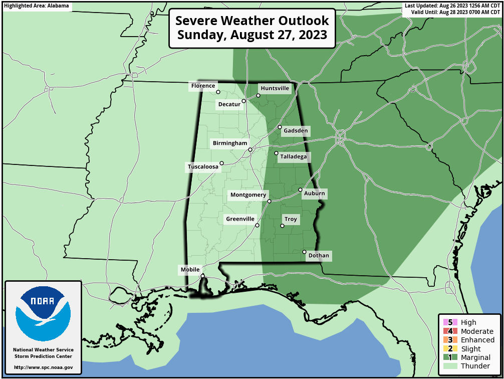
We’ll have a surface front work through the state on Sunday that will increase shower and thunderstorm activity during the afternoon and evening, and strong storms will be possible. The SPC has nearly the eastern half of the state under a marginal risk. Highs will be in the lower 90s to the lower 100s.
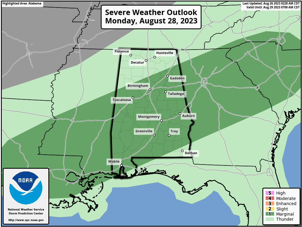
NEXT WEEK: Strong to severe storms will continue to be possible on Monday, and a large section of Alabama is under a marginal risk; damaging winds and quarter-sized hail will be possible. Much of the activity will occur during the afternoon and evening, but there is a chance of scattered showers and storms during the morning as well. Highs will be in the mid 80s to the mid 90s.
After that, the forecast gets a little unclear due to the approach of the tropical system. We’ll keep a chance of isolated to scattered afternoon showers and storms in the forecast for Tuesday, with highs in the mid 80s to the lower 90s.
Wednesday and Thursday will be the days we’ll need to watch. The Global Forecast System has the tropical system moving onshore near the Big Bend of Florida and scooting into extreme southwestern Georgia. Then it is forecast to turn more northeasterly and move into the Carolinas by late Thursday night. If this solution plays out, we’ll have scattered showers and a little bit of a breeze, especially on Wednesday afternoon through early Thursday morning. Highs will be in the 80s to the lower 90s on both days.
On Friday the system will be out over the Atlantic, and we look to have a dry day with warm temperatures. Highs will range from the lower 80s to close to 90 degrees.
For more weather news and information from James Spann, Scott Martin and other members of the James Spann team, visit AlabamaWx.


