James Spann: Another cold night for Alabama; warmer by the weekend
James Spann forecasts a warmer weekend for Alabama from Alabama News Center on Vimeo.
SUBFREEZING START: Here are some temperatures just before sunrise across Alabama:
- Margaret — 20
- Jasper — 21
- Tuckers Chapel (Cherokee County) — 21
- Gadsden — 22
- Fort Payne — 22
- Decatur — 23
- Chelsea — 23
- Haleyville — 23
- Hueytown — 24
- Heflin — 24
- Muscle Shoals — 25
- Good Hope — 25
- Bessemer — 25
- Huntsville — 26
- Demopolis — 27
- Anniston — 27
- Eufaula — 28
- Tuscaloosa — 29
- Evergreen — 29
- Montgomery — 30
- Jemison — 30
- Birmingham — 32
- Cullman — 32
- Dothan — 34
- Mobile — 36
- Gulf Shores — 39
With sunshine in full supply, the high today will be between 57 and 62 degrees over the northern half of Alabama, with low to mid 60s for the southern counties. Tonight won’t be as cold as last night, but colder pockets will see another freeze early Friday morning.
FRIDAY THROUGH SUNDAY: A warming trend headlines the forecast. With sunny days and fair nights, we expect a high in the 60s Friday, followed by 70s over the weekend.
NEXT WEEK: Unfortunately, the chance of rain looks very low through the week as drought conditions will continue to intensify across Alabama and the Deep South. We now have a dry forecast with highs between 75 and 80 degrees through Wednesday, followed by a cooling trend Thursday and Friday. We continue to see signals of a decent rain event for the state by 10-15 days.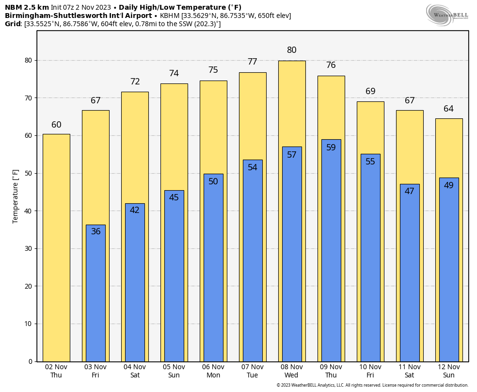 FOOTBALL WEATHER: Expect a clear sky for the high school games across Alabama Friday night with temperatures falling through the 50s.
Saturday, UAB hosts Florida Atlantic at Protective Stadium in downtown Birmingham (2 p.m. kickoff). The sky will be sunny with temperatures in the low 70s.
Auburn travels to Nashville to take on Vanderbilt (3 p.m. CT kickoff). The sky will be clear with upper 60s at kickoff, dropping into the low 60s by the final whistle.
Alabama will host LSU at Bryant-Denny Stadium (6:45 p.m. kickoff). The sky will be clear with temperatures falling through the 60s. It will be a perfect night for football in Tuscaloosa.
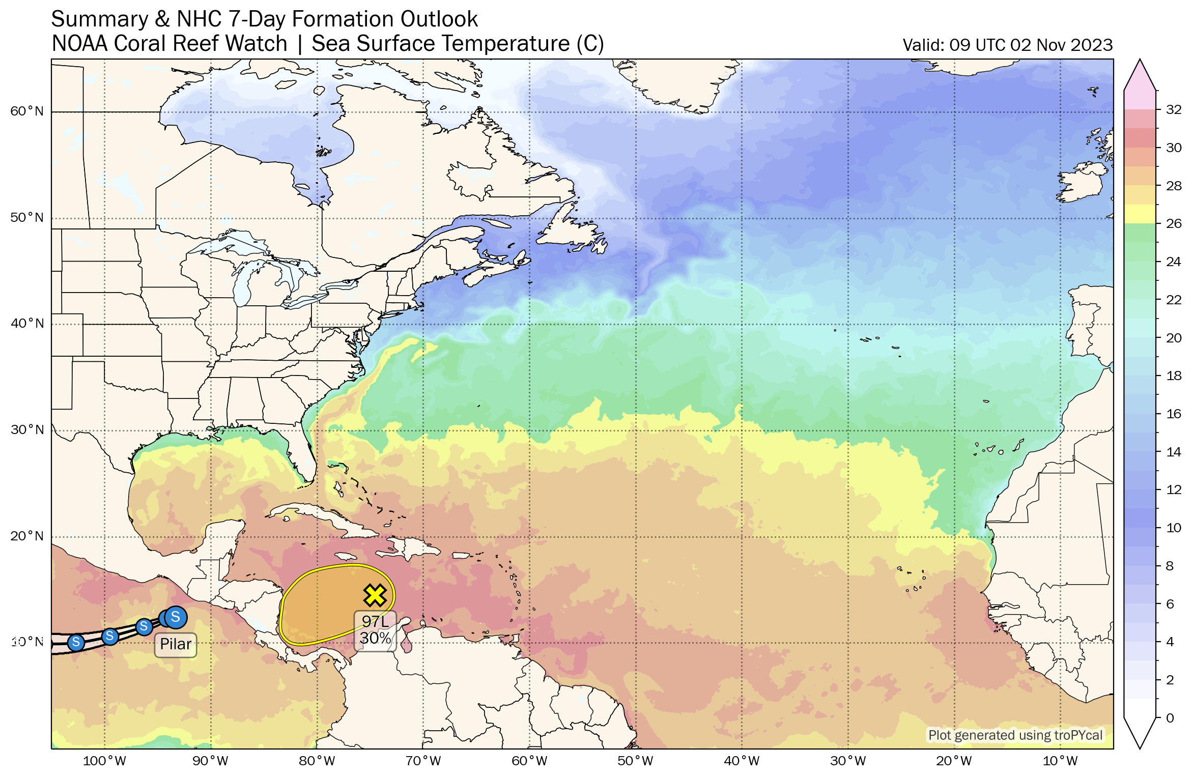
TROPICS: A trough of low pressure is producing limited shower and thunderstorm activity while moving westward over the central Caribbean Sea. Environmental conditions could become a little more conducive for some development of this disturbance over the next couple of days before it moves inland over Central America by this weekend. Regardless of development, this system has the potential to produce heavy rains over portions of Central America late this week and into the weekend. The chance of development has dropped to 30%.
 ON THIS DATE IN 1992: Another infamous November Great Lakes storm brought windy conditions to Minnesota’s Lake Superior shoreline. Winds of 70 mph caused waves to crash over 130-foot walls along the shore.
For more weather news and information from James Spann and his team, visit AlabamaWx.


