James Spann: Rain returns to Alabama over the weekend
James Spann forecasts two more dry days for Alabama, then a rainy weekend from Alabama News Center on Vimeo.
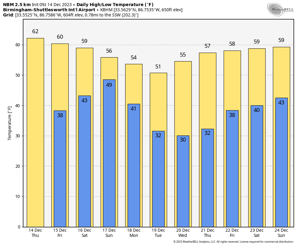
DRY THROUGH FRIDAY: We expect no major change in Alabama’s weather through Friday. Look for partly to mostly sunny days, fair nights and temperatures a little above average for mid-December, with highs between 60 and 65 degrees.
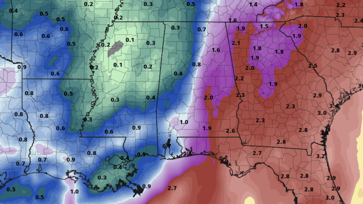
RAIN RETURNS: A surface low will form in the northern Gulf of Mexico Friday night and will spread rain into Alabama over the weekend. Models are more aggressive with moisture return in recent runs, and rain now seems likely for most of the state. The rain will begin Saturday afternoon over the southern counties and will spread northward Saturday night and Sunday. There is no risk of severe thunderstorms, and probably very little thunder. Rain amounts will be heavier over the eastern counties of Alabama, where 1-2 inches are likely. The southeast corner of the state around Dothan could see more than 2 inches. The western counties will see amounts generally around one-half inch.
Highs over the weekend will be between 55 and 60 degrees with clouds and occasional rain.
NEXT WEEK: Dry air returns Sunday night, and next week looks rain-free with sunny, cool days and fair, chilly nights. Highs will be mostly in the mid to upper 50s, with lows in the 30s. A freeze is likely over the northern half of the state Tuesday, Wednesday and Thursday mornings.
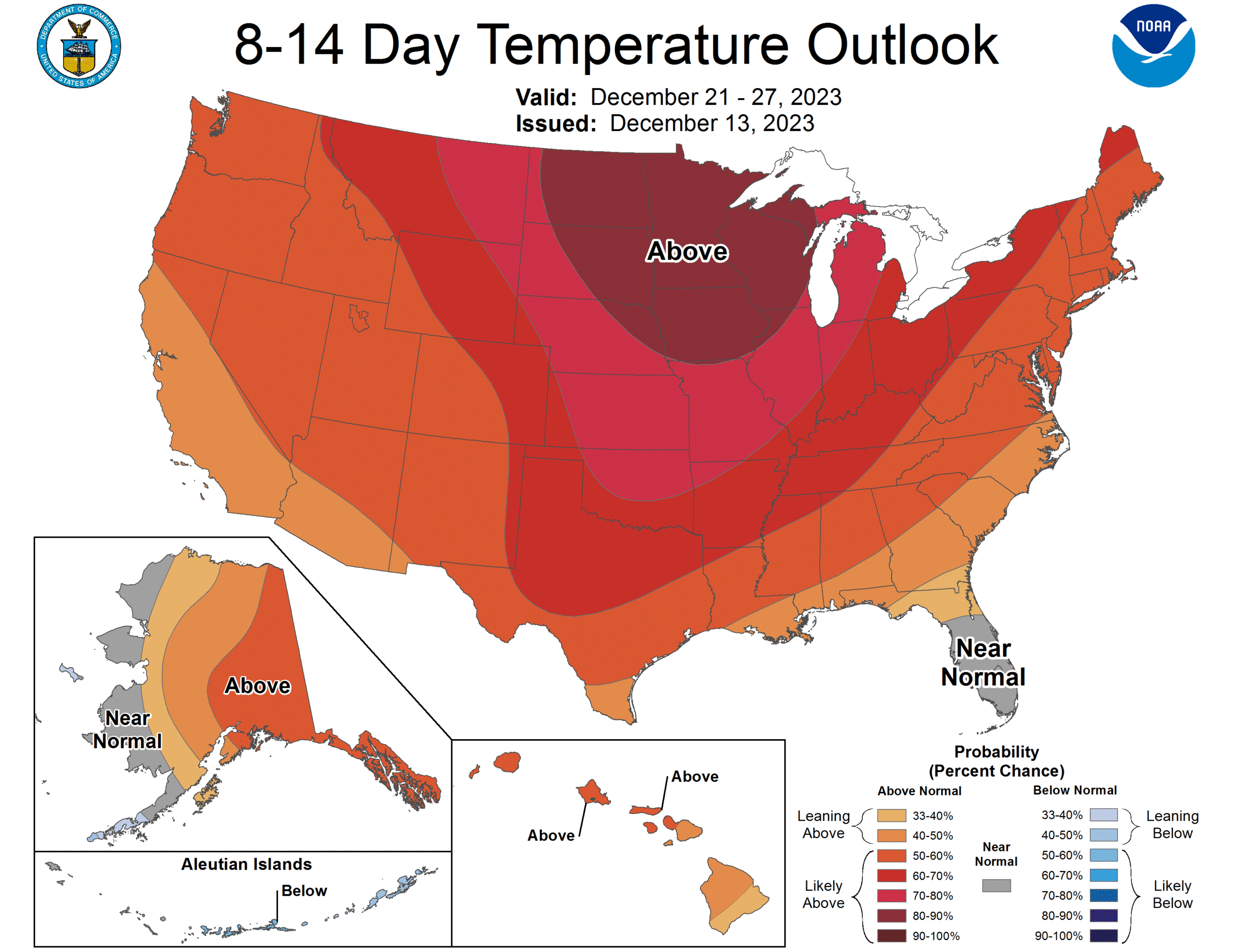
CHRISTMAS WEEK: Long-range guidance continues to suggest relatively mild Pacific air will cover much of the contiguous U.S. with temperatures a little above average for late December.
 ON THIS DATE IN 1952: Traces of snow or sleet were observed at or near Pensacola, Crestview, DeFuniak Springs, Quincy, Carrabelle, Tallahassee, St. Marks, Monticello, Madison, Mayo, Live Oak, Lake City, Glen St. Mary and Hilliard in Florida. Frozen precipitation occurred before noon at most points but happened in the afternoon at Mayo and Lake City and near Hilliard. Temperatures were above freezing, and snow or sleet melted as it fell.
ON THIS DATE IN 1997: Parts of west-central Alabama saw significant snowfall of 4 to 8 inches thanks to a deep, cold-core upper low passing over the region. To the west in Mississippi, this was one of the heavier snowfalls to occur since 1929. The weight of the snow caused limbs of trees to break, which knocked down power lines. Heavier snow in Alabama fell in places like Demopolis and Livingston.
For more weather news and information from James Spann and his team, visit AlabamaWx.


