James Spann: Possibly heavy rain, storms return to Alabama Friday
WARM MARCH DAY: Temperatures are well into the 70s across Alabama this afternoon with a partly to mostly sunny sky. Clouds will increase tonight ahead of the next storm system.
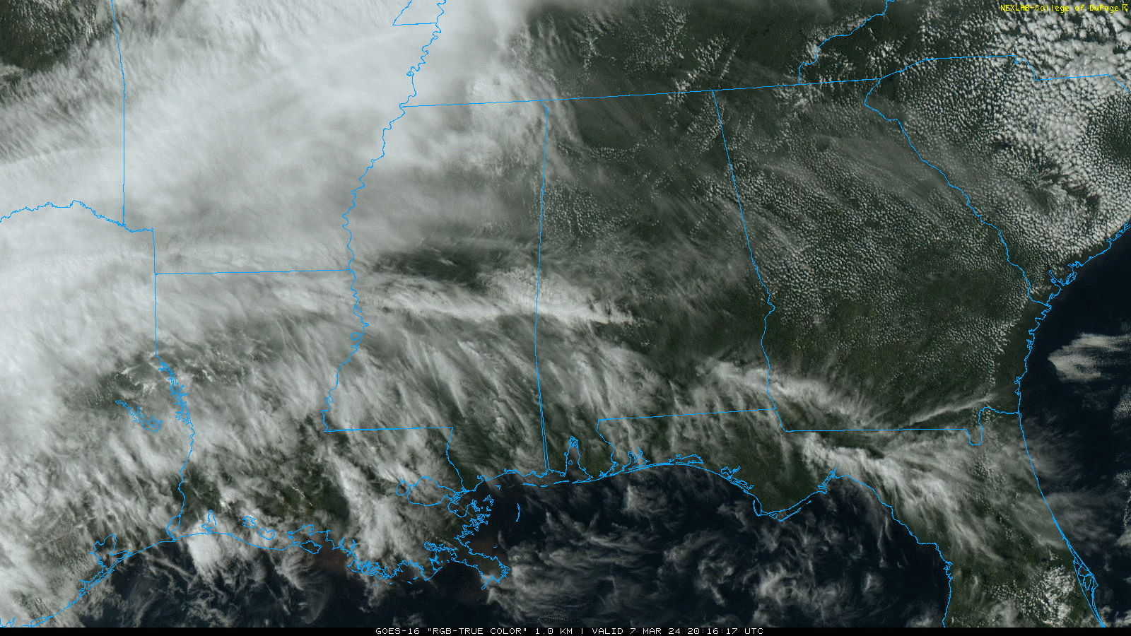
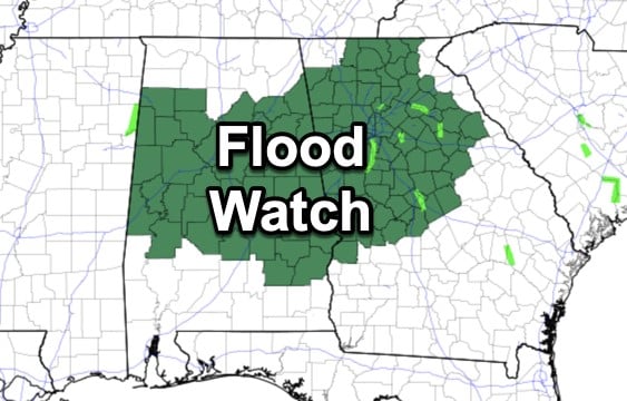
RAIN, STORMS RETURN: Showers and thunderstorms will arrive Friday. Models are a bit faster, suggesting some rain could reach the western counties of the state during the morning. Rain becomes widespread Friday afternoon and night, and into early Saturday morning. The rain could be heavy at times; a flash flood watch is in effect for much of north and central Alabama. Rain amounts of 1-3 inches are likely; isolated totals to 4 inches are possible.
The Storm Prediction Center has defined a slight risk (level 2 out of 5) of severe thunderstorms in its outlook valid through 6 a.m. Saturday for areas south of a line from Tuscaloosa to Sylacauga to Lafayette. A marginal risk (level 1) is up for most of the rest of the state.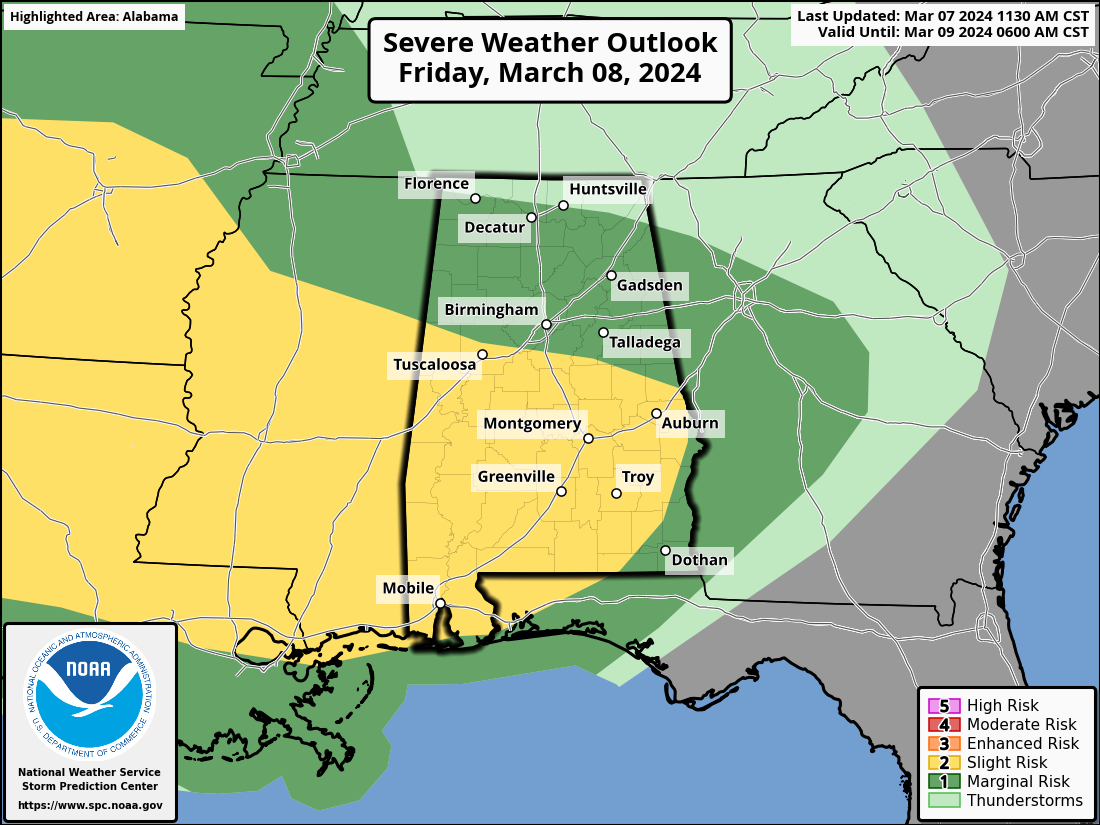
A severe weather risk is also defined after 6 a.m. Saturday for the southeast counties.
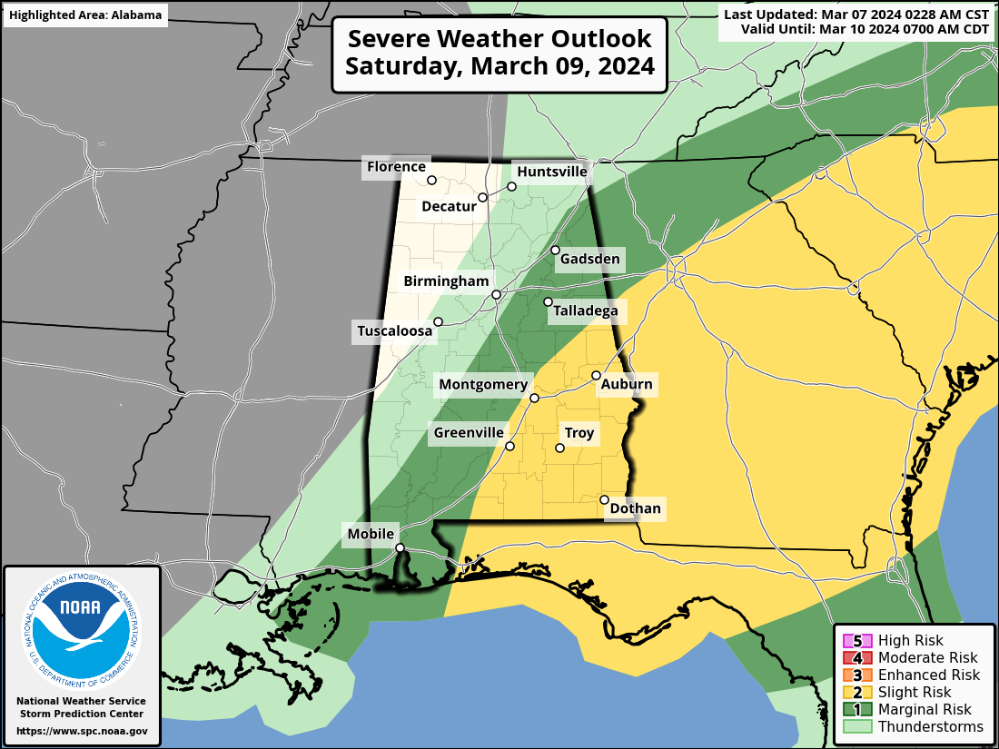 This is a somewhat conditional risk; surface-based instability is expected to be very limited, and mainly across the southern half of the state. If severe thunderstorms do develop, the main threat will come from strong, gusty winds, but a brief, isolated tornado or two can’t be ruled out.
While heavy rain is possible at any time Friday afternoon through early Saturday morning, the core threat of strong to severe storms over south Alabama will come from about 9 Friday night through 9 a.m. Saturday.
Rain will end from the west Saturday morning, and by Saturday afternoon most of the state will be dry, but clouds will linger. The highs Friday and Saturday will be near 70 degrees.
Cooler, drier air rolls into the Deep South Saturday night, and Sunday will be sunny and cool, with highs between 55 and 65 degrees across Alabama.
NEXT WEEK: At this point much of the week looks dry. Temperatures will drop into the 30s Monday morning over the northern two-thirds of the state, and some of the colder spots could see a light freeze. A warming trend is ahead for the rest of the week, with temperatures reaching the 70s Tuesday through Friday.
The next chance of rain most likely will be at some point over the following weekend, March 15-16.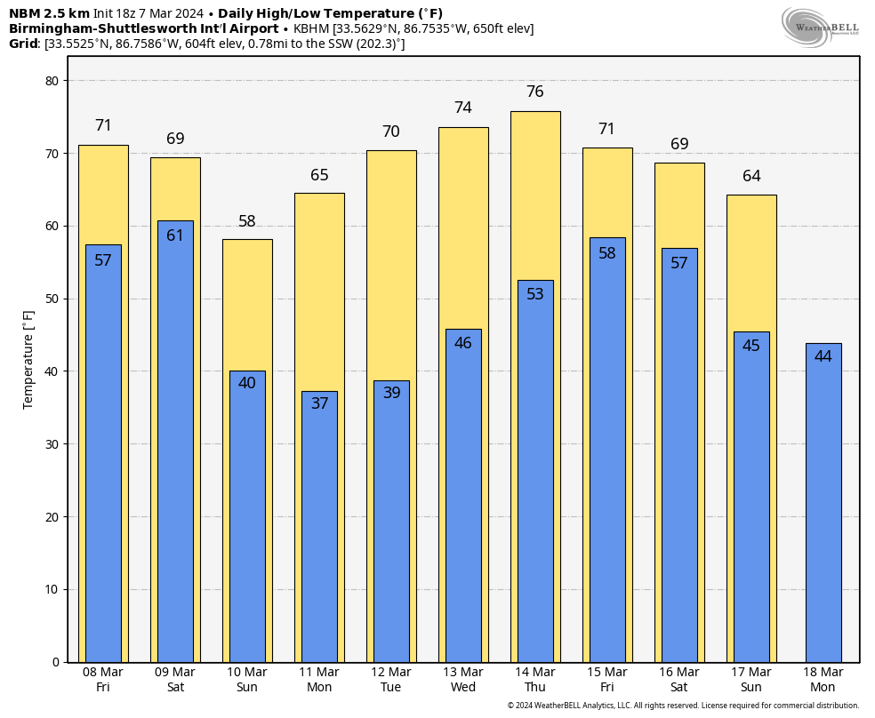 ON THIS DATE IN 1997: The worst was finally over for states hit hard by the flooding Ohio River. The river crested on March 6 at Louisville, Kentucky, 15 feet above flood stage, after topping out at nearly 13 feet at Cincinnati, Ohio, and more than 7 feet at Huntington, West Virginia.
ON THIS DATE IN 2018: A teacher was struck by lightning outside an Ocean County, New Jersey, middle school during a thundersnow event.
For more weather news and information from James Spann and his team, visit AlabamaWx.


