James Spann: Strong storms continue across south Alabama; dry Saturday ahead
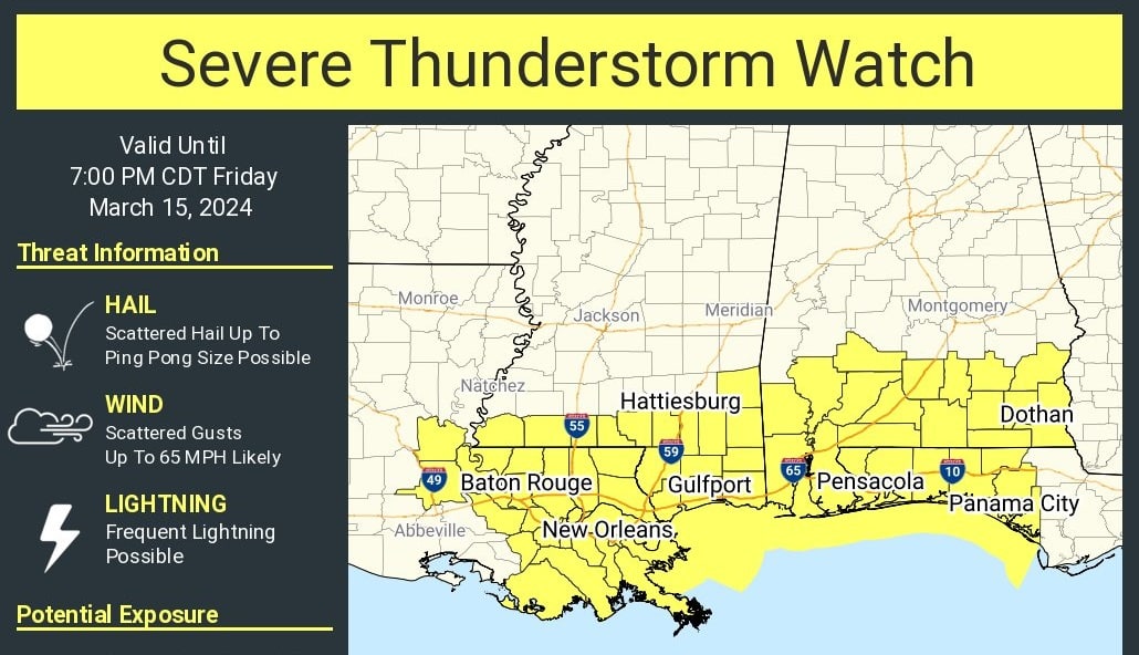
RADAR CHECK: Rain and strong thunderstorms continue to push through south Alabama this afternoon; heavier storms there are capable of producing hail and strong winds. A severe thunderstorm watch is in effect for the southern third of the state until 7 p.m.
THE ALABAMA WEEKEND: Most of the state will be rain-free Saturday with potential for some sun; the high will be in the low 70s. Showers return Sunday, with potential for a few stronger thunderstorms near the Gulf Coast. It won’t rain all day, and amounts will be less than one-half inch.
NEXT WEEK: Dry, colder air arrives Monday, and another late-season freeze is likely by daybreak Tuesday morning over the northern half of the state, with lows between 25 and 32 degrees likely. Frost is possible down into south Alabama. Showers will likely return Thursday night or Friday; for now, it doesn’t look like a severe thunderstorm situation.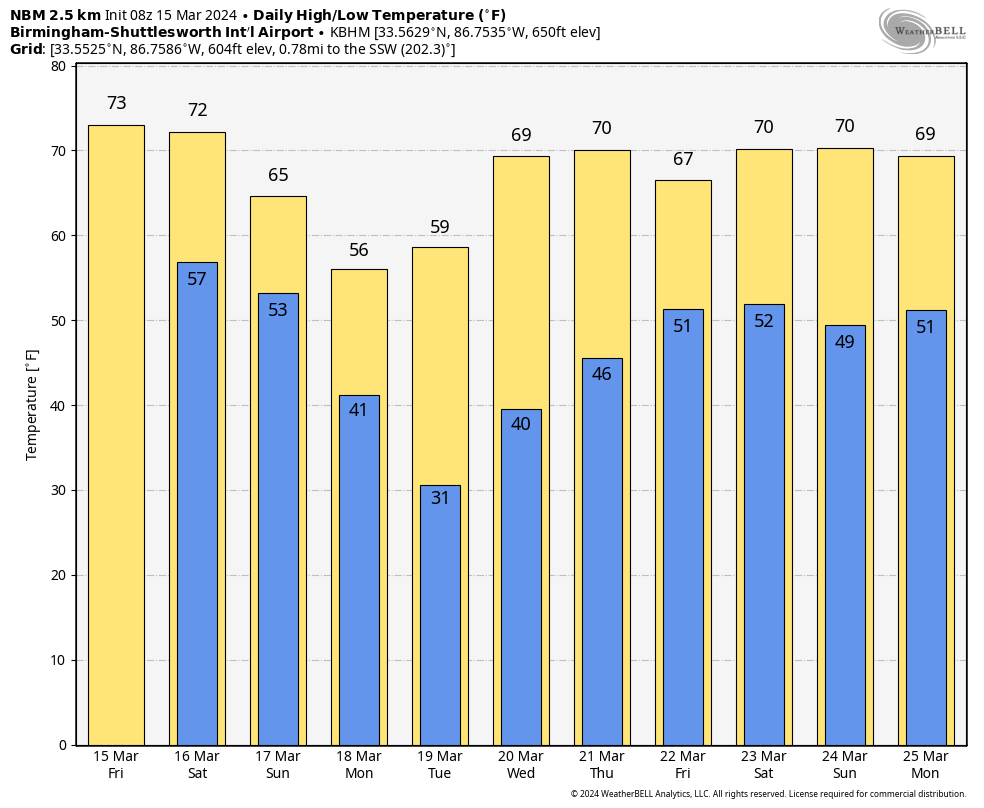 ON THIS DATE IN 1938: A tornado hit McPaul, Iowa, while moving from southeast to northwest; another raced through Batesville, Illinois, at 60 to 65 mph. A tornado causing F4 damage killed 10 and injured 12 in St. Clair County, Missouri. It was part of an outbreak that produced four tornadoes and was responsible for 11 deaths and 42 injuries.
For more weather news and information from James Spann and his team, visit AlabamaWx.


