James Spann: Drier air pushes into Alabama Friday
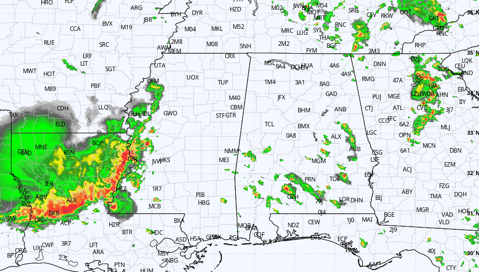
RADAR CHECK: We have random, scattered showers and thunderstorms over roughly the southern two-thirds of Alabama at midafternoon. Otherwise, the sky is partly to mostly sunny across the state with temperatures in the 80s. Scattered showers and storms will fade away after sunset.
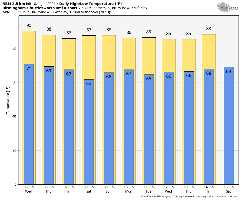
The weather won’t change much Wednesday and Thursday; expect partly sunny days with a few scattered showers and thunderstorms, mostly during the afternoon and evening. The more numerous showers on Thursday will likely be over the southern half of the state.
FRIDAY AND THE WEEKEND: A dry, continental air mass will drop into Alabama Thursday night, and at this point most of the state is looking rain-free Friday and Saturday with lower humidity and cooler nights. Highs will be in the 80s, but some of the cooler spots over north Alabama could dip into the upper 50s early Saturday morning. Global models now suggest a disturbance will likely bring a return of scattered showers and storms on Sunday, but it won’t rain all day.
NEXT WEEK: Global models have backed off on the idea of another surge of dry air Monday; for now, we will broad-brush the week with the typical summer pattern of partly sunny days and scattered, mostly afternoon and evening showers and thunderstorms. Showers will be most numerous over the northern half of the state; highs will be mostly in the 80s.
TROPICS: All remains quiet across the Atlantic basin, and tropical storm formation is not expected for the next seven days.
ON THIS DATE IN 1995: Category 1 Hurricane Allison made landfall in the Big Bend area of Florida before tracking northward as an extratropical system. Several tornadoes touched down in Georgia, the most significant in the town of St. Marys. An elementary school was destroyed, and significant damage was reported to several buildings at the Kings Bay Naval Submarine Base.
For more weather news and information from James Spann and his team, visit AlabamaWx.


