James Spann: Highs stay in the 90s for Alabama, with a few scattered showers, storms
James Spann says Alabama’s Fourth of July will be hot as a firecracker from Alabama News Center on Vimeo.
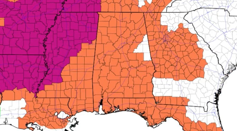
HOT AS A FIRECRACKER: We have some very routine summer weather for Alabama through the weekend: partly sunny, hot, humid days with scattered showers and storms, mostly during the afternoon and evening (1 until 11 p.m.). The chance of any one spot seeing rain is 25-30% today, 55-65% Friday and around 30% Saturday and Sunday. The showers that form will be totally random; some neighbors could see a good downpour, while others don’t see a drop — the “afternoon thunderstorm lottery,” as we often call it.
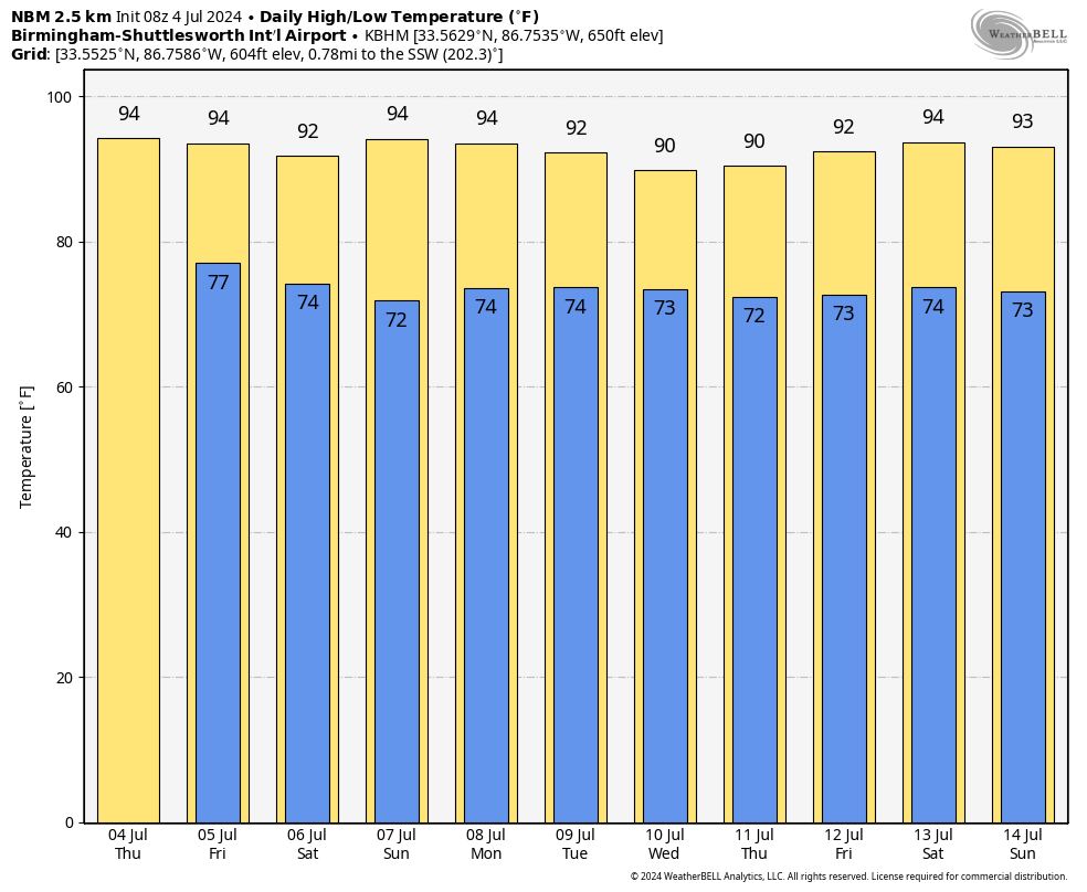
The weather won’t change much next week. Expect hot, humid days with a few scattered showers and storms daily; highs will be between 90 and 94 degrees, with lows in the 70s.
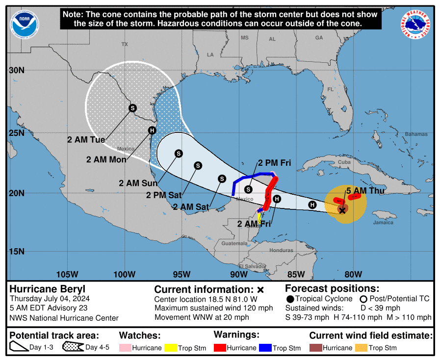
TROPICS: Hurricane Beryl continues to weaken; sustained winds are down to 120 mph. It is about 440 miles southeast of Tulum, Mexico, moving to the west/northwest at 20 mph.
Water vapor images show an upper-level trough moving west-southwestward over the southern Gulf of Mexico, helping to impart moderate-to-strong shear over Beryl. While the hurricane has been an over-performer so far, this magnitude of shear should cause notable weakening over the next day or so, but Beryl is expected to still be a hurricane as it moves into the Yucatan Peninsula late tonight.
After emerging into the Gulf of Mexico, Beryl will likely have a couple of days to restrengthen over warm waters with light or moderate shear. Almost all of the model guidance shows the system near hurricane strength as Beryl approaches the western Gulf Coast, and so does the official forecast. The National Hurricane Center (NHC) intensity forecast is basically the same as the previous one but should be considered of low confidence due to the inherent uncertainties of intensity forecasts in moderate shear.
Final landfall is forecast just south of Brownsville, Texas, Sunday night as a Category 1 hurricane. The only impact for the central Gulf Coast (Gulf Shores to Panama City Beach) is a high rip-current danger Friday through Sunday.
The tropical wave trailing Beryl in the Caribbean remains disorganized, and the NHC gives it only a 20% chance of development over the next seven days due to dry air, shear and upwelling from Beryl.
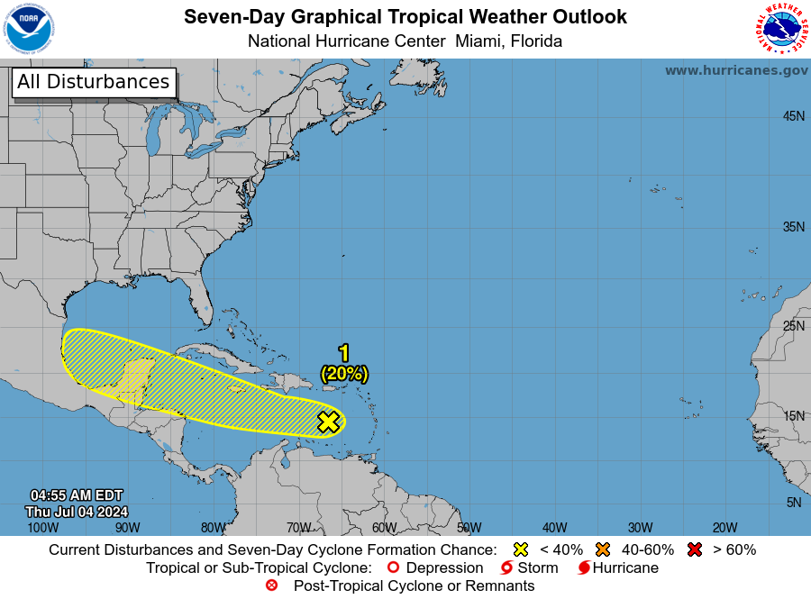 The rest of the Atlantic basin is quiet.
ON THIS DATE IN 1911: Record temperatures were set in the northeastern United States as a heat wave hit the area that would go on to kill 380 people. In Nashua, New Hampshire, the mercury peaked at 106 degrees. Other high-temperature records were set all over New England during an 11-day period.
For more weather news and information from James Spann and his team, visit AlabamaWx.


