James Spann: Tropical rain for Alabama Wednesday, Thursday
THIS AFTERNOON: The sky is mostly sunny over the northern half of Alabama this afternoon with temperatures between 86 and 90 degrees. Clouds cover much of south Alabama, and some rain is falling over Mobile and Baldwin counties. Rain will be confined to far south Alabama tonight, but clouds will increase statewide with a low between 67 and 72.
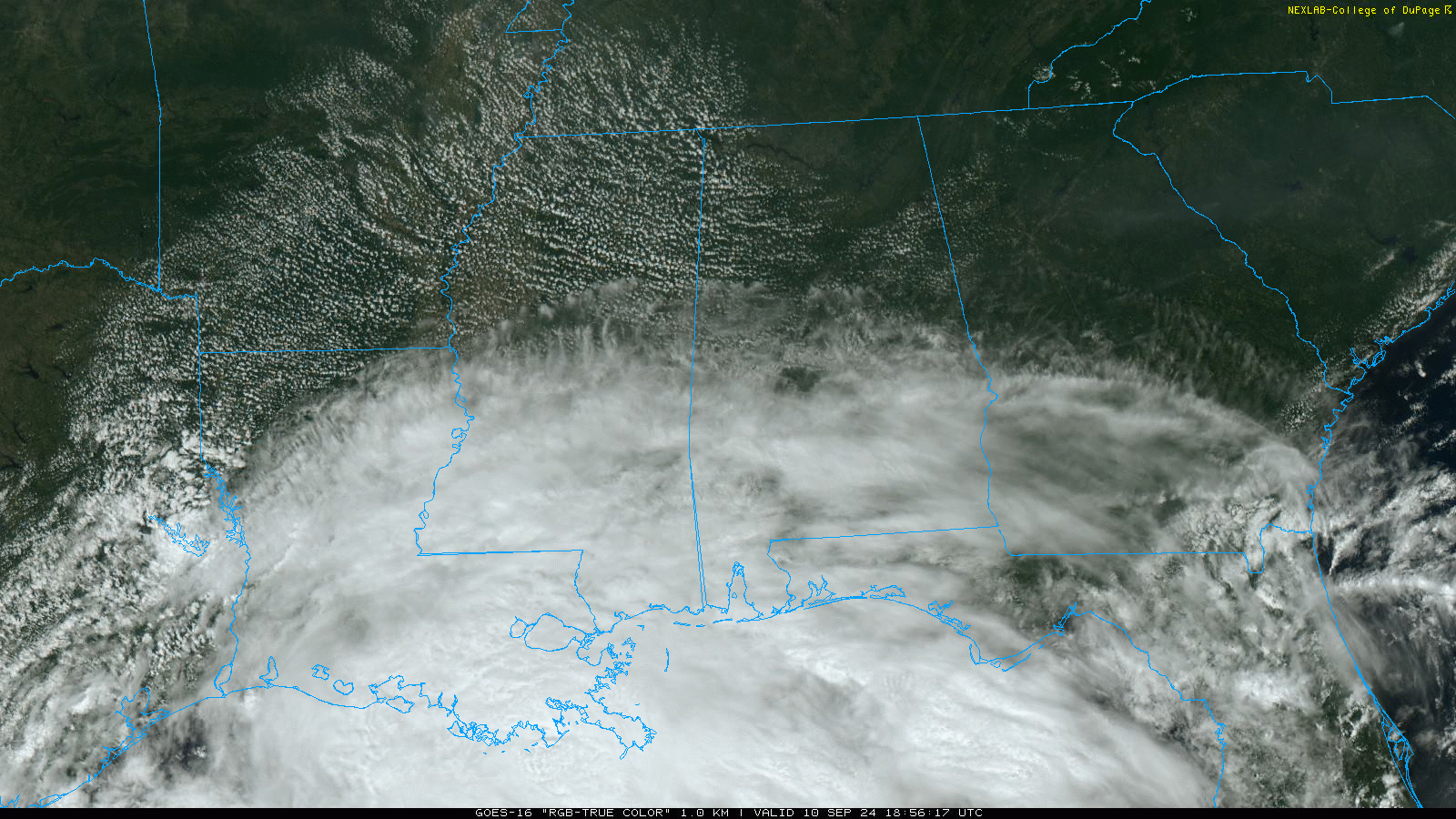
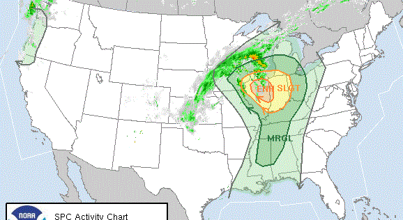
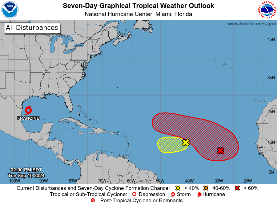
FRANCINE: Tropical Storm Francine still has sustained winds of 65 mph. The center is about 380 miles southwest of Morgan City, Louisiana. The system is moving northeast at 9 mph.
Francine has about 24-30 hours to strengthen over warm water before it encounters strong shear near the Louisiana coast. While there is a possibility that dry air entrainment could reduce the intensification rate, the intensity continues to call for steady to rapid strengthening during this time, based on the otherwise favorable conditions. While it is not explicitly shown in the latest forecast, the cyclone could reach a peak intensity near 100 mph between the 24-hour point and landfall.
Intensification is expected to stop before landfall, and rapid weakening is expected after landfall.
The new National Hurricane Center (NHC) forecast track has shifted a little eastward on the late-morning update; landfall is now projected on the Louisiana coast late Wednesday afternoon at Category 1 strength.
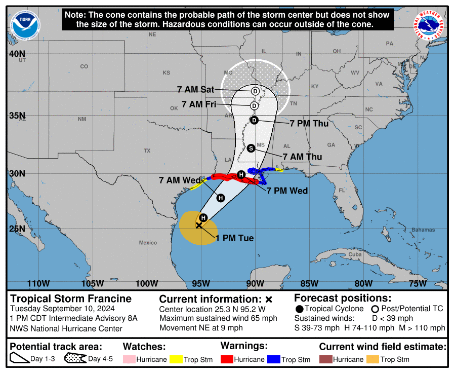 Based on the updated track, a tropical storm watch has been issued for the Alabama Gulf Coast.
More about the impact for Alabama Wednesday night and Thursday:
- Gradient winds could gust as high as 50 mph along the Alabama Gulf Coast late Wednesday and Wednesday night; gusts to 35 mph are possible for the northern half of the state on Thursday.
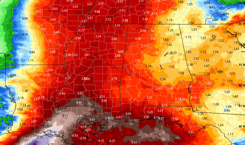
- Rain amounts over Mobile and Baldwin counties will be 2-4 inches, with 1-3 inches for the rest of the state. Heavier totals will likely be over the western counties.
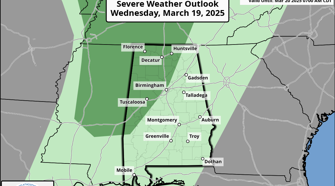
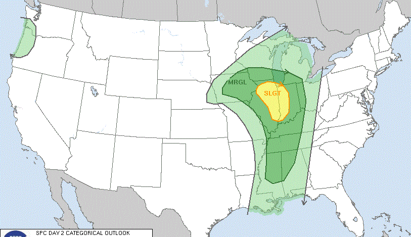
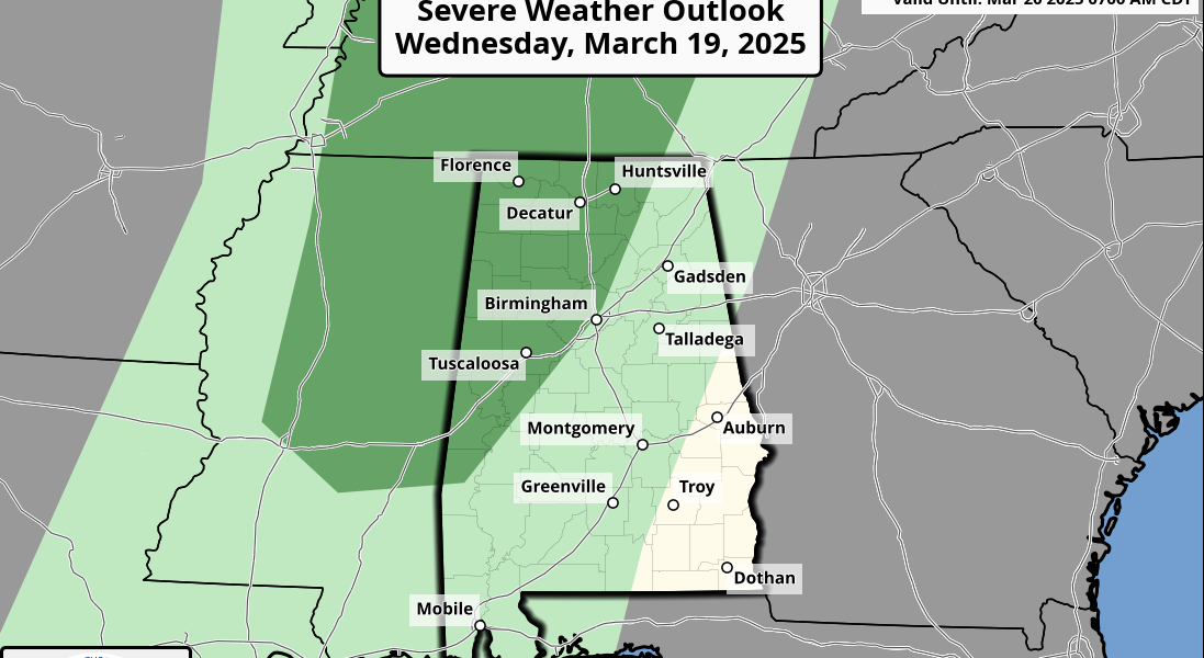
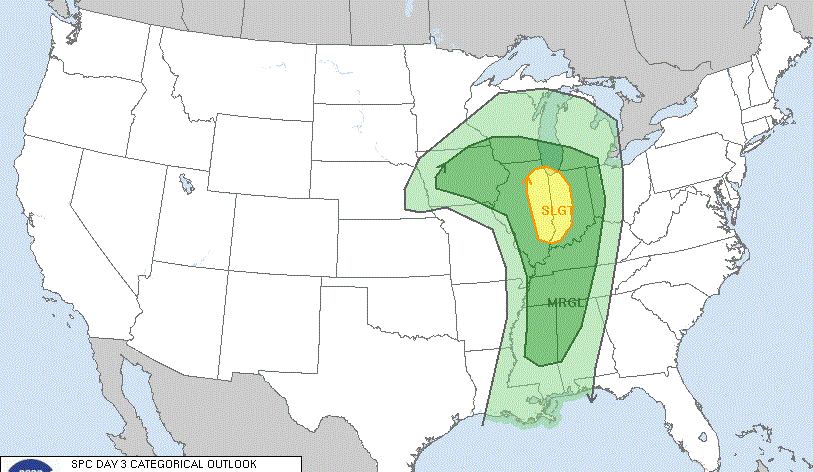
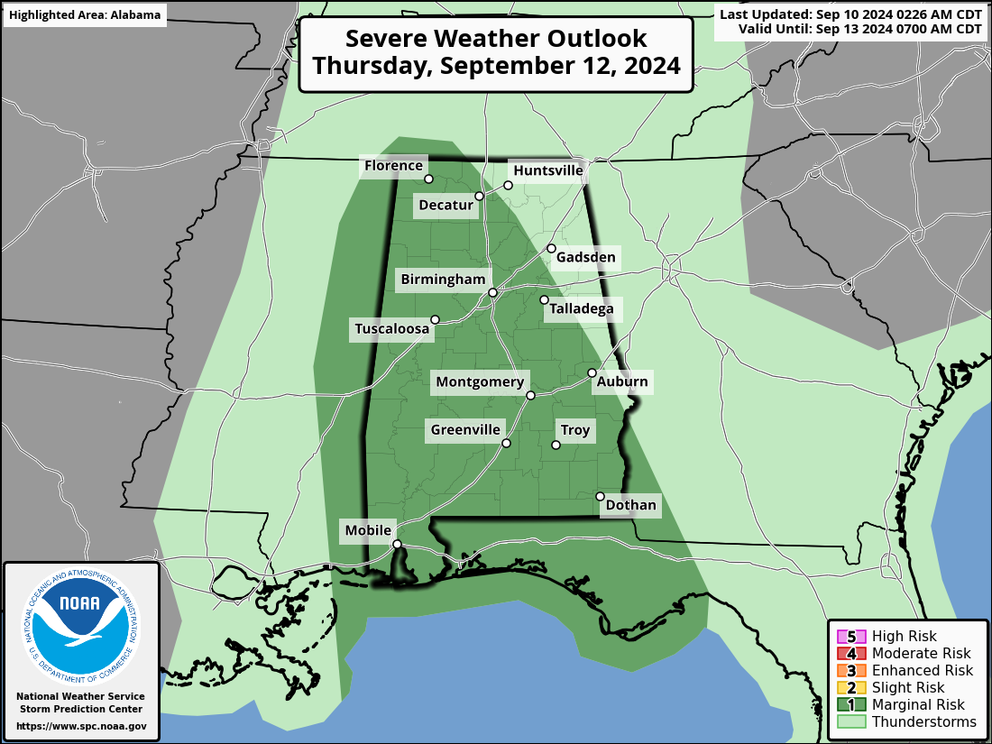
- A few brief, isolated tornadoes can’t be ruled out across the state; the Storm Prediction Center has defined a slight risk (level 2 out of 5) of severe thunderstorms for Mobile and Baldwin counties Wednesday night, and most of the state (with the exception of the northeast counties) is in a marginal risk (level 1) during the day Thursday.
- The weather will improve along the Gulf Coast during the day Thursday as Francine moves northward. However, a high rip-current danger will be in place across the central Gulf Coast through Friday.
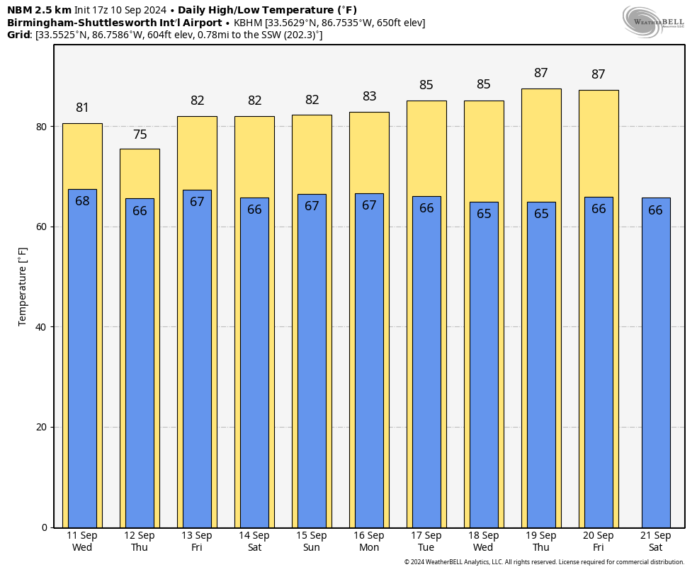
FRIDAY AND THE WEEKEND: The remnant circulation of Francine will likely stall northwest of Alabama, and this means some risk of scattered showers and thunderstorms daily Friday through Sunday. This won’t be a continuous rain, and the sun will be out at times. Highs will be in the low to mid 80s.
NEXT WEEK: Some risk of scattered showers and storms will likely continue through at least the first half of the week; highs remain in the 80s.
TROPICS: Other than Francine, the NHC is monitoring two waves in the central and eastern Atlantic with potential for development; it remains to be seen whether they will affect any land.
ON THIS DATE IN 2017: Hurricane Irma made landfall on Cudjoe Key, Florida, as a Category 4 storm with winds of 130 mph. It was the most intense hurricane to strike the continental United States since Katrina in 2005, the first major hurricane to make landfall in Florida since Wilma in the same year, and the first Category 4 hurricane to strike the state since Charley in 2004. The hurricane caused at least 134 deaths and caused widespread, catastrophic damage throughout its long lifetime, particularly in the northeastern Caribbean and the Florida Keys.
For more weather news and information from James Spann and his team, visit AlabamaWx.