Scott Martin: Stormy weekend for Alabama
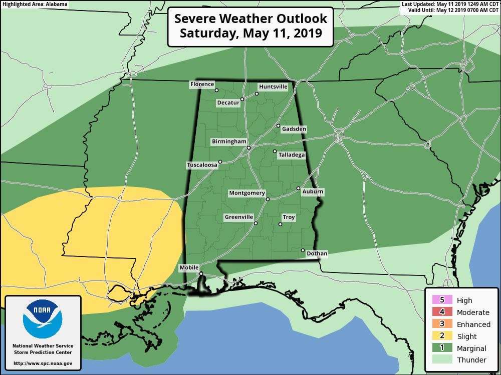
TODAY: The Storm Prediction Center has almost the entire state in a marginal risk for severe storms today as a stationary front continues to be stuck over the northwestern parts of north and central Alabama. With that front providing the lift and building instability during the heating of the day, we will see several rounds of storms move through. We have low confidence on the placement and timing of the strongest storms, but at this point it looks like those will be mainly over the western two-thirds of the state during the midafternoon through the late evening.
Our main threats for today will be from damaging thunderstorm wind gusts up to 60 mph and hail up to quarter-size. While a tornado threat is not zero, we do not expect any tornadoes. We still have to stay weather aware and expect the unexpected, as we are still in our spring severe weather season. Highs will be in the mid-70s to the lower 80s. Scattered to numerous showers and storms remain possible overnight with lows dropping into the 60s.
If you’re heading out to the Regions Tradition at Greystone, there will be a good bit of dry weather, but expect thunderstorms at any time today, especially during the afternoon.
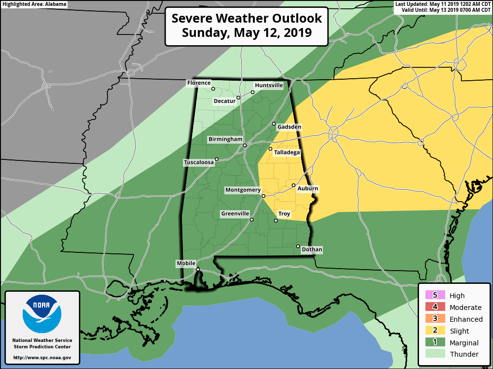
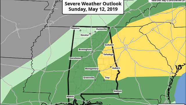
SUNDAY: Sunday will be another stormy day with the potential for severe storms across much of Alabama. The stationary front starts to move through the area as a cold front, giving us a better shot of more organized severe storms. The SPC has most of Alabama in a marginal risk, with a higher-level slight risk for portions of eastern Alabama.
Again, damaging winds up to 60 mph and quarter-size hail will be the main threats, but we will have a small tornado threat as we’ll have a little more shear to deal with. The main window for stronger to severe storms will be from 6 a.m. through 2 p.m. as the front moves through. We may also have a small threat of some flash flooding.
Highs on Sunday will be in the mid to upper 70s. Rainfall amounts throughout the weekend will be around 1-2 inches, but a few locations could see up to 3 inches. All shower and storm activity will end late Sunday.
MONDAY: We return to much more beautiful weather on Monday as the front clears the area, leaving us with plenty of sunshine and very nice temperatures. Highs will be in the mid-70s to the lower 80s.
TUESDAY: We continue with plenty of sunshine and highs in the mid-70s to the lower 80s.
WEDNESDAY: Much of the day will be mostly sunny, but a small chance of showers or thunderstorms will be possible for locations north of the I-20 corridor. Afternoon highs will be in the upper 70s to the lower 80s.
THURSDAY: We’ll continue with a very small chance of a few showers or thunderstorms north of the I-20 corridor. Where there is no rain, skies will be mostly clear. Highs will be in the lower to mid-80s.
FRIDAY: A brilliant and warm Friday will await us, with nearly maximum sunshine and highs in the lower to mid-80s.
BEACH FORECAST CENTER: Get the latest weather and rip current forecasts for the beaches from Fort Morgan to Panama City on our Beach Forecast Center page. There, you can select the forecast of the region you are interested in.
For more weather news and information from James Spann, Scott Martin and other members of the James Spann team, visit AlabamaWx.


